- Dataset Availability
- 2002-03-31T00:00:00Z–2024-03-31T00:00:00Z
- Dataset Provider
- NASA Jet Propulsion Laboratory
- Earth Engine Snippet
-
ee.ImageCollection("NASA/GRACE/MASS_GRIDS_V03/MASCON_CRI") - Tags
Description
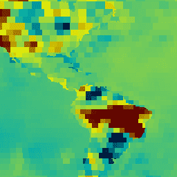
This dataset contains gridded monthly global water storage/height anomalies relative to a time-mean, derived from GRACE and GRACE-FO and processed at JPL using the Mascon approach (RL06.1Mv03). This version of the data employs a Coastal Resolution Improvement (CRI) filter that reduces signal leakage errors across coastlines. These data are provided in a single data file in netCDF format, and can be used for analysis for ocean, ice, and hydrology phenomena. The water storage/height anomalies are given in equivalent water thickness units (cm). The solution provided here is derived from solving for monthly gravity field variations in terms of geolocated spherical cap mass concentration functions, rather than global spherical harmonic coefficients. Additionally, realistic geophysical information is introduced during the solution inversion to intrinsically remove correlated error. Thus, these Mascon grids do not need to be destriped or smoothed, like traditional spherical harmonic gravity solutions. The complete Mascon solution consists of 4,551 relatively independent estimates of surface mass change that have been derived using an equal-area 3-degree grid of individual mascons. A subset of these individual mascons span coastlines, and contain mixed land and ocean mass change signals. In a post-processing step, the CRI filter is applied to those mixed land/ocean Mascons to separate land and ocean mass. The land mask used to perform this separation is provided in the same directory as this dataset. Since the individual mascons act as an inherent smoother on the gravity field, a set of optional gain factors (for continental hydrology applications) that can be applied to the solution to study mass change signals at sub-mascon resolution is also provided within the same data directory as the Mascon data. This RL06.1Mv03 is an updated version of the previous Tellus JPL Mascon RL06Mv02. RL06.1Mv03 differs from RL06Mv02 only in the Level-1B accelerometer transplant data that is used for the GF2 (GRACE-FO 2)satellite; RL06.1Mv03 uses the ACH data product. For more information, please visit GRACE page. For a detailed description on the Mascon solution, including the mathematical derivation, implementation of geophysical constraints, and solution validation, please see Watkins et al., 2015. For a detailed description of the CRI filter implementation, please see Wiese et al., 2016.
Bands
Resolution
55660 meters
Bands
| Name | Units | Description |
|---|---|---|
lwe_thickness |
cm | Equivalent liquid water thickness in centimeters. |
uncertainty |
1-sigma uncertainty for each 3-degree mascon estimate. The provided estimates of uncertainty are regarded to be conservative. See the provider's Error & Uncertainty Estimates section |
Terms of Use
Terms of Use
All NASA-produced data from the GRACE mission is made freely available for the public to use. When using any of the GRCTellus data, please add an acknowledgment: "GRACE land are available at https://grace.jpl.nasa.gov, supported by the NASA MEaSUREs Program." and cite with the citations provided.
Citations
D.N. Wiese. 2015. GRACE monthly global water mass grids NETCDF RELEASE 6.1. Ver. 3.0. PO.DAAC, CA, USA.. Dataset accessed [YYYY-MM-DD] at https://doi.org/10.5067/TEMSC-3JC63.
Watkins, M. M., D. N. Wiese, D.-N. Yuan, C. Boening, and F. W. Landerer (2015), Improved methods for observing Earth's time variable mass, mass distribution with GRACE using spherical cap mascons, J. Geophys. Res Solid Earth, 120, doi:10.1002/2014JB011547.
Wiese, D. N., F. W. Landerer, and M. M. Watkins (2016), Quantifying and reducing leakage errors in the JPL RL05M GRACE mascon solution, Water Resour. Res., 52, 7490-7502, doi:10.1002/2016WR019344.
DOIs
Explore with Earth Engine
Code Editor (JavaScript)
var dataset = ee.ImageCollection('NASA/GRACE/MASS_GRIDS_V03/MASCON_CRI')
                  .filter(ee.Filter.date('2016-08-01', '2016-08-30'));
var equivalentWaterThickness = dataset.select('lwe_thickness');
var equivalentWaterThicknessVis = {
  min: -25.0,
  max: 25.0,
  palette: ['001137', '01abab', 'e7eb05', '620500'],
};
Map.setCenter(6.746, 46.529, 2);
Map.addLayer(
    equivalentWaterThickness, equivalentWaterThicknessVis,
    'Equivalent Water Thickness');