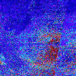
Formaldehyde Level 3 集合可提供常规网格上的微量气体信息,该网格覆盖了 TEMPO 的视场,用于名义 TEMPO 观测。3 级文件是通过合并构成 TEMPO 东-西扫描周期的所有 2 级文件中的信息得出的。栅格包含以下信息:甲醛垂直柱、用于气团因子计算和参考扇区或去条带校正的辅助数据,以及检索质量标志。重新网格化算法使用面积加权方法。
NASA/LARC/SD/ASDC。(n.d.). TEMPO 网格化 HCHO 垂直柱浓度 V03(临时)[数据集]。NASA Langley Atmospheric Science Data Center DAAC。检索自 https://doi.org/10.5067/IS-40e/TEMPO/HCHO_L3.003
[null,null,[],[],[],null,["Dataset Availability\n: 2023-08-01T00:00:00Z--2025-08-31T13:08:25Z\n\nDataset Provider\n:\n\n\n [NASA ASDC](https://asdc.larc.nasa.gov/)\n\nTags\n:\n[air-quality](/earth-engine/datasets/tags/air-quality) [formaldehyde](/earth-engine/datasets/tags/formaldehyde) [nasa](/earth-engine/datasets/tags/nasa) [pollution](/earth-engine/datasets/tags/pollution) [satellite-imagery](/earth-engine/datasets/tags/satellite-imagery) [tropomi](/earth-engine/datasets/tags/tropomi) \n\nDescription \nFormaldehyde Level 3 collection provides trace gas information on a\nregular grid covering the TEMPO field of regard for nominal TEMPO\nobservations. Level 3 files are derived by combining information from\nall Level 2 files constituting a TEMPO East-West scan cycle. The\nrasters contain information on formaldehyde vertical columns,\nancillary data used in air mass factor calculations and reference sector\nor de-striping corrections, and retrieval quality flags.\nThe re-gridding algorithm uses an area-weighted approach.\n\n- A version of this dataset with QA filters applied is available as [NASA/TEMPO/HCHO_L3_QA](/earth-engine/datasets/catalog/NASA_TEMPO_HCHO_L3_QA)\n- [General Documentation](https://asdc.larc.nasa.gov/documents/tempo/guide/TEMPO_Level-2-3_trace_gas_clouds_user_guide_V1.2.pdf)\n\nBands\n\n\n**Pixel Size**\n\n2226 meters\n\n**Bands**\n\n| Name | Units | Pixel Size | Description |\n|-----------------------------------|-----------------|------------|--------------------------------------------------------------------------------------------------------------------------------------------------------|\n| `weight` | km\\^2 | meters | Sum of Level 2 pixel overlap areas. Represents the weighting factor for each grid cell, indicating the fraction of the grid cell area with valid data. |\n| `vertical_column` | molecules/cm\\^2 | meters | HCHO vertical column |\n| `vertical_column_uncertainty` | molecules/cm\\^2 | meters | HCHO vertical column uncertainty |\n| `main_data_quality_flag` | Dimensionless | meters | Main data quality flag. Provides an overall assessment of the data quality |\n| `num_vertical_column_samples` | Dimensionless | meters | Number of vertical column samples |\n| `min_vertical_column_sample` | molecules/cm\\^2 | meters | Smallest vertical column sample |\n| `max_vertical_column_sample` | molecules/cm\\^2 | meters | Largest vertical column sample |\n| `solar_zenith_angle` | deg | meters | Solar zenith angle at pixel center |\n| `viewing_zenith_angle` | deg | meters | Viewing zenith angle at pixel center |\n| `relative_azimuth_angle` | deg | meters | Relative azimuth angle at pixel center |\n| `surface_pressure` | hPa | meters | Surface pressure |\n| `terrain_height` | m | meters | Terrain height |\n| `snow_ice_fraction` | Dimensionless | meters | Fraction of pixel area covered by snow and/or ice |\n| `fitted_slant_column` | molecules/cm\\^2 | meters | HCHO fitted slant column |\n| `fitted_slant_column_uncertainty` | molecules/cm\\^2 | meters | HCHO fitted slant column uncertainty |\n| `albedo` | Dimensionless | meters | Surface albedo |\n| `amf` | Dimensionless | meters | HCHO air mass factor |\n| `eff_cloud_fraction` | Dimensionless | meters | Effective cloud fraction |\n| `amf_cloud_fraction` | Dimensionless | meters | Cloud radiance fraction for AMF calculation |\n| `amf_cloud_pressure` | hPa | meters | Cloud pressure for AMF calculation |\n\n**main_data_quality_flag Class Table**\n\n| Value | Color | Description |\n|-------|-------|-------------|\n| 0 | None | good |\n| 1 | None | suspect |\n| 2 | None | bad |\n\nTerms of Use\n\n**Terms of Use**\n\nThis dataset is in the public domain and is available\nwithout restriction on use and distribution. See [NASA's\nEarth Science Data \\& Information Policy](https://www.earthdata.nasa.gov/engage/open-data-services-and-software/data-and-information-policy)\nfor additional information.\n\nCitations \nCitations:\n\n- NASA/LARC/SD/ASDC. (n.d.). TEMPO gridded HCHO vertical columns V03\n (PROVISIONAL) \\[Data set\\]. NASA Langley\n Atmospheric Science Data Center DAAC.\n Retrieved from https://doi.org/10.5067/IS-40e/TEMPO/HCHO_L3.003\n\nDOIs\n\n- \u003chttps://doi.org/10.5067/IS-40e/TEMPO/HCHO_L3.003\u003e\n\nExplore with Earth Engine **Important:** Earth Engine is a platform for petabyte-scale scientific analysis and visualization of geospatial datasets, both for public benefit and for business and government users. Earth Engine is free to use for research, education, and nonprofit use. To get started, please [register for Earth Engine access.](https://console.cloud.google.com/earth-engine)\n\nCode Editor (JavaScript) \n\n```javascript\nvar collection = ee.ImageCollection('NASA/TEMPO/HCHO_L3')\n .filterDate('2024-04-01', '2024-04-05')\n\nvar visParams = {\n min: 0,\n max: 1.5e16,\n bands: ['vertical_column'],\n palette: [\n '000080', '0000D9', '4000FF', '8000FF', '0080FF',\n '00D9FF', '80FFFF', 'FF8080', 'D90000', '800000'\n ]\n};\nMap.setCenter(-95.06, 42.02, 3)\nMap.addLayer(collection, visParams, 'HCHO vertical column')\n```\n[Open in Code Editor](https://code.earthengine.google.com/?scriptPath=Examples:Datasets/NASA/NASA_TEMPO_HCHO_L3) \n[TEMPO gridded HCHO vertical columns V03](/earth-engine/datasets/catalog/NASA_TEMPO_HCHO_L3) \nFormaldehyde Level 3 collection provides trace gas information on a regular grid covering the TEMPO field of regard for nominal TEMPO observations. Level 3 files are derived by combining information from all Level 2 files constituting a TEMPO East-West scan cycle. The rasters contain information on formaldehyde vertical columns, ancillary ... \nNASA/TEMPO/HCHO_L3, air-quality,formaldehyde,nasa,pollution,satellite-imagery,tropomi \n2023-08-01T00:00:00Z/2025-08-31T13:08:25Z \n-90 -180 90 180 \nGoogle Earth Engine \nhttps://developers.google.com/earth-engine/datasets\n\n- [https://doi.org/10.5067/IS-40e/TEMPO/HCHO_L3.003](https://doi.org/https://asdc.larc.nasa.gov/)\n- [https://doi.org/10.5067/IS-40e/TEMPO/HCHO_L3.003](https://doi.org/https://developers.google.com/earth-engine/datasets/catalog/NASA_TEMPO_HCHO_L3)"]]