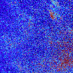
포름알데히드 레벨 3 컬렉션은 명목상 TEMPO 관측을 위한 TEMPO 관심 분야를 포함하는 정규 그리드에 대한 미량 기체 정보를 제공합니다. 레벨 3 파일은 TEMPO 동서 스캔 주기를 구성하는 모든 레벨 2 파일의 정보를 결합하여 파생됩니다. 래스터에는 포름알데히드 수직 열, 공기 질량 계수 계산 및 참조 부문 또는 스트라이핑 제거 수정에 사용되는 보조 데이터, 검색 품질 플래그에 관한 정보가 포함됩니다.
리 그리딩 알고리즘은 영역 가중치 접근 방식을 사용합니다.
QA 필터링된 TEMPO HCHO L3 데이터 세트는 원본 데이터의 품질 관리 버전입니다. 구름 덮개율이 높고 (>50%) 극단적인 태양 천정각 (>80도)과 주요 데이터 품질 (플래그 > 0)을 갖는 데이터 포인트를 삭제하여 생성됩니다.
NASA/LARC/SD/ASDC. (n.d.). TEMPO 격자형 HCHO 수직 열 V03(임시) [데이터 세트]. NASA Langley
Atmospheric Science Data Center DAAC.
https://doi.org/10.5067/IS-40e/TEMPO/HCHO_L3.003에서 가져옴
포름알데히드 레벨 3 컬렉션은 명목상 TEMPO 관측을 위한 TEMPO 관심 분야를 포괄하는 정규 그리드에 대한 미량 기체 정보를 제공합니다. 레벨 3 파일은 TEMPO 동서 스캔 주기를 구성하는 모든 레벨 2 파일의 정보를 결합하여 파생됩니다. 래스터에는 포름알데히드 수직 기둥, 보조 …
[null,null,[],[],[],null,["Dataset Availability\n: 2023-08-01T00:00:00Z--2025-09-03T13:07:27Z\n\nDataset Provider\n:\n\n\n [QA Filtered: Google and NASA ASDC](https://asdc.larc.nasa.gov/)\n\nTags\n:\n[air-quality](/earth-engine/datasets/tags/air-quality) [formaldehyde](/earth-engine/datasets/tags/formaldehyde) [nasa](/earth-engine/datasets/tags/nasa) [pollution](/earth-engine/datasets/tags/pollution) [satellite-imagery](/earth-engine/datasets/tags/satellite-imagery) [tropomi](/earth-engine/datasets/tags/tropomi) \n\nDescription \nFormaldehyde Level 3 collection provides trace gas information on a\nregular grid covering the TEMPO field of regard for nominal TEMPO\nobservations. Level 3 files are derived by combining information from\nall Level 2 files constituting a TEMPO East-West scan cycle. The\nrasters contain information on formaldehyde vertical columns,\nancillary data used in air mass factor calculations and reference sector\nor de-striping corrections, and retrieval quality flags.\nThe re-gridding algorithm uses an area-weighted approach.\n\nThe QA Filtered TEMPO HCHO L3 dataset is a quality-controlled version of\nthe original data. It is generated by removing data points with high cloud\ncover (\\\u003e50%), extreme solar zenith angle (\\\u003e80 degrees), and\nmain data quality (flag \\\u003e 0).\n\n- A version of this dataset without QA filters applied is available as [NASA/TEMPO/HCHO_L3](/earth-engine/datasets/catalog/NASA_TEMPO_HCHO_L3)\n- [General Documentation](https://asdc.larc.nasa.gov/documents/tempo/guide/TEMPO_Level-2-3_trace_gas_clouds_user_guide_V1.2.pdf)\n\nBands\n\n\n**Pixel Size**\n\n2226 meters\n\n**Bands**\n\n| Name | Units | Pixel Size | Description |\n|-----------------------------------|-----------------|------------|--------------------------------------------------------------------------------------------------------------------------------------------------------|\n| `weight` | km\\^2 | meters | Sum of Level 2 pixel overlap areas. Represents the weighting factor for each grid cell, indicating the fraction of the grid cell area with valid data. |\n| `vertical_column` | molecules/cm\\^2 | meters | HCHO vertical column |\n| `vertical_column_uncertainty` | molecules/cm\\^2 | meters | HCHO vertical column uncertainty |\n| `main_data_quality_flag` | Dimensionless | meters | Main data quality flag which is always 0, indicating good quality data. |\n| `num_vertical_column_samples` | Dimensionless | meters | Number of vertical column samples |\n| `min_vertical_column_sample` | molecules/cm\\^2 | meters | Smallest vertical column sample |\n| `max_vertical_column_sample` | molecules/cm\\^2 | meters | Largest vertical column sample |\n| `solar_zenith_angle` | deg | meters | Data is filtered to include only observations with solar zenith angle less than or equal to 80 degrees. |\n| `viewing_zenith_angle` | deg | meters | Viewing zenith angle at pixel center |\n| `relative_azimuth_angle` | deg | meters | Relative azimuth angle at pixel center |\n| `surface_pressure` | hPa | meters | Surface pressure |\n| `terrain_height` | m | meters | Terrain height |\n| `snow_ice_fraction` | Dimensionless | meters | Fraction of pixel area covered by snow and/or ice |\n| `fitted_slant_column` | molecules/cm\\^2 | meters | HCHO fitted slant column |\n| `fitted_slant_column_uncertainty` | molecules/cm\\^2 | meters | HCHO fitted slant column uncertainty |\n| `albedo` | Dimensionless | meters | Surface albedo |\n| `amf` | Dimensionless | meters | HCHO air mass factor |\n| `eff_cloud_fraction` | Dimensionless | meters | Data is filtered to include only observations with effective cloud fraction less than or equal to 50%. |\n| `amf_cloud_fraction` | Dimensionless | meters | Cloud radiance fraction for AMF calculation |\n| `amf_cloud_pressure` | hPa | meters | Cloud pressure for AMF calculation |\n\nTerms of Use\n\n**Terms of Use**\n\nThis dataset is in the public domain and is available\nwithout restriction on use and distribution. See [NASA's\nEarth Science Data \\& Information Policy](https://www.earthdata.nasa.gov/engage/open-data-services-and-software/data-and-information-policy)\nfor additional information.\n\nCitations \nCitations:\n\n- NASA/LARC/SD/ASDC. (n.d.). TEMPO gridded HCHO vertical columns V03\n (PROVISIONAL) \\[Data set\\]. NASA Langley\n Atmospheric Science Data Center DAAC.\n Retrieved from https://doi.org/10.5067/IS-40e/TEMPO/HCHO_L3.003\n\nDOIs\n\n- \u003chttps://doi.org/10.5067/IS-40e/TEMPO/HCHO_L3.003\u003e\n\nExplore with Earth Engine **Important:** Earth Engine is a platform for petabyte-scale scientific analysis and visualization of geospatial datasets, both for public benefit and for business and government users. Earth Engine is free to use for research, education, and nonprofit use. To get started, please [register for Earth Engine access.](https://console.cloud.google.com/earth-engine)\n\nCode Editor (JavaScript) \n\n```javascript\nvar collection = ee.ImageCollection('NASA/TEMPO/HCHO_L3_QA')\n .filterDate('2024-04-01', '2024-04-05')\n\nvar visParams = {\n min: 0,\n max: 1.5e16,\n bands: ['vertical_column'],\n palette: [\n '000080', '0000D9', '4000FF', '8000FF', '0080FF',\n '00D9FF', '80FFFF', 'FF8080', 'D90000', '800000'\n ]\n};\nMap.setCenter(-95.06, 42.02, 3)\nMap.addLayer(collection, visParams, 'HCHO vertical column')\n```\n[Open in Code Editor](https://code.earthengine.google.com/?scriptPath=Examples:Datasets/NASA/NASA_TEMPO_HCHO_L3_QA) \n[TEMPO gridded HCHO (QA filtered) vertical columns V03](/earth-engine/datasets/catalog/NASA_TEMPO_HCHO_L3_QA) \nFormaldehyde Level 3 collection provides trace gas information on a regular grid covering the TEMPO field of regard for nominal TEMPO observations. Level 3 files are derived by combining information from all Level 2 files constituting a TEMPO East-West scan cycle. The rasters contain information on formaldehyde vertical columns, ancillary ... \nNASA/TEMPO/HCHO_L3_QA, air-quality,formaldehyde,nasa,pollution,satellite-imagery,tropomi \n2023-08-01T00:00:00Z/2025-09-03T13:07:27Z \n-90 -180 90 180 \nGoogle Earth Engine \nhttps://developers.google.com/earth-engine/datasets\n\n- [https://doi.org/10.5067/IS-40e/TEMPO/HCHO_L3.003](https://doi.org/https://asdc.larc.nasa.gov/)\n- [https://doi.org/10.5067/IS-40e/TEMPO/HCHO_L3.003](https://doi.org/https://developers.google.com/earth-engine/datasets/catalog/NASA_TEMPO_HCHO_L3_QA)"]]