Page Summary
-
The OpenET PT-JPL Monthly Evapotranspiration v2.0 dataset, provided by OpenET, Inc., offers monthly evapotranspiration data from 1999 to the present.
-
This dataset utilizes the Priestley-Taylor Jet Propulsion Laboratory (PT-JPL) model with enhancements for contemporary weather data, open water evaporation, and advection in arid environments.
-
Key inputs for the model include Landsat surface reflectance and thermal radiation, along with NLDAS, Spatial CIMIS, and gridMET weather data.
-
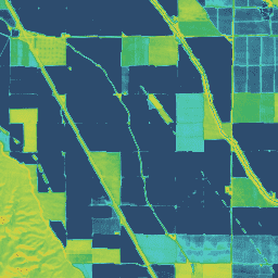
The dataset contains two bands: 'et' for the PT-JPL ET value in mm and 'count' for the number of cloud-free values.
-
The dataset has a spatial resolution of 30 meters and is available under the CC-BY-4.0 terms of use.
- Dataset Availability
- 1999-10-01T00:00:00Z–2024-12-01T00:00:00Z
- Dataset Producer
- OpenET, Inc.
- Cadence
- 1 Month
- Tags
Description
Priestley-Taylor Jet Propulsion Laboratory (PT-JPL)
The core formulation of the PT-JPL model within the OpenET framework has not changed from the original formulation detailed in Fisher et al. (2008). However, enhancements and updates to model inputs and time integration for PT-JPL were made to take advantage of contemporary gridded weather datasets, provide consistency with other models, improve open water evaporation estimates, and account for advection over crop and wetland areas in semiarid and arid environments. These changes include the use of Landsat surface reflectance and thermal radiation for calculating net radiation, photosynthetically active radiation, plant canopy and moisture variables, and use of NLDAS, Spatial CIMIS, and gridMET weather data for estimating insolation and ASCE reference ET. Similar to the implementation of other OpenET models, estimation of daily and monthly time integrated ET is based on the fraction of ASCE reference ET. Open water evaporation is estimated following a surface energy balance approach of Abdelrady et al. (2016) that is specific for water bodies by accounting for water heat flux as opposed to soil heat flux.
Bands
Bands
Pixel size: 30 meters (all bands)
| Name | Units | Pixel Size | Description |
|---|---|---|---|
et |
mm | 30 meters | PT-JPL ET value |
count |
count | 30 meters | Number of cloud free values |
Image Properties
Image Properties
| Name | Type | Description |
|---|---|---|
| build_date | STRING | Date assets were built |
| cloud_cover_max | DOUBLE | Maximum CLOUD_COVER_LAND percent value for Landsat images included in interpolation |
| collections | STRING | List of Landsat collections for Landsat images included in the interpolation |
| core_version | STRING | OpenET core library version |
| end_date | STRING | End date of month |
| et_reference_band | STRING | Band in et_reference_source that contains the daily reference ET data |
| et_reference_resample | STRING | Spatial interpolation mode to resample daily reference ET data |
| et_reference_source | STRING | Collection ID for the daily reference ET data |
| interp_days | DOUBLE | Maximum number of days before and after each image date to include in interpolation |
| interp_method | STRING | Method used to interpolate between Landsat model estimates |
| interp_source_count | DOUBLE | Number of available images in the interpolation source image collection for the target month |
| mgrs_tile | STRING | MGRS grid zone ID |
| model_name | STRING | OpenET model name |
| model_version | STRING | OpenET model version |
| scale_factor_count | DOUBLE | Scaling factor that should be applied to the count band |
| scale_factor_et | DOUBLE | Scaling factor that should be applied to the et band |
| start_date | STRING | Start date of month |
Terms of Use
Terms of Use
Citations
Fisher, J.B., Tu, K.P. and Baldocchi, D.D., 2008. Global estimates of the land–atmosphere water flux based on monthly AVHRR and ISLSCP-II data, validated at 16 FLUXNET sites. Remote Sensing of Environment, 112(3), pp.901-919. doi:10.1016/j.rse.2007.06.025
Abdelrady, A., Timmermans, J., Vekerdy, Z. and Salama, M., 2016. Surface energy balance of fresh and saline waters: AquaSEBS. Remote sensing, 8(7), p.583. doi:10.3390/rs8070583
DOIs
Explore with Earth Engine
Code Editor (JavaScript)
var dataset = ee.ImageCollection('OpenET/PTJPL/CONUS/GRIDMET/MONTHLY/v2_0')
  .filterDate('2020-01-01', '2021-01-01');

// Compute the annual evapotranspiration (ET) as the sum of the monthly ET
// images for the year.
var et = dataset.select('et').sum();

var visualization = {
  min: 0,
  max: 1400,
  palette: [
    '9e6212', 'ac7d1d', 'ba9829', 'c8b434', 'd6cf40', 'bed44b', '9fcb51',
    '80c256', '61b95c', '42b062', '45b677', '49bc8d', '4dc2a2', '51c8b8',
    '55cece', '4db4ba', '459aa7', '3d8094', '356681', '2d4c6e',
  ]
};

Map.setCenter(-100, 38, 5);

Map.addLayer(et, visualization, 'OpenET PT-JPL Annual ET');