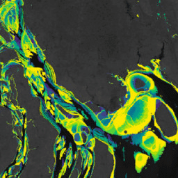
Murray Global Intertidal Change Dataset에는 707,528개의 Landsat Archive 이미지의 감독 분류를 통해 생성된 갯벌 생태계의 전 세계 지도가 포함되어 있습니다. 각 픽셀은 전 세계에 분포된 학습 데이터 세트를 참고하여 갯벌, 영구적인 물 또는 기타로 분류되었습니다.
분류는 1984년 1월 1일부터 2016년 12월 31일까지 북위 60도와 남위 60도 사이의 전 세계 해안선을 따라 구현되었습니다.
이미지 컬렉션은 설정된 기간 (1984~1986년, 1987~1989년, 1990~1992년, 1993~1995년, 1996~1998년, 1999~2001년, 2002~2004년, 2005~2007년, 2008~2010년, 2011~2013년, 2014~2016년)에 30m 픽셀 해상도로 촬영된 11개의 전 세계 갯벌 지도 시계열로 구성됩니다.
고도 (+100m) 및 수심 (-100m) 한도로 정의된 갯벌 분류기 구현의 공간적 한계를 나타내는 플래그입니다.
대역
픽셀 크기 30미터
대역
이름
단위
픽셀 크기
설명
datamask
발생
미터
데이터 포함을 나타내는 플래그입니다.
데이터 마스크의 비트 마스크
비트 0: 데이터 마스크
0: 데이터 없음
1: 분류된 영역
이용약관
이용약관
이 작업물은 크리에이티브 커먼즈 저작자 표시 4.0 국제 라이선스에 따라 이용할 수 있습니다.
조간대 데이터를 사용하는 경우 관련 학술지 논문을 인용하는 등 적절한 출처 표시를 포함해야 합니다.
인용
인용:
Murray, N.J., Phinn, S.R., DeWitt, M., Ferrari, R., Johnston, R., Lyons, M.B.,
Clinton, N., Thau, D. & Fuller, R.A. (2019) The global distribution and
trajectory of tidal flats. Nature, 565, 222~225.
doi:10.1038/s41586-018-0805-8,
Murray, N. J., Phinn, S. P., Fuller, R. A., DeWitt, M., Ferrari, R.,
Johnston, R., Clinton, N., & Lyons, M. B. (2022). 1984년부터 2019년까지의 갯벌 생태계 고해상도 전 세계 지도 Scientific Data,
9(1).
doi:10.1038/s41597-022-01635-5,
Murray Global Intertidal Change Dataset에는 707,528개의 Landsat Archive 이미지의 감독 분류를 통해 생성된 조간대 생태계의 전 세계 지도가 포함되어 있습니다. 각 픽셀은 전 세계에 분포된 학습 데이터 세트를 참고하여 갯벌, 영구적인 물 또는 기타로 분류되었습니다. 분류는 다음을 따라 구현되었습니다.
[null,null,[],[[["\u003cp\u003eThe Murray Global Intertidal Change Dataset provides global maps of tidal flat ecosystems based on a supervised classification of over 700,000 Landsat images from 1984 to 2016.\u003c/p\u003e\n"],["\u003cp\u003eThe dataset covers coastlines between 60° North and 60° South, classifying each 30m pixel as tidal flat, permanent water, or other.\u003c/p\u003e\n"],["\u003cp\u003eEleven global maps of tidal flats are included, representing different time periods between 1984 and 2016.\u003c/p\u003e\n"],["\u003cp\u003eThis dataset is licensed under a Creative Commons Attribution 4.0 International License, requiring proper acknowledgment and citation in any use.\u003c/p\u003e\n"],["\u003cp\u003eThe dataset was created by Murray et al.and is available for exploration and analysis within Google Earth Engine.\u003c/p\u003e\n"]]],["The Murray Global Intertidal Change Dataset provides global tidal flat ecosystem maps from 1984 to 2016, derived from 707,528 Landsat images. Pixels are classified as tidal flat, permanent water, or other, using training data. The dataset contains eleven 30m-resolution time-series maps, covering 1984-2016, along the global coastline between 60°N and 60°S. It includes a `datamask` band indicating data inclusion and can be accessed through Google Earth Engine. Citations are required for use.\n"],null,["# Murray Global Intertidal Change Data Mask\n\nDataset Availability\n: 1984-01-01T00:00:00Z--2017-01-01T00:00:00Z\n\nDataset Provider\n:\n\n\n [Murray/UQ/Google/USGS/NASA](https://intertidal.app)\n\nTags\n:\n[coastal](/earth-engine/datasets/tags/coastal) [google](/earth-engine/datasets/tags/google) [intertidal](/earth-engine/datasets/tags/intertidal) [landsat-derived](/earth-engine/datasets/tags/landsat-derived) [murray](/earth-engine/datasets/tags/murray) [surface-ground-water](/earth-engine/datasets/tags/surface-ground-water) [tidal-flats](/earth-engine/datasets/tags/tidal-flats) [uq](/earth-engine/datasets/tags/uq) \n\n#### Description\n\nThe Murray Global Intertidal Change Dataset contains global maps of tidal flat\necosystems produced via a supervised classification of 707,528 Landsat\nArchive images. Each pixel was classified into tidal flat, permanent water\nor other with reference to a globally distributed set of training data.\n\nThe classification was implemented along the entire global coastline\nbetween 60° North and 60° South from 1 January 1984 to 31 December 2016.\nThe image collection consists consists of a time-series of 11 global maps\nof tidal flats at 30m pixel resolution for set time-periods (1984-1986;\n1987-1989; 1990-1992; 1993-1995; 1996-1998; 1999-2001; 2002-2004;\n2005-2007; 2008-2010; 2011-2013; 2014-2016)\n\nFlag indicating the spatial limits of the implementation of the tidal flat\nclassifier as defined by altitudinal (+100m) and bathymetric (-100m) limits.\n\n### Bands\n\n\n**Pixel Size**\n\n30 meters\n\n**Bands**\n\n| Name | Units | Pixel Size | Description |\n|------------|------------|------------|------------------------------------|---|---|---|---|---|---|---|---|---|---|---|---|---|---|---|---|---|---|---|---|---|---|---|---|---|---|---|---|---|---|---|---|---|---|---|---|---|---|---|---|---|---|---|---|---|---|---|---|---|---|---|---|---|---|---|---|---|---|---|---|---|---|---|---|---|---|---|---|---|---|---|---|---|---|---|---|---|---|---|---|---|---|---|---|---|---|---|---|---|---|---|---|---|---|---|---|\n| `datamask` | occurrence | meters | A flag to indicate data inclusion. |\n| Bitmask for datamask - Bit 0: Data mask - 0: No data - 1: Classified area ||||||||||||||||||||||||||||||||||||||||||||||||||||||||||||||||||||||||||||||||||||||||||||||||||||\n\n### Terms of Use\n\n**Terms of Use**\n\nThis work is licensed under a Creative Commons Attribution 4.0\nInternational License.\n\nAny use of the intertidal data must include proper acknowledgement,\nincluding citing the associated journal article.\n\n### Citations\n\nCitations:\n\n- Murray, N.J., Phinn, S.R., DeWitt, M., Ferrari, R., Johnston, R., Lyons, M.B.,\n Clinton, N., Thau, D. \\& Fuller, R.A. (2019) The global distribution and\n trajectory of tidal flats. Nature, 565, 222-225.\n [doi:10.1038/s41586-018-0805-8](https://doi.org/10.1038/s41586-018-0805-8),\n- Murray, N. J., Phinn, S. P., Fuller, R. A., DeWitt, M., Ferrari, R.,\n Johnston, R., Clinton, N., \\& Lyons, M. B. (2022). High-resolution global\n maps of tidal flat ecosystems from 1984 to 2019. Scientific Data,\n 9(1).\n [doi:10.1038/s41597-022-01635-5](https://doi.org/10.1038/s41597-022-01635-5),\n\n### DOIs\n\n- \u003chttps://doi.org/10.1038/s41586-018-0805-8\u003e\n\n### Explore with Earth Engine\n\n| **Important:** Earth Engine is a platform for petabyte-scale scientific analysis and visualization of geospatial datasets, both for public benefit and for business and government users. Earth Engine is free to use for research, education, and nonprofit use. To get started, please [register for Earth Engine access.](https://console.cloud.google.com/earth-engine)\n\n### Code Editor (JavaScript)\n\n```javascript\nvar dataset = ee.Image('UQ/murray/Intertidal/v1_1/data_mask');\n\nvar visualization = {\n bands: ['datamask'],\n min: 0,\n max: 1,\n palette: ['000000', 'ffffff']\n};\n\nMap.setCenter(126.6339, 37.4394, 10);\n\nMap.addLayer(dataset, visualization, 'Data mask');\n```\n[Open in Code Editor](https://code.earthengine.google.com/?scriptPath=Examples:Datasets/UQ/UQ_murray_Intertidal_v1_1_data_mask) \n[Murray Global Intertidal Change Data Mask](/earth-engine/datasets/catalog/UQ_murray_Intertidal_v1_1_data_mask) \nThe Murray Global Intertidal Change Dataset contains global maps of tidal flat ecosystems produced via a supervised classification of 707,528 Landsat Archive images. Each pixel was classified into tidal flat, permanent water or other with reference to a globally distributed set of training data. The classification was implemented along the ... \nUQ/murray/Intertidal/v1_1/data_mask, coastal,google,intertidal,landsat-derived,murray,surface-ground-water,tidal-flats,uq \n1984-01-01T00:00:00Z/2017-01-01T00:00:00Z \n-60 -180 60 180 \nGoogle Earth Engine \nhttps://developers.google.com/earth-engine/datasets\n\n- [https://doi.org/10.1038/s41586-018-0805-8](https://doi.org/https://intertidal.app)\n- [https://doi.org/10.1038/s41586-018-0805-8](https://doi.org/https://developers.google.com/earth-engine/datasets/catalog/UQ_murray_Intertidal_v1_1_data_mask)"]]