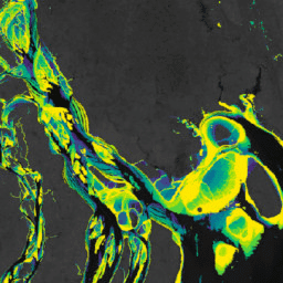
Murray Global Intertidal Change Dataset에는 707,528개의 Landsat Archive 이미지의 감독 분류를 통해 생성된 갯벌 생태계의 전 세계 지도가 포함되어 있습니다. 각 픽셀은 전 세계에 분포된 학습 데이터 세트를 참고하여 갯벌, 영구적인 물 또는 기타로 분류되었습니다.
분류는 1984년 1월 1일부터 2016년 12월 31일까지 북위 60도와 남위 60도 사이의 전 세계 해안선을 따라 구현되었습니다.
이미지 컬렉션은 설정된 기간 (1984~1986년, 1987~1989년, 1990~1992년, 1993~1995년, 1996~1998년, 1999~2001년, 2002~2004년, 2005~2007년, 2008~2010년, 2011~2013년, 2014~2016년)에 30m 픽셀 해상도로 촬영된 11개의 전 세계 갯벌 지도 시계열로 구성됩니다.
이 제품은 전 세계 해안선을 따라 펼쳐진 갯벌 생태계를 보여줍니다.
분석에서 갯벌로 분류된 픽셀은 미고정된 미세 입자 퇴적물 (갯벌), 미고정된 조립 퇴적물 (모래 갯벌), 고정된 퇴적물, 유기물 또는 암석 (넓은 갯벌 암반)을 비롯한 여러 유형의 갯벌 생태계를 나타내며, 맹그로브 및 식생 습지와 같은 식생이 우세한 조간대 생태계의 존재를 나타내는 스펙트럼 서명은 제외됩니다. 이 분석은 정기적인 조수 범람의 영향을 받는 픽셀을 식별하는 것을 목표로 하며, 따라서 조간대 역학을 관찰할 수 있는 기타 조간대 시스템도 포함될 수 있습니다.
대역
픽셀 크기 30미터
대역
이름
단위
픽셀 크기
설명
classification
발생
미터
인터벌의 조간대 영역 분류입니다.
분류를 위한 비트 마스크
비트 0: 조간대 분류입니다.
0: 조간대가 아닌 지역으로 분류됨
1: 분류된 조간대
이용약관
이용약관
이 작업물은 크리에이티브 커먼즈 저작자 표시 4.0 국제 라이선스에 따라 이용할 수 있습니다.
조간대 데이터를 사용하는 경우 관련 학술지 논문을 인용하는 등 적절한 출처 표시를 포함해야 합니다.
인용
인용:
Murray, N.J., Phinn, S.R., DeWitt, M., Ferrari, R., Johnston, R., Lyons, M.B.,
Clinton, N., Thau, D. & Fuller, R.A. (2019) The global distribution and
trajectory of tidal flats. Nature, 565, 222~225.
doi:10.1038/s41586-018-0805-8,
Murray, N. J., Phinn, S. P., Fuller, R. A., DeWitt, M., Ferrari, R.,
Johnston, R., Clinton, N., & Lyons, M. B. (2022). 1984년부터 2019년까지의 갯벌 생태계 고해상도 전 세계 지도 Scientific Data,
9(1).
doi:10.1038/s41597-022-01635-5,
Murray Global Intertidal Change Dataset에는 707,528개의 Landsat Archive 이미지의 감독 분류를 통해 생성된 조간대 생태계의 전 세계 지도가 포함되어 있습니다. 각 픽셀은 전 세계에 분포된 학습 데이터 세트를 참고하여 갯벌, 영구적인 물 또는 기타로 분류되었습니다. 분류는 다음을 따라 구현되었습니다.
[null,null,[],[[["\u003cp\u003eThe Murray Global Intertidal Change Dataset provides global maps of tidal flat ecosystems based on a supervised classification of Landsat imagery from 1984 to 2016.\u003c/p\u003e\n"],["\u003cp\u003eThe dataset identifies tidal flats, permanent water, and other land cover types along coastlines between 60° North and 60° South.\u003c/p\u003e\n"],["\u003cp\u003eThe classification includes various tidal flat ecosystems like mudflats, sand flats, and rock platforms, but excludes vegetated areas like mangroves and marshes.\u003c/p\u003e\n"],["\u003cp\u003eThis dataset is available as a time-series of 11 global maps at 30m resolution, allowing for analysis of intertidal change over time.\u003c/p\u003e\n"],["\u003cp\u003eThe dataset is licensed under a Creative Commons Attribution 4.0 International License and requires proper attribution when used.\u003c/p\u003e\n"]]],[],null,["# Murray Global Intertidal Change Classification\n\nDataset Availability\n: 1984-01-01T00:00:00Z--2017-01-01T00:00:00Z\n\nDataset Provider\n:\n\n\n [Murray/UQ/Google/USGS/NASA](https://intertidal.app)\n\nCadence\n: 3 Years\n\nTags\n:\n[coastal](/earth-engine/datasets/tags/coastal) [google](/earth-engine/datasets/tags/google) [intertidal](/earth-engine/datasets/tags/intertidal) [landsat-derived](/earth-engine/datasets/tags/landsat-derived) [murray](/earth-engine/datasets/tags/murray) [surface-ground-water](/earth-engine/datasets/tags/surface-ground-water) [tidal-flats](/earth-engine/datasets/tags/tidal-flats) [uq](/earth-engine/datasets/tags/uq) \n\n#### Description\n\nThe Murray Global Intertidal Change Dataset contains global maps of tidal flat\necosystems produced via a supervised classification of 707,528 Landsat\nArchive images. Each pixel was classified into tidal flat, permanent water\nor other with reference to a globally distributed set of training data.\n\nThe classification was implemented along the entire global coastline\nbetween 60° North and 60° South from 1 January 1984 to 31 December 2016.\nThe image collection consists consists of a time-series of 11 global maps\nof tidal flats at 30m pixel resolution for set time-periods (1984-1986;\n1987-1989; 1990-1992; 1993-1995; 1996-1998; 1999-2001; 2002-2004;\n2005-2007; 2008-2010; 2011-2013; 2014-2016)\n\nThis product depicts tidal flat ecosystems around the global coastline.\n\nPixels classified as tidal flat in the analysis represent several types of\ntidal flat ecosystems, including unconsolidated fine-grain sediments (tidal\nmudflats), unconsolidated coarse-grain sediments (tidal sand flats), and\nconsolidated sediments, organic material or rocks (wide tidal\nrock-platforms), while excluding spectral signatures indicating the\npresence of vegetation dominated intertidal ecosystems such as mangroves\nand vegetated marshes. The analysis aimed to identify pixels that are\nsubject to regular tidal inundation, and therefore may also include other\nintertidal systems where intertidal dynamics are observable.\n\n### Bands\n\n\n**Pixel Size**\n\n30 meters\n\n**Bands**\n\n| Name | Units | Pixel Size | Description |\n|------------------|------------|------------|-----------------------------------------------------|---|---|---|---|---|---|---|---|---|---|---|---|---|---|---|---|---|---|---|---|---|---|---|---|---|---|---|---|---|---|---|---|---|---|---|---|---|---|---|---|---|---|---|---|---|---|---|---|---|---|---|---|---|---|---|---|---|---|---|---|---|---|---|---|---|---|---|---|---|---|---|---|---|---|---|---|---|---|---|---|---|---|---|---|---|---|---|---|---|---|---|---|---|---|---|---|\n| `classification` | occurrence | meters | Intertertidal area classification for the interval. |\n| Bitmask for classification - Bit 0: Intertidal area classification. - 0: Classified non-intertidal area - 1: Classified intertidal area ||||||||||||||||||||||||||||||||||||||||||||||||||||||||||||||||||||||||||||||||||||||||||||||||||||\n\n### Terms of Use\n\n**Terms of Use**\n\nThis work is licensed under a Creative Commons Attribution 4.0\nInternational License.\n\nAny use of the intertidal data must include proper acknowledgement,\nincluding citing the associated journal article.\n\n### Citations\n\nCitations:\n\n- Murray, N.J., Phinn, S.R., DeWitt, M., Ferrari, R., Johnston, R., Lyons, M.B.,\n Clinton, N., Thau, D. \\& Fuller, R.A. (2019) The global distribution and\n trajectory of tidal flats. Nature, 565, 222-225.\n [doi:10.1038/s41586-018-0805-8](https://doi.org/10.1038/s41586-018-0805-8),\n- Murray, N. J., Phinn, S. P., Fuller, R. A., DeWitt, M., Ferrari, R.,\n Johnston, R., Clinton, N., \\& Lyons, M. B. (2022). High-resolution global\n maps of tidal flat ecosystems from 1984 to 2019. Scientific Data,\n 9(1).\n [doi:10.1038/s41597-022-01635-5](https://doi.org/10.1038/s41597-022-01635-5),\n\n### DOIs\n\n- \u003chttps://doi.org/10.1038/s41586-018-0805-8\u003e\n\n### Explore with Earth Engine\n\n| **Important:** Earth Engine is a platform for petabyte-scale scientific analysis and visualization of geospatial datasets, both for public benefit and for business and government users. Earth Engine is free to use for research, education, and nonprofit use. To get started, please [register for Earth Engine access.](https://console.cloud.google.com/earth-engine)\n\n### Code Editor (JavaScript)\n\n```javascript\nvar dataset = ee.ImageCollection('UQ/murray/Intertidal/v1_1/global_intertidal');\n\nvar visualization = {\n bands: ['classification'],\n min: 0,\n max: 1,\n palette: ['0000ff']\n};\n\nMap.setCenter(126.6339, 37.4394, 10);\n\nMap.addLayer(dataset, visualization, 'Intertidal areas');\n```\n[Open in Code Editor](https://code.earthengine.google.com/?scriptPath=Examples:Datasets/UQ/UQ_murray_Intertidal_v1_1_global_intertidal) \n[Murray Global Intertidal Change Classification](/earth-engine/datasets/catalog/UQ_murray_Intertidal_v1_1_global_intertidal) \nThe Murray Global Intertidal Change Dataset contains global maps of tidal flat ecosystems produced via a supervised classification of 707,528 Landsat Archive images. Each pixel was classified into tidal flat, permanent water or other with reference to a globally distributed set of training data. The classification was implemented along the ... \nUQ/murray/Intertidal/v1_1/global_intertidal, coastal,google,intertidal,landsat-derived,murray,surface-ground-water,tidal-flats,uq \n1984-01-01T00:00:00Z/2017-01-01T00:00:00Z \n-60 -180 60 180 \nGoogle Earth Engine \nhttps://developers.google.com/earth-engine/datasets\n\n- [https://doi.org/10.1038/s41586-018-0805-8](https://doi.org/https://intertidal.app)\n- [https://doi.org/10.1038/s41586-018-0805-8](https://doi.org/https://developers.google.com/earth-engine/datasets/catalog/UQ_murray_Intertidal_v1_1_global_intertidal)"]]