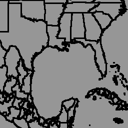
Глобальная база данных политико-административных границ geoBoundaries — это онлайн-ресурс с открытой лицензией, содержащий информацию о границах (например, штатов, округов) всех стран мира. В настоящее время отслеживаются границы 199 субъектов, включая все 195 государств-членов ООН, Гренландию, Тайвань, Ниуэ и Косово.
Комплексные глобальные административные зоны (CGAZ) представляют собой набор глобальных композитных изображений административных границ. Спорные территории удаляются и заменяются полигонами в соответствии с определениями Государственного департамента США. Система включает три уровня границ: ADM0, ADM1 и ADM2, привязанные к международным границам (согласно определениям Государственного департамента США), с заполненными пробелами между границами.
Этот набор данных является частью CGAZ. Он был получен из версии 6.0.0 Global Composite Files с DBF_DATE_LAST_UPDATE=2023-09-13. Он показывает границы на уровне ADM1 (границы округов).
Схема таблицы
Схема таблицы
Имя
Тип
Описание
shapeGroup
НИТЬ
Уникальный код страны
shapeName
НИТЬ
Название административного региона
shapeType
НИТЬ
Тип границы:
ADM0: Уровень страны
ADM1: районный уровень
ADM2: уровень муниципалитета
shapeID
ДВОЙНОЙ
Уникальный идентификатор, присвоенный форме
Условия эксплуатации
Наборы данных geoBoundaries предоставляются по лицензии CC BY 4.0, которая допускает большинство вариантов коммерческого, некоммерческого и академического использования. См. условия использования поставщика .
Глобальная база данных политико-административных границ geoBoundaries — это онлайн-ресурс с открытой лицензией, содержащий информацию о границах (например, штатов, округов) всех стран мира. В настоящее время отслеживаются 199 субъектов, включая все 195 государств-членов ООН, Гренландию, Тайвань, Ниуэ и Косово. Комплексные глобальные административные зоны (CGAZ) — это…
[null,null,[],[[["\u003cp\u003eThe geoBoundaries dataset provides district-level (ADM1) political administrative boundaries for 199 countries and territories worldwide.\u003c/p\u003e\n"],["\u003cp\u003eIt's part of the CGAZ project, offering standardized boundaries with disputed areas resolved using US Department of State definitions.\u003c/p\u003e\n"],["\u003cp\u003eThe dataset is available under the CC BY 4.0 license, enabling commercial, non-commercial, and academic use.\u003c/p\u003e\n"],["\u003cp\u003eUsers can access and analyze the dataset through Google Earth Engine using provided code snippets and visualization tools.\u003c/p\u003e\n"],["\u003cp\u003eBoundary data is sourced from the William and Mary geoLab's geoBoundaries project, version 6.0.0, with the latest updates as of September 13, 2023.\u003c/p\u003e\n"]]],["The geoBoundaries database, provided by William and Mary geoLab, offers open-license administrative boundaries for 199 global entities, including UN member states. This dataset, part of Comprehensive Global Administrative Zones (CGAZ), is version 6.0.0, last updated on 2023-09-13. It features ADM1 (district-level) boundaries with data available on Earth Engine via `ee.FeatureCollection(\"WM/geoLab/geoBoundaries/600/ADM1\")`. Data can be visualized with `ui.Map.FeatureViewLayer`, and the terms of use allow for commercial, noncommercial, and academic usage under the CC BY 4.0 license.\n"],null,["# geoBoundaries: Political administrative boundaries at District level (ADM1), v6.0.0\n\nDataset Availability\n: 2023-09-14T00:00:00Z--2023-09-14T00:00:00Z\n\nDataset Provider\n:\n\n\n [William and Mary geoLab](https://www.geoboundaries.org/index.html)\n\nTags\n:\n[borders](/earth-engine/datasets/tags/borders) [countries](/earth-engine/datasets/tags/countries) [infrastructure-boundaries](/earth-engine/datasets/tags/infrastructure-boundaries) [table](/earth-engine/datasets/tags/table) \n\n#### Description\n\nThe geoBoundaries Global Database of Political Administrative Boundaries\nDatabase is an online, open license resource of boundaries (i.e., state,\ncounty) for every country in the world. Currently 199 total entities are\ntracked, including all 195 UN member states, Greenland, Taiwan, Niue, and\nKosovo.\n\nComprehensive Global Administrative Zones (CGAZ) is a set of global\ncomposites for administrative boundaries. Disputed areas are removed and\nreplaced with polygons following US Department of State definitions. It has\nthree boundary levels ADM0, ADM1, and ADM2, clipped to international\nboundaries (US Department of State), with gaps filled between borders.\n\nThis dataset is part of CGAZ. It was ingested from\n[version 6.0.0](https://github.com/wmgeolab/geoBoundaries/tree/1289e40e366c7b320550be1ee0614a9472d572d4)\nof Global Composite Files with DBF_DATE_LAST_UPDATE=2023-09-13.\nIt shows boundaries at level\nADM1 (district-level boundaries).\n\n### Table Schema\n\n**Table Schema**\n\n| Name | Type | Description |\n|------------|--------|----------------------------------------------------------------------------------------|\n| shapeGroup | STRING | Unique country code |\n| shapeName | STRING | Administrative region name |\n| shapeType | STRING | Boundary type: - ADM0: Country level - ADM1: District level - ADM2: Municipality level |\n| shapeID | DOUBLE | Unique ID assigned to the shape |\n\n### Terms of Use\n\n**Terms of Use**\n\ngeoBoundaries datasets are provided under the CC BY 4.0 license, which\nallows for most commmercial, noncommercial, and academic uses. See\n[provider terms of use](https://www.geoboundaries.org/index.html#usage).\n\n### Explore with Earth Engine\n\n| **Important:** Earth Engine is a platform for petabyte-scale scientific analysis and visualization of geospatial datasets, both for public benefit and for business and government users. Earth Engine is free to use for research, education, and nonprofit use. To get started, please [register for Earth Engine access.](https://console.cloud.google.com/earth-engine)\n\n### Code Editor (JavaScript)\n\n```javascript\nvar dataset = ee.FeatureCollection('WM/geoLab/geoBoundaries/600/ADM1');\n\nMap.setCenter(-100.0, 38.5, 4);\n\nvar styleParams = {\n fillColor: 'b5ffb4',\n color: '00909F',\n width: 1.0,\n};\n\ndataset = dataset.style(styleParams);\n\nMap.addLayer(dataset, {}, 'ADM1 Boundaries');\n```\n[Open in Code Editor](https://code.earthengine.google.com/?scriptPath=Examples:Datasets/WM/WM_geoLab_geoBoundaries_600_ADM1) \n[geoBoundaries: Political administrative boundaries at District level (ADM1), v6.0.0](/earth-engine/datasets/catalog/WM_geoLab_geoBoundaries_600_ADM1) \nThe geoBoundaries Global Database of Political Administrative Boundaries Database is an online, open license resource of boundaries (i.e., state, county) for every country in the world. Currently 199 total entities are tracked, including all 195 UN member states, Greenland, Taiwan, Niue, and Kosovo. Comprehensive Global Administrative Zones (CGAZ) is a ... \nWM/geoLab/geoBoundaries/600/ADM1, borders,countries,infrastructure-boundaries,table \n2023-09-14T00:00:00Z/2023-09-14T00:00:00Z \n-90 -180 90 180 \nGoogle Earth Engine \nhttps://developers.google.com/earth-engine/datasets\n\n- [](https://doi.org/https://www.geoboundaries.org/index.html)\n- [](https://doi.org/https://developers.google.com/earth-engine/datasets/catalog/WM_geoLab_geoBoundaries_600_ADM1)"]]