-
GPW 연간 우세한 초원 클래스 v1
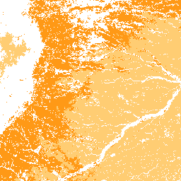
이 데이터 세트는 2000년부터 2022년까지 30m 공간 해상도로 초지 (경작 및 자연/반자연)의 전 세계 연간 우세 클래스 지도를 제공합니다. Land & Carbon Lab Global Pasture Watch 이니셔티브에서 제작한 매핑된 초지 범위에는 최소 30%의 … 전역 global-pasture-watch land landcover landuse landuse-landcover -
GPW 연간 경작지 확률 v1
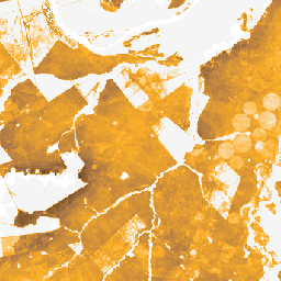
이 데이터 세트는 2000년부터 2022년까지의 경작된 초지의 전 세계 연간 확률 지도를 30m 공간 해상도로 제공합니다. Land & Carbon Lab Global Pasture Watch 이니셔티브에서 제작한 매핑된 초지 범위에는 건조 또는 … 전역 global-pasture-watch land landcover landuse landuse-landcover -
GPW 연간 자연/반자연 초지 확률 v1
이 데이터 세트는 2000년부터 2022년까지 30m 공간 해상도로 자연/반자연 초지의 전 세계 연간 확률 지도를 제공합니다. Land & Carbon Lab Global Pasture Watch 이니셔티브에서 제작한 매핑된 초지 범위에는 건조 또는 … 전역 global-pasture-watch land landcover landuse landuse-landcover -
GPW 연간 보정되지 않은 총 기본 생산성 (uGPP) v1
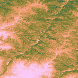
이 데이터 세트는 2000년부터 30m 공간 해상도로 제공되는 전 세계 보정되지 않은 EO 기반 총 일차 생산량을 제공합니다. Land & Carbon Lab Global Pasture Watch 이니셔티브에서 제작한 현재 데이터 세트는 2000년부터 30m 공간 해상도로 전 세계의 총 일차 생산량 (GPP) 값을 제공합니다. GPP 값은 … global global-pasture-watch land landcover landuse plant-productivity
Global Pasture Watch
[null,null,[],[[["\u003cp\u003eThe Global Pasture Watch research consortium, initiated by the Land & Carbon Lab, focuses on developing global products for grasslands and livestock grazing.\u003c/p\u003e\n"],["\u003cp\u003eThe consortium comprises experts in geospatial monitoring, machine learning, ecology, and agriculture from leading research institutions.\u003c/p\u003e\n"],["\u003cp\u003eThree key datasets are provided: annual probability maps of cultivated grasslands, dominant class maps of grasslands, and annual probability maps of natural/semi-natural grasslands.\u003c/p\u003e\n"],["\u003cp\u003eThese datasets offer global coverage from 2000 to 2022 at a 30-meter spatial resolution.\u003c/p\u003e\n"],["\u003cp\u003eThe mapped grassland extent includes any land cover type containing at least 30% grassland.\u003c/p\u003e\n"]]],["The Land & Carbon Lab, in collaboration with the WRI and Bezos Earth Fund, formed the Global Pasture Watch consortium. This group of experts develops global products for grassland and livestock monitoring. They produce annual maps from 2000-2022 at 30-meter resolution detailing the probability of cultivated, natural/semi-natural grasslands, and dominant grassland classes. The maps identify any land cover containing at least 30% of dry or.\n"],null,["# Global Pasture Watch\n\nThe Land \\& Carbon Lab, convened by the World Resources Institute (WRI) and the Bezos Earth Fund, established the Global Pasture Watch research consortium. The consortium, which is made up of experts in geospatial monitoring, machine learning, ecology and agriculture across some of the world's leading research institutions, is developing global products for grasslands and livestock grazing in the 21st century. \n[](https://landcarbonlab.org/data/global-grassland-and-livestock-monitoring) \n-\n\n |-------------------------------------------------------------------------------------------------------------------------------------------------------------------------------------------------------------------------------------------------------------------------------------------------------------------------------------|\n | [### GPW Annual Dominant Class of Grasslands v1](/earth-engine/datasets/catalog/projects_global-pasture-watch_assets_ggc-30m_v1_grassland_c) |\n | This dataset provides global annual dominant class maps of grasslands (cultivated and natural/semi-natural) from 2000 to 2022 at 30-m spatial resolution. Produced by Land \\& Carbon Lab Global Pasture Watch initiative, the mapped grassland extent includes any land cover type, which contains at least 30% ... |\n | [global](/earth-engine/datasets/tags/global) [global-pasture-watch](/earth-engine/datasets/tags/global-pasture-watch) [land](/earth-engine/datasets/tags/land) [landcover](/earth-engine/datasets/tags/landcover) [landuse](/earth-engine/datasets/tags/landuse) [landuse-landcover](/earth-engine/datasets/tags/landuse-landcover) |\n\n-\n\n |-------------------------------------------------------------------------------------------------------------------------------------------------------------------------------------------------------------------------------------------------------------------------------------------------------------------------------------|\n | [### GPW Annual Probabilities of Cultivated Grasslands v1](/earth-engine/datasets/catalog/projects_global-pasture-watch_assets_ggc-30m_v1_cultiv-grassland_p) |\n | This dataset provides global annual probability maps of cultivated grassland from 2000 to 2022 at 30-m spatial resolution. Produced by Land \\& Carbon Lab Global Pasture Watch initiative, the mapped grassland extent includes any land cover type, which contains at least 30% of dry or ... |\n | [global](/earth-engine/datasets/tags/global) [global-pasture-watch](/earth-engine/datasets/tags/global-pasture-watch) [land](/earth-engine/datasets/tags/land) [landcover](/earth-engine/datasets/tags/landcover) [landuse](/earth-engine/datasets/tags/landuse) [landuse-landcover](/earth-engine/datasets/tags/landuse-landcover) |\n\n-\n\n |-------------------------------------------------------------------------------------------------------------------------------------------------------------------------------------------------------------------------------------------------------------------------------------------------------------------------------------|\n | [### GPW Annual Probabilities of Natural/Semi-natural Grasslands v1](/earth-engine/datasets/catalog/projects_global-pasture-watch_assets_ggc-30m_v1_nat-semi-grassland_p) |\n | This dataset provides global annual probability maps of natural/semi-natural grassland from 2000 to 2022 at 30-m spatial resolution. Produced by Land \\& Carbon Lab Global Pasture Watch initiative, the mapped grassland extent includes any land cover type, which contains at least 30% of dry or ... |\n | [global](/earth-engine/datasets/tags/global) [global-pasture-watch](/earth-engine/datasets/tags/global-pasture-watch) [land](/earth-engine/datasets/tags/land) [landcover](/earth-engine/datasets/tags/landcover) [landuse](/earth-engine/datasets/tags/landuse) [landuse-landcover](/earth-engine/datasets/tags/landuse-landcover) |\n\n-\n\n |---------------------------------------------------------------------------------------------------------------------------------------------------------------------------------------------------------------------------------------------------------------------------------------------------------------------------------------|\n | [### GPW Annual uncalibrated Gross Primary Productivity (uGPP) v1](/earth-engine/datasets/catalog/projects_global-pasture-watch_assets_ggpp-30m_v1_ugpp_m) |\n | This dataset provides global uncalibrated EO-based Gross Primary Productivity from 2000 at 30-m spatial resolution. Produced by Land \\& Carbon Lab Global Pasture Watch initiative, the current dataset provides Gross Primary Productivity (GPP) values globally at 30-m spatial resolution from 2000 onwards. GPP values are ... |\n | [global](/earth-engine/datasets/tags/global) [global-pasture-watch](/earth-engine/datasets/tags/global-pasture-watch) [land](/earth-engine/datasets/tags/land) [landcover](/earth-engine/datasets/tags/landcover) [landuse](/earth-engine/datasets/tags/landuse) [plant-productivity](/earth-engine/datasets/tags/plant-productivity) |"]]