-
USGS 3DEP 10m National Map Seamless (1/3 Arc-Second)
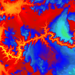
Il s'agit de l'ensemble de données DEM 3DEP continu pour les États-Unis, avec une couverture complète des 48 États contigus, d'Hawaï et des territoires américains. La couverture de l'Alaska est partiellement disponible pour le moment et sera étendue à l'ensemble de l'État dans le cadre de l'initiative de cartographie de l'Alaska. L'espacement au sol est… 3dep dem elevation elevation-topography geophysical topography -
Carte nationale USGS 3DEP 1m
Il s'agit d'une collection d'images en mosaïque avec une taille de pixel de 1 mètre provenant du programme 3D Elevation (3DEP). Les fonds de données 3DEP servent de couche d'altitude pour la carte nationale et fournissent des informations de base sur l'altitude pour les études sur les sciences de la Terre et les applications de cartographie aux États-Unis. 3dep dem elevation elevation-topography geophysical topography -
Métadonnées spatiales de la carte nationale 3DEP de l'USGS 1/3 arc-seconde (10 m)
Il s'agit d'un tableau contenant les métadonnées de l'élément 3DEP 10m DEM. Les métadonnées spatiales de l'étendue de l'unité de travail (WESM) contiennent des informations sur la disponibilité actuelle des données lidar et des informations de base sur les projets lidar, y compris le niveau de qualité lidar, les dates d'acquisition des données et des liens vers les métadonnées au niveau du projet. En savoir plus … 3dep elevation-topography table usgs
Datasets tagged 3dep in Earth Engine
[null,null,[],[[["\u003cp\u003eThe USGS 3DEP provides seamless 10m resolution elevation data for the conterminous U.S., Hawaii, and U.S. territories, with expanding coverage for Alaska.\u003c/p\u003e\n"],["\u003cp\u003eMetadata for the 3DEP 10m DEM is available, including lidar data availability, quality level, acquisition dates, and project-level metadata links.\u003c/p\u003e\n"],["\u003cp\u003eThe USGS 3DEP also offers a tiled collection of 1m resolution elevation images, serving as the elevation layer of The National Map for various applications.\u003c/p\u003e\n"]]],["The USGS 3DEP dataset offers seamless DEM data for the US, including the 48 contiguous states, Hawaii, and US territories, with partial coverage of Alaska that is being expanded. This data is available at 10m and 1m resolution. The 10m DEM has corresponding metadata table for lidar data availability. This 3DEP information serves as the elevation layer for the National Map and supports earth science studies and mapping applications.\n"],null,["# Datasets tagged 3dep in Earth Engine\n\n-\n\n |-------------------------------------------------------------------------------------------------------------------------------------------------------------------------------------------------------------------------------------------------------------------------------------------------------------------------|\n | [### USGS 3DEP 10m National Map Seamless (1/3 Arc-Second)](/earth-engine/datasets/catalog/USGS_3DEP_10m_collection) |\n | This is the seamless 3DEP DEM dataset for the U.S. with full coverage of the 48 conterminous states, Hawaii, and U.S. territories. Alaska coverage is partially available now and is being expanded to statewide coverage as part of the Alaska Mapping Initiative. Ground spacing is ... |\n | [3dep](/earth-engine/datasets/tags/3dep) [dem](/earth-engine/datasets/tags/dem) [elevation](/earth-engine/datasets/tags/elevation) [elevation-topography](/earth-engine/datasets/tags/elevation-topography) [geophysical](/earth-engine/datasets/tags/geophysical) [topography](/earth-engine/datasets/tags/topography) |\n\n-\n\n |-------------------------------------------------------------------------------------------------------------------------------------------------------------------------------------------------------------------------------------------------------------------------------------------------------------------------|\n | [### USGS 3DEP 1m National Map](/earth-engine/datasets/catalog/USGS_3DEP_1m) |\n | This is a tiled collection of images with 1m pixel size from the 3D Elevation Program (3DEP). The 3DEP data holdings serve as the elevation layer of The National Map and provide foundational elevation information for earth science studies and mapping applications in the United ... |\n | [3dep](/earth-engine/datasets/tags/3dep) [dem](/earth-engine/datasets/tags/dem) [elevation](/earth-engine/datasets/tags/elevation) [elevation-topography](/earth-engine/datasets/tags/elevation-topography) [geophysical](/earth-engine/datasets/tags/geophysical) [topography](/earth-engine/datasets/tags/topography) |\n\n-\n\n |--------------------------------------------------------------------------------------------------------------------------------------------------------------------------------------------------------------------------------------------------------------------------------------------------------------|\n | [### USGS 3DEP National Map Spatial Metadata 1/3 Arc-Second (10m)](/earth-engine/datasets/catalog/USGS_3DEP_10m_metadata) |\n | This is a table with metadata for the 3DEP 10m DEM asset. The Work unit Extent Spatial Metadata (WESM) contains current lidar data availability and basic information about lidar projects, including lidar quality level, data acquisition dates, and links to project-level metadata. See more details ... |\n | [3dep](/earth-engine/datasets/tags/3dep) [elevation-topography](/earth-engine/datasets/tags/elevation-topography) [table](/earth-engine/datasets/tags/table) [usgs](/earth-engine/datasets/tags/usgs) |"]]