-
Évapotranspiration réelle pour l'Australie (CMRSET Landsat V2.2)

Cet ensemble de données fournit une évapotranspiration réelle (ETR ou ETa) précise pour l'Australie à l'aide de l'algorithme CMRSET. La bande AET (nommée "ETa") contient la valeur quotidienne moyenne du modèle CMRSET pour toutes les observations Landsat sans nuage au cours de ce mois (indiquée par la valeur 3 dans les données AET… agriculture australie csiro évaporation évapotranspiration landsat-derived -
DEM australien 5M

La grille du modèle numérique d'élévation (MNE) de l'Australie, dérivée du modèle LiDAR, représente un MNE national de 5 mètres (sol nu) qui a été dérivé de quelque 236 relevés LiDAR individuels entre 2001 et 2015, couvrant une superficie de plus de 245 000 kilomètres carrés. … australia dem elevation elevation-topography ga geophysical -
DEM-H : modèle numérique d'élévation SRTM australien avec contraintes hydrologiques

Le modèle numérique d'élévation (DEM-H) à contraintes hydrologiques a été dérivé des données SRTM acquises par la NASA en février 2000. Le modèle a été conditionné hydrologiquement et le drainage a été appliqué. Le DEM-H capture les chemins de flux en fonction des altitudes SRTM et des lignes de flux cartographiées, et permet de délimiter… australia dem elevation elevation-topography ga geophysical -
DEM-S : modèle numérique d'altitude lissé australien

Le modèle numérique d'élévation lissé (DEM-S) est dérivé des données SRTM acquises par la NASA en février 2000. Le DEM-S représente la topographie de la surface du sol (à l'exclusion des éléments de végétation) et a été lissé pour réduire le bruit et améliorer la représentation de la forme de la surface. Un processus adaptatif appliqué plus… australia dem elevation elevation-topography ga geophysical -
Aperçu de National Intertidal Digital Elevation Model 25m 1.0.0

Le modèle numérique d'élévation intertidale national (NIDEM ; Bishop-Taylor et al. 2018, 2019) est un ensemble de données d'élévation à l'échelle continentale pour la zone intertidale exposée de l'Australie. NIDEM fournit la première représentation tridimensionnelle des plages et côtes sableuses intertidales, des vasières, des côtes rocheuses et des récifs d'Australie à 25 m… australia dem elevation-topography ga -
SLGA : Soil and Landscape Grid of Australia (attributs du sol)
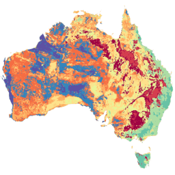
La grille australienne des sols et du paysage (SLGA, Soil and Landscape Grid of Australia) est un ensemble de données complet sur les attributs des sols en Australie, avec une résolution de 3 secondes d'arc (pixels d'environ 90 mètres). Les surfaces sont les résultats de la modélisation qui décrivent la distribution spatiale des attributs du sol à l'aide des données existantes sur le sol et des données environnementales… australie csiro soil tern
Datasets tagged australia in Earth Engine
[null,null,[],[],["Several datasets provide detailed geographic and environmental information about Australia. Digital Elevation Models (DEMs) include a 5-meter grid from LiDAR surveys, a hydrologically enforced model, and a smoothed model from SRTM data, as well as a national intertidal DEM. Additional data includes the Soil and Landscape Grid of Australia (SLGA) with soil attributes. Landsat data is processed to show actual evapotranspiration (AET), land cover, water observations, and statistical analysis.\n"]]