-
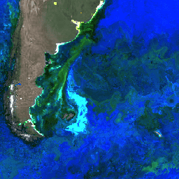
Ocean Color SMI: Standard Mapped Image MODIS Aqua Data(해양 색상 SMI: 표준 매핑 이미지 MODIS Aqua 데이터)

이 레벨 3 제품에는 EOSDIS에서 생성되거나 수집된 해양 색상 및 위성 해양 생물학 데이터가 포함됩니다. 이 데이터 세트는 연안 지역의 생물학 및 수문학, 연안 해양 서식지의 다양성 및 지리적 분포의 변화, 생지화학적 플럭스, … 생물학 엽록소 modis nasa ocean oceandata -
Ocean Color SMI: Standard Mapped Image MODIS Terra Data
이 레벨 3 제품에는 EOSDIS에서 생성되거나 수집된 해양 색상 및 위성 해양 생물학 데이터가 포함됩니다. 이 데이터 세트는 연안 지역의 생물학 및 수문학, 연안 해양 서식지의 다양성 및 지리적 분포의 변화, 생지화학적 플럭스, … 생물학 엽록소 modis nasa ocean oceandata -
Ocean Color SMI: Standard Mapped Image SeaWiFS Data(표준 매핑 이미지 SeaWiFS 데이터)

이 레벨 3 제품에는 EOSDIS에서 생성되거나 수집된 해양 색상 및 위성 해양 생물학 데이터가 포함됩니다. 이 데이터 세트는 연안 지역의 생물학 및 수문학, 연안 해양 서식지의 다양성 및 지리적 분포의 변화, 생지화학적 플럭스, … 생물학 엽록소 NASA 해양 해양 데이터 해양
Datasets tagged biology in Earth Engine
[null,null,[],[],["The data provided are Level 3 ocean color and satellite ocean biology datasets from EOSDIS. These datasets, derived from MODIS Aqua, MODIS Terra, and SeaWiFS, are used for studying coastal zone biology and hydrology. They track changes in marine habitat diversity and distribution. The data further allows for the study of biogeochemical fluxes, and provide information about chlorophyll, and reflectance, in ocean. The datasets are provided by NASA.\n"]]