-
ESA WorldCereal AEZ v100

Le système de classification WorldCereal de l'Agence spatiale européenne (ESA) vise à générer des produits dans un délai d'un mois après la fin d'une saison de croissance donnée. En raison de la nature dynamique de ces saisons de croissance à travers le monde, une stratification mondiale en zones agro-écologiques (ZAE) a été effectuée sur la base… agriculture boundaries crop esa global table -
WDOECM : autres mesures de conservation efficaces basées sur les zones (points)

Zone géographiquement définie autre qu'une zone protégée, qui est régie et gérée de manière à obtenir des résultats positifs et durables à long terme pour la conservation in situ de la biodiversité, avec les fonctions et services écosystémiques associés et, le cas échéant, les fonctions et services culturels, spirituels, socio-économiques et autres fonctions et services locaux… boundaries ecosystems iucn marine mpa protected -
WDOECM : autres mesures de conservation efficaces basées sur les zones (polygones)

Zone géographiquement définie autre qu'une zone protégée, qui est régie et gérée de manière à obtenir des résultats positifs et durables à long terme pour la conservation in situ de la biodiversité, avec les fonctions et services écosystémiques associés et, le cas échéant, les fonctions et services culturels, spirituels, socio-économiques et autres fonctions et services locaux… boundaries ecosystems iucn marine mpa protected -
WDPA : base de données mondiale sur les aires protégées (points)
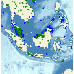
La base de données mondiale sur les aires protégées (WDPA) est la source d'informations la plus à jour et la plus complète sur les aires protégées. Elle est mise à jour tous les mois à partir des informations fournies par les gouvernements, les organisations non gouvernementales, les propriétaires fonciers et les communautés. Il est géré par le Centre mondial de surveillance de la conservation de la nature du Programme des Nations Unies pour l'environnement (PNUE-WCMC) avec … boundaries ecosystems iucn marine mpa protected -
WDPA : base de données mondiale sur les aires protégées (polygones)

La base de données mondiale sur les aires protégées (WDPA) est la source d'informations la plus à jour et la plus complète sur les aires protégées. Elle est mise à jour tous les mois à partir des informations fournies par les gouvernements, les organisations non gouvernementales, les propriétaires fonciers et les communautés. Il est géré par le Centre mondial de surveillance de la conservation de la nature du Programme des Nations Unies pour l'environnement (PNUE-WCMC) avec … boundaries ecosystems iucn marine mpa protected
Datasets tagged boundaries in Earth Engine
[null,null,[],[],["The ESA WorldCereal classification system stratifies the globe into Agro-Ecological Zones (AEZ) to produce crop data within one month of the growing season's end. The World Database on Protected Areas (WDPA), both point and polygon versions, is a comprehensive, monthly-updated resource on protected areas. Other Effective Area-based Conservation Measures (WDOECM), also in point and polygon formats, identify areas achieving long-term biodiversity conservation, including ecosystem, cultural, and socioeconomic benefits.\n"]]