-
CHIRTS-daily:气候危害中心红外温度与观测站每日温度数据产品

Climate Hazards Center InfraRed Temperature with Stations daily temperature data product(CHIRTS-daily;Verdin 等人,2020 年)是一种准全球性高分辨率网格化数据集(分辨率为 0.05° × 0.05°,范围为 60°S - 70°N),可提供每日最低温度 (Tmin) 和最高 2 米温度 (Tmax),以及四个派生变量:饱和蒸汽… chg climate daily era5 geophysical reanalysis -
CPC 全球统一的基于降雨量计的每日降水分析

CPC Unified Gauge-Based Analysis of Global Daily Precipitation 数据集提供 1979 年至今的陆地每日降水估计值。该数据集由 NOAA 的气候预测中心 (CPC) 开发,利用最佳插值技术将全球雨量计网络的数据与…相结合。 每日 noaa 降水 天气 -
CPC 全球统一温度

此数据集提供全球陆地地区每日地表气温的网格化分析,包括每日最高气温 (Tmax) 和最低气温 (Tmin)。这些数据涵盖 1979 年至今,以 0.5 度纬度/经度网格呈现,与 CPC 基于地面观测站的全球每日… 气候 每日 noaa 降水 天气 -
哥白尼全球海洋生物地球化学预报 - BIO

Operational Mercator Ocean 生物地球化学全球海洋分析和预报系统(分辨率为 1/4 度)每周更新一次,提供 10 天的 3D 全球海洋预报。时间序列按时间进行聚合,以达到两整年的时间序列滑动窗口。这… copernicus 每日 预报 海洋 海洋 海洋 -
哥白尼全球海洋生物地球化学预测 - CAR

Operational Mercator Ocean 生物地球化学全球海洋分析和预报系统(分辨率为 1/4 度)每周更新一次,提供 10 天的 3D 全球海洋预报。时间序列按时间进行聚合,以达到两整年的时间序列滑动窗口。这… copernicus 每日 预报 海洋 海洋 海洋 -
哥白尼全球海洋生物地球化学预测 - CO2

Operational Mercator Ocean 生物地球化学全球海洋分析和预报系统(分辨率为 1/4 度)每周更新一次,提供 10 天的 3D 全球海洋预报。时间序列按时间进行聚合,以达到两整年的时间序列滑动窗口。这… copernicus 每日 预报 海洋 海洋 海洋 -
哥白尼全球海洋生物地球化学预报 - NUT

Operational Mercator Ocean 生物地球化学全球海洋分析和预报系统(分辨率为 1/4 度)每周更新一次,提供 10 天的 3D 全球海洋预报。时间序列按时间进行聚合,以达到两整年的时间序列滑动窗口。这… copernicus 每日 预报 海洋 海洋 海洋 -
哥白尼全球海洋生物地球化学预报 - 光学
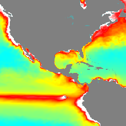
Operational Mercator Ocean 生物地球化学全球海洋分析和预报系统(分辨率为 1/4 度)每周更新一次,提供 10 天的 3D 全球海洋预报。时间序列按时间进行聚合,以达到两整年的时间序列滑动窗口。这… copernicus 每日 预报 海洋 海洋 海洋 -
哥白尼全球海洋生物地球化学预测 - PFT

Operational Mercator Ocean 生物地球化学全球海洋分析和预报系统(分辨率为 1/4 度)每周更新一次,提供 10 天的 3D 全球海洋预报。时间序列按时间进行聚合,以达到两整年的时间序列滑动窗口。这… copernicus 每日 预报 海洋 海洋 海洋 -
哥白尼全球海洋生物地球化学预报 - 浮游生物

Operational Mercator Ocean 生物地球化学全球海洋分析和预报系统(分辨率为 1/4 度)每周更新一次,提供 10 天的 3D 全球海洋预报。时间序列按时间进行聚合,以达到两整年的时间序列滑动窗口。这… copernicus 每日 预报 海洋 海洋 海洋 -
哥白尼卫星海洋颜色每日数据

此数据集提供从多个卫星传感器获得的全球每日海洋表面叶绿素-a 浓度和遥感反射率估计值。遥感反射率(或 Rrs)定义为水面出射辐射与下行辐照度的比率,是用于…的算法的主要输入 叶绿素 a 哥白尼 每日 海洋 海洋 -
Daymet V4:每日地面天气和气候学摘要

Daymet V4 提供北美大陆、夏威夷和波多黎各的网格化每日天气参数估计值(波多黎各的数据从 1950 年开始提供)。它基于所选气象站数据和各种支持性数据源得出。与之前版本相比,Daymet … 气候 每日 日光 通量 地球物理 nasa -
EMIT L1B 传感器处校准的辐射率和地理定位数据 60 米

EMIT 项目是 NASA 地球科学部 (ESD) 项目主管指导下的地球风险仪器 (EV-I) 计划的一部分。EMIT 包含一个 VSWIR 红外戴森成像光谱仪,该光谱仪经过改造,可安装在国际空间站 (ISS) 上。EMIT 测量的是辐射度… daily emit nasa radiance satellite-imagery -
EMIT L2A 地表反射率估计值和不确定性以及掩码 60 米

EMIT 项目是 NASA 地球科学部 (ESD) 项目主管指导下的地球风险仪器 (EV-I) 计划的一部分。EMIT 包含一个 VSWIR 红外戴森成像光谱仪,该光谱仪经过改造,可安装在国际空间站 (ISS) 上。EMIT 测量的是辐射度… daily emit nasa reflectance satellite-imagery -
地球表面矿物尘埃源调查 - 甲烷增强

EMIT 项目是 NASA 地球科学部 (ESD) 项目主管指导下的地球风险仪器 (EV-I) 计划的一部分。EMIT 包含一个 VSWIR 红外戴森成像光谱仪,该光谱仪经过改造,可安装在国际空间站 (ISS) 上。EMIT 测量的是辐射度… 大气 每日 排放 甲烷 nasa -
地球表面矿物尘埃源调查 - 甲烷羽流复合体

EMIT 项目是 NASA 地球科学部 (ESD) 项目主管指导下的地球风险仪器 (EV-I) 计划的一部分。EMIT 包含一个 VSWIR 红外戴森成像光谱仪,该光谱仪经过改造,可安装在国际空间站 (ISS) 上。EMIT 测量的是辐射度… 大气 每日 排放 甲烷 nasa -
FORMA 提醒阈值

WRI 的注意事项:WRI 决定停止更新 FORMA 提醒。目标是简化 Global Forest Watch 用户体验并减少冗余。我们发现,Terra-i 和 GLAD 的使用频率更高。此外,使用 GLAD 作为标准,发现 Terra-i 的性能优于 FORMA… 每日 森林砍伐 火灾 森林 FORMA gfw -
FORMA 提醒

WRI 的注意事项:WRI 决定停止更新 FORMA 提醒。目标是简化 Global Forest Watch 用户体验并减少冗余。我们发现,Terra-i 和 GLAD 的使用频率更高。此外,使用 GLAD 作为标准,发现 Terra-i 的性能优于 FORMA… 每日 森林砍伐 火灾 森林 FORMA gfw -
FORMA 原始输出 FIRMS

WRI 的注意事项:WRI 决定停止更新 FORMA 提醒。目标是简化 Global Forest Watch 用户体验并减少冗余。我们发现,Terra-i 和 GLAD 的使用频率更高。此外,使用 GLAD 作为标准,发现 Terra-i 的性能优于 FORMA… 每日 森林砍伐 火灾 森林 FORMA gfw -
FORMA 原始输出 NDVI

WRI 的注意事项:WRI 决定停止更新 FORMA 提醒。目标是简化 Global Forest Watch 用户体验并减少冗余。我们发现,Terra-i 和 GLAD 的使用频率更高。此外,使用 GLAD 作为标准,发现 Terra-i 的性能优于 FORMA… 每日 森林砍伐 森林 森林生物质 FORMA gfw -
FORMA 植被 T 统计信息

WRI 的注意事项:WRI 决定停止更新 FORMA 提醒。目标是简化 Global Forest Watch 用户体验并减少冗余。我们发现,Terra-i 和 GLAD 的使用频率更高。此外,使用 GLAD 作为标准,发现 Terra-i 的性能优于 FORMA… 每日 森林砍伐 森林 森林生物质 FORMA gfw -
全球海洋物理分析和预报(每日)
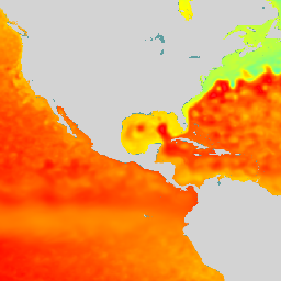
Copernicus 海洋物理学 2D 日平均场 (cmems_mod_glo_phy_anfc_0.083deg_P1D-m) 以 8 公里的分辨率提供全球日平均海洋表面和底部变量。Operational Mercator 全球海洋分析和预报系统每天都会更新 10 天的二维全球海洋预报。时间序列在以下位置进行了汇总… copernicus 每日 预报 海洋 海洋 -
MCD19A1.061:陆地表面 BRF 日度 L2G 全球 500 米和 1 千米

MCD19A1 版本 6.1 数据产品是中等分辨率成像光谱辐射计 (MODIS) Terra 和 Aqua 组合陆地表面双向反射率 (BRF) 网格化 2 级产品,以 500 米和 1 公里分辨率每日生成。如需了解详情,请参阅 MAIAC 用户指南。 气溶胶 aod aqua 每日 全球 maiac -
MCD19A2.061:Terra 和 Aqua MAIAC 陆地气溶胶光学深度每日 1 公里

MCD19A2 V6.1 数据产品是 MODIS Terra 和 Aqua 组合的多角度大气校正 (MAIAC) 陆地气溶胶光学厚度 (AOD) 网格化 Level 2 产品,以 1 公里分辨率每日生成。如需了解详情,请参阅 MAIAC 用户指南。注意:此商品有… 气溶胶 aod aqua 大气 每日 全球 -
MCD43A1.061 MODIS BRDF 反照率模型参数(每日,500 米)

MCD43A1 V6.1 双向反射率分布函数和反照率 (BRDF/Albedo) 模型形参数据集是一种 500 米的每日 16 天产品。儒略日表示 16 天检索期内的第 9 天,因此观测结果会进行加权,以估计当天的 BRDF/反照率。… 反照率 brdf 每日 全球 modis nasa -
MCD43A2.061 MODIS BRDF-Albedo 质量每日 500 米

MCD43A2 V6.1 双向反射率分布函数和反照率 (BRDF/Albedo) 质量数据集是一种 500 米的每日 16 天产品。它包含相应 16 天 MCD43A3 反照率和 MCD43A4 Nadir-BRDF (NBAR) 产品的所有质量信息。MCD43A2 包含各个波段的质量和观测数据,… 反照率 brdf 每日 全球 modis nasa -
MCD43A3.061 MODIS 反照率每日 500 米

MCD43A3 V6.1 反照率模型数据集是每日 16 天的产品。它为每个 MODIS 地表反射率波段(波段 1 至波段 7)以及 3 个宽光谱波段提供了方向性半球反射率(黑空反照率)和双半球反射率(白空反照率)… 反照率 晴空 每日 全球 modis nasa -
MCD43A4.061 MODIS Nadir BRDF-Adjusted Reflectance Daily 500m

MCD43A4 V6.1 Nadir Bidirectional Reflectance Distribution Function Adjusted Reflectance (NBAR) 产品提供 MODIS“陆地”波段 1-7 的 500 米反射率数据。这些值会使用双向反射率分布函数进行调整,以模拟从天底视角收集的值。… 反照率 brdf 每日 全球 modis nasa -
MCD43C3.061 BRDF/反照率每日 L3 0.05 度 CMG

MCD43C3 版本 6.1 双向反射率分布函数和反照率 (BRDF/Albedo) 反照率数据集每天生成一次,使用 16 天的 Terra 和 Aqua MODIS 数据,以 0.05 度(赤道处为 5,600 米)的气候模型网格 (CMG) 为单位。数据按时间加权到第 9 … 反照率 晴空 BRDF 每日 全球 MODIS -
MOD09GA.061 Terra 地表反射率每日全球 1 公里和 500 米
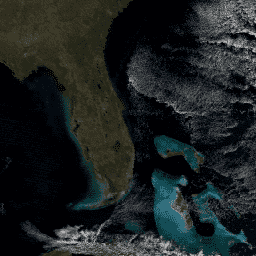
MODIS 地表反射率产品可提供地表光谱反射率的估计值,该值是在没有大气散射或吸收的情况下于地面测得的。低级别数据已针对大气气体和气溶胶进行校正。MOD09GA 版本 6.1 以 … 格式提供波段 1-7。 daily global modis nasa satellite-imagery sr -
MOD09GQ.061 Terra 地表反射率每日全球 250 米
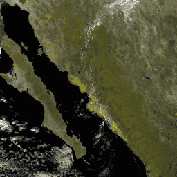
MODIS 地表反射率产品可提供地表光谱反射率的估计值,该值是在没有大气散射或吸收的情况下于地面测得的。低级别数据已针对大气气体和气溶胶进行校正。MOD09GQ 版本 6.1 提供了波段 1 和 … daily global modis nasa satellite-imagery sr -
MOD10A1.061 Terra 积雪覆盖每日全球 500 米

MOD10A1 V6.1 Snow Cover Daily Global 500m 产品包含积雪、雪反照率、积雪覆盖率和质量评估 (QA) 数据。积雪覆盖率数据基于一种积雪测绘算法,该算法采用归一化差异积雪指数 (NDSI) 和其他条件测试。常规… 反照率 冰冻圈 每日 地球物理 全球 modis -
MOD10A2.061 Terra 积雪 8 天 L3 全球 500 米

MOD10A2 是 Terra 卫星上 MODIS 提供的积雪覆盖率数据集。该数据集报告了 8 天内最大积雪范围,分辨率为 500 米。之所以选择 8 天的合成周期,是因为这是精确的地面轨道重复周期… 冰冻圈 每日 地球物理 全球 modis nasa -
MOD11A1.061 Terra 地表温度和发射率每日全球 1 公里

MOD11A1 V6.1 产品以 1200 x 1200 公里网格的形式提供每日陆地表面温度 (LST) 和发射率值。温度值源自 MOD11_L2 观测带产品。在 30 度纬度以上,部分像素可能有多项观测结果,其中晴空条件… 气候 每日 发射率 全球 lst modis -
MOD14A1.061:Terra 热异常和火灾每日全球 1 公里

MOD14A1 V6.1 数据集提供以 1 公里分辨率呈现的每日火灾掩膜合成数据,这些数据源自 MODIS 4 微米和 11 微米辐射亮度。火灾检测策略基于对火灾的绝对检测(当火势足以检测到时)以及相对于…的检测 每日 火灾 全球 modis nasa terra -
MOD21A1D.061 Terra 地表温度和 3 波段发射率每日全球 1 公里
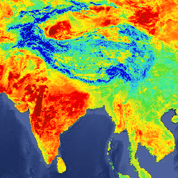
MOD21A1D 数据集每天根据白天 2 级网格化 (L2G) 中间 LST 产品生成,空间分辨率为 1,000 米。L2G 流程将每日 MOD21 条带颗粒映射到正弦 MODIS 网格,并存储落在网格单元上的所有观测结果… 气候 每日 发射率 全球 lst nasa -
MOD21A1N.061 Terra 地表温度和 3 波段发射率每日全球 1 公里

MOD21A1N 数据集每天根据夜间 2 级网格化 (L2G) 中间 LST 产品生成,空间分辨率为 1,000 米。L2G 流程将每日 MOD21 条带颗粒映射到正弦 MODIS 网格,并存储落在网格单元上的所有观测结果… 气候 每日 发射率 全球 lst nasa -
MOD21C1.061 Terra 地表温度和 3 波段发射率每日 L3 全球 0.05 度 CMG

MOD21C1 数据集每天生成一次,采用 0.05 度(赤道处为 5,600 米)气候模型网格 (CMG),数据源为白天 2 级网格化 (L2G) 中间 LST 产品。L2G 流程将每日 MOD21 条带颗粒映射到正弦 MODIS 网格,并存储所有… 气候 每日 发射率 全球 lst nasa -
MODOCGA.006 Terra 海洋反射率每日全球 1 公里
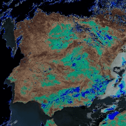
MODOCGA V6 海洋反射率产品包含来自 Terra MODIS 波段 8-16 的 1 公里反射率数据。该产品被称为海洋反射率,因为波段 8-16 主要用于生成海洋产品,但由于图块…,因此该产品并非海洋产品 每日 全球 modis nasa 海洋 反射率 -
MYD09GA.061 Aqua 地表反射率每日全球 1 公里和 500 米
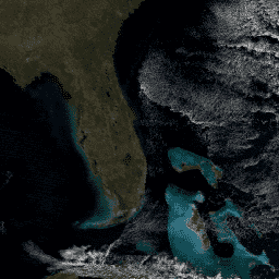
MODIS 地表反射率产品可提供地表光谱反射率的估计值,该值是在没有大气散射或吸收的情况下于地面测得的。低级别数据已针对大气气体和气溶胶进行校正。MYD09GA 版本 6.1 以 … 格式提供波段 1-7。 aqua daily global modis nasa satellite-imagery -
MYD09GQ.061 Aqua 地表反射率每日全球 250 米
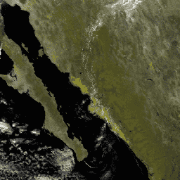
MODIS 地表反射率产品可提供地表光谱反射率的估计值,该值是在没有大气散射或吸收的情况下于地面测得的。低级别数据已针对大气气体和气溶胶进行校正。MYD09GQ 版本 6.1 提供波段 1 和 … aqua daily global modis nasa satellite-imagery -
MYD10A1.061 Aqua 每日全球 500 米积雪覆盖率

MYD10A1 V6 积雪每日全球 500 米产品包含积雪、积雪反照率、积雪覆盖率和质量评估 (QA) 数据。积雪覆盖率数据基于一种积雪测绘算法,该算法采用归一化差异积雪指数 (NDSI) 和其他条件测试。常规… 反照率 Aqua 冰冻圈 每日 地球物理 全球 -
MYD11A1.061 Aqua 地表温度和发射率每日全球 1 公里

MYD11A1 V6.1 产品以 1200 x 1200 公里网格的形式提供每日陆地表面温度 (LST) 和发射率值。温度值源自 MYD11_L2 扫描带产品。在 30 度纬度以上,部分像素可能有多项观测结果,其中晴空条件… aqua 气候 每日 发射率 全球 lst -
MYD14A1.061:Aqua 热异常和火灾每日全球 1 公里

MYD14A1 V6.1 数据集提供以 1 公里分辨率呈现的每日火灾掩膜合成数据,这些数据源自 MODIS 4 微米和 11 微米辐射亮度。火灾检测策略基于对火灾的绝对检测(当火势足以检测到时)以及相对于…的检测 aqua 每日 火灾 全球 modis nasa -
MYD21A1D.061 Aqua 地表温度和 3 波段发射率每日全球 1 公里
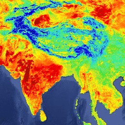
MYD21A1D 数据集每天根据白天 1,000 米空间分辨率的 L2G 中间 LST 产品生成。L2G 流程将每日 MOD21 条带颗粒映射到正弦 MODIS 网格,并存储落在网格单元上的所有观测结果… aqua 气候 每日 发射率 全球 lst -
MYD21A1N.061 Aqua 地表温度和 3 波段发射率每日全球 1 公里
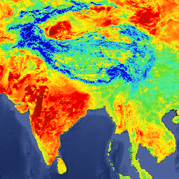
MYD21A1N 数据集每天根据夜间 2 级网格化 (L2G) 中间 LST 产品生成,空间分辨率为 1,000 米。L2G 流程将每日 MOD21 条带颗粒映射到正弦 MODIS 网格,并存储落在网格单元上的所有观测结果… aqua 气候 每日 发射率 全球 lst -
MYD21C1.061 Aqua 地表温度和 3 波段发射率每日 L3 全球 0.05 度 CMG

MYD21C1 数据集每天生成一次,采用 0.05 度(赤道处为 5,600 米)的气候模型网格 (CMG),数据源为白天第 2 级网格化 (L2G) 中间 LST 产品。L2G 流程将每日 MYD21 扫描带颗粒映射到正弦 MODIS 网格,并存储所有… aqua 气候 每日 发射率 全球 lst -
MYDOCGA.006 Aqua 海洋反射率每日全球 1 公里
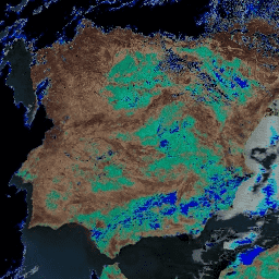
MYDOCGA V6 海洋反射率产品包含来自 Aqua MODIS 波段 8-16 的 1 公里反射率数据。该产品被称为海洋反射率,因为波段 8-16 主要用于生成海洋产品,但由于图块…,因此该产品并非海洋产品 aqua 每日 全球 modis nasa 海洋 -
NOAA CDR AVHRR AOT:全球海洋上空的每日气溶胶光学厚度,版本 04

气溶胶光学厚度 (AOT) 的 NOAA 气候数据记录 (CDR) 是一组全球每日 0.1 度派生数据,这些数据来自 PATMOS-x AVHRR 2b 级通道 1(0.63 微米)轨道晴空辐射。气溶胶产品是在无云条件下,根据 … 期间的 AVHRR 影像生成的 气溶胶 大气 大气 avhrr cdr 每日 -
NOAA CDR AVHRR LAI FAPAR:叶面积指数和光合有效辐射吸收分数,版本 5

AVHRR 叶面积指数 (LAI) 和光合有效辐射吸收分数 (FAPAR) 数据集的 NOAA 气候数据记录 (CDR) 包含表征植物冠层和光合作用活动的派生值。此数据集派生自 NOAA AVHRR 地表反射率产品,并且… avhrr cdr daily fapar lai land -
NOAA CDR AVHRR NDVI:归一化差值植被指数,版本 5

AVHRR 常态化差值植生指标 (NDVI) 的 NOAA 气候数据记录 (CDR) 包含从 NOAA AVHRR 地表反射率产品中得出的网格化日 NDVI。它提供了一种地表植被覆盖活动测量方法,以 0.05° 的分辨率进行网格化,并在全球陆地上进行计算… avhrr cdr daily land ndvi noaa -
NOAA CDR AVHRR:地表反射率,版本 5

AVHRR 地表反射率的 NOAA 气候数据记录 (CDR) 包含网格化每日地表反射率和亮度温度,这些数据是从七颗 NOAA 极地轨道卫星上搭载的高级甚高分辨率辐射计 (AVHRR) 传感器获取的。数据以 0.05° 的分辨率进行网格化,并计算… avhrr cdr daily land noaa reflectance -
NOAA CDR OISST v02r01:最佳插值海平面温度

NOAA 1/4 度每日最佳插值海面温度 (OISST) 提供完整的海洋温度场,该温度场通过在常规全球网格上合并来自不同平台(卫星、船舶、浮标)的经过偏差调整的观测结果来构建,并通过插值填补空白。来自高级甚高分辨率…的卫星数据 avhrr cdr daily ice noaa ocean -
NOAA CDR VIIRS LAI FAPAR:叶面积指数和光合有效辐射吸收分数,版本 1

此气候数据记录 (CDR) 结合了叶面积指数 (LAI) 和光合有效辐射吸收分数 (FAPAR) 的数据集,这两个生物物理变量可用于评估植被压力、预测农业产量以及其他建模和资源管理应用。LAI 跟踪单侧… cdr daily fapar lai land noaa -
NOAA CDR VIIRS NDVI:归一化差值植被指数,版本 1

此数据集包含网格化每日归一化差值植被指数 (NDVI),该指数源自 NOAA 可见光红外成像辐射计套件 (VIIRS) 地表反射率的气候数据记录 (CDR)。数据记录涵盖了 2014 年至今,使用的是 NOAA 极地轨道卫星的数据。这些数据是根据…预测的 cdr daily land ndvi noaa vegetation-indices -
PRISM 每日空间气候数据集

PRISM 每日和每月数据集是由俄勒冈州立大学 PRISM 气候小组制作的美国本土网格化气候数据集。此集合包含 AN81 和 AN91 数据,由“dataset_type”属性指示。网格是使用 PRISM(Parameter-elevation Regressions … 气候 每日 地球物理 oregonstate 降水 压力 -
VNP09GA:VIIRS 地表反射率每日 500 米和 1 千米

可见光红外成像辐射仪套件 (VIIRS) 每日地表反射率 (VNP09GA) 产品可根据 Suomi 国家极地轨道合作伙伴计划 (S-NPP) VIIRS 传感器提供陆地表面反射率估计值。提供三个影像波段(I1、I2、I3)的数据,名义分辨率为 500 米(约 463 米)… daily nasa noaa npp reflectance satellite-imagery -
VNP09H1:VIIRS 地表反射率 8 天 L3 全球 500 米

8 天可见光红外成像辐射仪套件 (VIIRS) 地表反射率 (VNP09H1) 第 1 版合成产品可提供 Suomi 国家极轨伙伴卫星 (Suomi NPP) VIIRS 传感器在标称分辨率 500 米(约 463 米)的三个影像波段(I1、I2、I3)的地表反射率估计值。… daily nasa noaa npp reflectance satellite-imagery -
VNP21A1D.002:每日 1 公里白天陆地表面温度和发射率
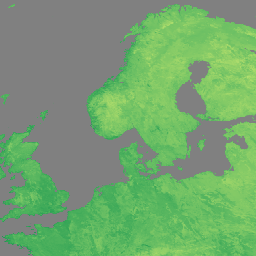
NASA Suomi 国家极地轨道合作伙伴计划 (Suomi NPP) 可见光红外成像辐射仪套件 (VIIRS) 地表温度和发射率 (LST&E) 日间版本 1 产品 (VNP21A1D) 每天根据白天 2 级网格化 (L2G) 中间产品编译而成。L2G 流程可将每日 VNP21 轨道粒度数据映射到 … 气候 每日 天 陆地 nasa noaa -
VNP21A1N.002:夜间地表温度和发射率每日 1 公里

NASA Suomi 国家极地轨道合作伙伴计划 (Suomi NPP) 可见光红外成像辐射仪套件 (VIIRS) 地表温度和发射率 (LST&E) 夜间版本 1 产品 (VNP21A1N) 每天从夜间 2 级网格化 (L2G) 中间产品编译而成。L2G 流程可将每日 VNP21 轨道粒度数据映射到 … 气候 每日 陆地 美国宇航局 (NASA) 夜间 美国国家海洋和大气管理局 (NOAA) -
VNP46A1:VIIRS 日常网格化日夜波段 500 米线性纬度/经度网格夜间

Suomi 国家极地轨道合作伙伴计划 (SNPP) 可见光红外成像辐射仪套件 (VIIRS) 支持一种昼夜频段 (DNB) 传感器,可提供夜间可见光和近红外 (NIR) 光的全球每日测量数据,适用于地球系统科学和应用。VIIRS DNB 在低光照条件下的超高灵敏度… daily dnb nasa noaa population viirs -
VNP46A2:VIIRS 经过月球间隙填充的 BRDF 夜间灯光每日 L3 全球 500 米数据
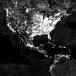
Suomi 国家极地轨道合作伙伴计划 (SNPP) 可见光红外成像辐射仪套件 (VIIRS) 支持一种昼夜波段 (DNB) 传感器,可提供全球每日夜间可见光和近红外(NIR) 光测量数据,适用于地球系统科学和应用。VIIRS DNB 在弱光条件下的超高灵敏度… brdf daily nasa nighttime noaa population
Datasets tagged daily in Earth Engine
[null,null,[],[],[]]
