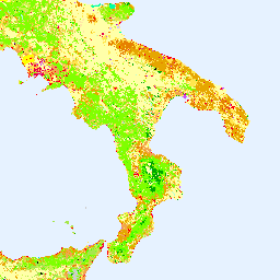
-
哥白尼 CORINE 土地覆盖
CORINE(环境信息协调)土地覆盖 (CLC) 目录于 1985 年启动,旨在规范欧洲土地数据的收集,以支持环境政策的制定。该项目由欧洲环境署 (EEA) 在欧盟框架下协调实施,旨在… copernicus eea esa eu landcover landuse-landcover -
Copernicus 全球土地覆盖图层:CGLS-LC100 集合 3
Copernicus 全球土地服务 (CGLS) 被指定为土地服务的组成部分,用于运营多用途服务组件,该组件可提供一系列关于全球土地表面状态和演变的生物地球物理产品。动态土地覆盖地图(网址:… copernicus eea esa eu landcover landuse-landcover
Datasets tagged eea in Earth Engine
[null,null,[],[[["\u003cp\u003eThe CORINE Land Cover inventory, coordinated by the European Environment Agency, provides standardized land cover data for Europe to support environmental policy.\u003c/p\u003e\n"],["\u003cp\u003eThe Copernicus Global Land Service offers bio-geophysical products on the status and evolution of land surfaces at a global scale.\u003c/p\u003e\n"],["\u003cp\u003eBoth datasets are part of the Copernicus program and focus on land cover and land use information for environmental monitoring and policy development.\u003c/p\u003e\n"]]],["The Copernicus program provides land cover data through two key initiatives. The CORINE Land Cover (CLC) inventory, initiated in 1985 and coordinated by the EEA, standardizes land data collection in Europe. The Copernicus Global Land Service (CGLS) offers bio-geophysical products and dynamic land cover maps at a global scale, providing insights into land surface status and evolution. Both use the European Union's resources, are associated with the European Environment Agency (EEA), European Space Agency (ESA), and focus on land cover.\n"],null,["# Datasets tagged eea in Earth Engine\n\n-\n\n |-----------------------------------------------------------------------------------------------------------------------------------------------------------------------------------------------------------------------------------------------------------------------------------------------------------|\n | [### Copernicus CORINE Land Cover](/earth-engine/datasets/catalog/COPERNICUS_CORINE_V20_100m) |\n | The CORINE (coordination of information on the environment) Land Cover (CLC) inventory was initiated in 1985 to standardize data collection on land in Europe to support environmental policy development. The project is coordinated by the European Environment Agency (EEA) in the frame of the EU ... |\n | [copernicus](/earth-engine/datasets/tags/copernicus) [eea](/earth-engine/datasets/tags/eea) [esa](/earth-engine/datasets/tags/esa) [eu](/earth-engine/datasets/tags/eu) [landcover](/earth-engine/datasets/tags/landcover) [landuse-landcover](/earth-engine/datasets/tags/landuse-landcover) |\n\n-\n\n |-----------------------------------------------------------------------------------------------------------------------------------------------------------------------------------------------------------------------------------------------------------------------------------------------|\n | [### Copernicus Global Land Cover Layers: CGLS-LC100 Collection 3](/earth-engine/datasets/catalog/COPERNICUS_Landcover_100m_Proba-V-C3_Global) |\n | The Copernicus Global Land Service (CGLS) is earmarked as a component of the Land service to operate a multi-purpose service component that provides a series of bio-geophysical products on the status and evolution of land surface at global scale. The Dynamic Land Cover map at ... |\n | [copernicus](/earth-engine/datasets/tags/copernicus) [eea](/earth-engine/datasets/tags/eea) [esa](/earth-engine/datasets/tags/esa) [eu](/earth-engine/datasets/tags/eu) [landcover](/earth-engine/datasets/tags/landcover) [landuse-landcover](/earth-engine/datasets/tags/landuse-landcover) |"]]