-
Landsat Global Land Survey 2005, Landsat 5 장면
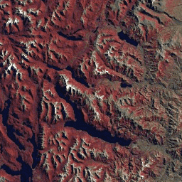
GLS2005 데이터 세트는 2004년과 2007년 사이에 수집되었으며 지구의 육지를 다루는 9,500개의 직교 보정된 잎이 있는 중간 해상도 위성 이미지 모음입니다. GLS2005는 주로 Landsat 5와 격차가 메워진 Landsat 7 데이터를 사용하며 EO-1 ALI 및 Terra ASTER 데이터로 … etm gls l5 landsat radiance satellite-imagery -
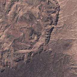
Landsat Global Land Survey 2005, Landsat 7 장면
GLS2005 데이터 세트는 2004년과 2007년 사이에 수집되었으며 지구의 육지를 다루는 9,500개의 직교 보정된 잎이 있는 중간 해상도 위성 이미지 모음입니다. GLS2005는 주로 Landsat 5와 격차가 메워진 Landsat 7 데이터를 사용하며 EO-1 ALI 및 Terra ASTER 데이터로 … etm gls l7 landsat radiance satellite-imagery -
USGS Landsat 7 Collection 2 Tier 1 원시 장면
확장 및 보정된 센서 전 방사도를 나타내는 Landsat 7 컬렉션 2 Tier 1 DN 값입니다. 사용 가능한 데이터 품질이 가장 우수한 Landsat 장면은 Tier 1로 분류되며 시계열 처리 분석에 적합한 것으로 간주됩니다. Tier 1에는 다음과 같은 Level-1 Precision Terrain (L1TP) 처리 데이터가 포함됩니다. c2 etm global l7 landsat le7 -
USGS Landsat 7 Collection 2 Tier 1 및 실시간 데이터 원시 장면
Landsat 7 Collection 2 Tier 1 및 실시간 데이터 DN 값으로, 확장 및 보정된 센서 전 방사도를 나타냅니다. 사용 가능한 데이터 품질이 가장 우수한 Landsat 장면은 Tier 1로 분류되며 시계열 처리 분석에 적합한 것으로 간주됩니다. Tier 1에는 처리된 1차 정밀도 지형 (L1TP)이 포함됩니다. c2 etm global l7 landsat le7 -
USGS Landsat 7 Collection 2 Tier 2 원시 장면
확장 및 보정된 센서 전 방사도를 나타내는 Landsat 7 컬렉션 2 Tier 2 DN 값입니다. 처리 중에 Tier 1 기준을 충족하지 않는 장면은 Tier 2에 할당됩니다. 여기에는 체계적 지형 (L1GT) 및 체계적 (L1GS) 처리된 장면과 L1TP 장면 중 … c2 etm global l7 landsat le7 -
USGS Landsat 7 Level 2, Collection 2, Tier 1
이 데이터 세트에는 Landsat 7 ETM+ 센서에서 생성된 데이터에서 파생된 대기 보정된 표면 반사율과 지표 온도가 포함되어 있습니다. 이러한 이미지에는 기하학적으로 교정된 표면 반사율로 처리된 가시광선 및 근적외선 (VNIR) 4개 밴드와 단파 적외선 (SWIR) 2개 밴드, 열 … cfmask cloud etm fmask global landsat -
USGS Landsat 7 Level 2, Collection 2, Tier 2
이 데이터 세트에는 Landsat 7 ETM+ 센서에서 생성된 데이터에서 파생된 대기 보정된 표면 반사율과 지표 온도가 포함되어 있습니다. 이러한 이미지에는 기하학적으로 교정된 표면 반사율로 처리된 가시광선 및 근적외선 (VNIR) 4개 밴드와 단파 적외선 (SWIR) 2개 밴드, 열 … cfmask cloud etm fmask global landsat
Datasets tagged etm in Earth Engine
[null,null,[],[[["\u003cp\u003eThis page provides access to various Landsat 7 datasets, including raw and atmospherically corrected scenes from Collection 2, Tiers 1 and 2.\u003c/p\u003e\n"],["\u003cp\u003eThe GLS2005 dataset offers a global collection of medium-resolution satellite images from 2004-2007, primarily using Landsat 5 and 7 data.\u003c/p\u003e\n"],["\u003cp\u003eLandsat 7 Collection 2 is organized into Tier 1 (highest quality for time-series analysis) and Tier 2 (other scenes).\u003c/p\u003e\n"],["\u003cp\u003eLevel 2 products offer atmospherically corrected surface reflectance and land surface temperature data derived from Landsat 7 ETM+ sensor.\u003c/p\u003e\n"],["\u003cp\u003eData includes visible, near-infrared, short-wave infrared, and thermal bands, processed to orthorectified surface reflectance.\u003c/p\u003e\n"]]],["The datasets are from the Landsat program, specifically Landsat 5 and 7. The GLS2005 dataset contains 9500 orthorectified satellite images from 2004-2007, using Landsat 5 and 7, with some other satellites to fill gaps. Landsat 7 Collection 2 datasets include Tier 1, Tier 2 and real-time raw scenes. It also contains Level 2 datasets which have surface reflectance and land surface temperature derived from the Landsat 7 sensor.\n"],null,["# Datasets tagged etm in Earth Engine\n\n-\n\n |------------------------------------------------------------------------------------------------------------------------------------------------------------------------------------------------------------------------------------------------------------------------------------------------|\n | [### Landsat Global Land Survey 2005, Landsat 5 scenes](/earth-engine/datasets/catalog/LANDSAT_GLS2005_L5) |\n | The GLS2005 data set is a collection of 9500 orthorectified leaf-on medium-resolution satellite images collected between 2004 and 2007 and covering the Earth's land masses. GLS2005 uses mainly Landsat 5 and gap-filled Landsat 7 data with EO-1 ALI and Terra ASTER data filling in any ... |\n | [etm](/earth-engine/datasets/tags/etm) [gls](/earth-engine/datasets/tags/gls) [l5](/earth-engine/datasets/tags/l5) [landsat](/earth-engine/datasets/tags/landsat) [radiance](/earth-engine/datasets/tags/radiance) [satellite-imagery](/earth-engine/datasets/tags/satellite-imagery) |\n\n-\n\n |------------------------------------------------------------------------------------------------------------------------------------------------------------------------------------------------------------------------------------------------------------------------------------------------|\n | [### Landsat Global Land Survey 2005, Landsat 7 scenes](/earth-engine/datasets/catalog/LANDSAT_GLS2005_L7) |\n | The GLS2005 data set is a collection of 9500 orthorectified leaf-on medium-resolution satellite images collected between 2004 and 2007 and covering the Earth's land masses. GLS2005 uses mainly Landsat 5 and gap-filled Landsat 7 data with EO-1 ALI and Terra ASTER data filling in any ... |\n | [etm](/earth-engine/datasets/tags/etm) [gls](/earth-engine/datasets/tags/gls) [l7](/earth-engine/datasets/tags/l7) [landsat](/earth-engine/datasets/tags/landsat) [radiance](/earth-engine/datasets/tags/radiance) [satellite-imagery](/earth-engine/datasets/tags/satellite-imagery) |\n\n-\n\n |---------------------------------------------------------------------------------------------------------------------------------------------------------------------------------------------------------------------------------------------------------------------------------------------------------------------------|\n | [### USGS Landsat 7 Collection 2 Tier 1 Raw Scenes](/earth-engine/datasets/catalog/LANDSAT_LE07_C02_T1) |\n | Landsat 7 Collection 2 Tier 1 DN values, representing scaled, calibrated at-sensor radiance. Landsat scenes with the highest available data quality are placed into Tier 1 and are considered suitable for time-series processing analysis. Tier 1 includes Level-1 Precision Terrain (L1TP) processed data that have ... |\n | [c2](/earth-engine/datasets/tags/c2) [etm](/earth-engine/datasets/tags/etm) [global](/earth-engine/datasets/tags/global) [l7](/earth-engine/datasets/tags/l7) [landsat](/earth-engine/datasets/tags/landsat) [le7](/earth-engine/datasets/tags/le7) |\n\n-\n\n |-------------------------------------------------------------------------------------------------------------------------------------------------------------------------------------------------------------------------------------------------------------------------------------------------------------------------------|\n | [### USGS Landsat 7 Collection 2 Tier 1 and Real-Time data Raw Scenes](/earth-engine/datasets/catalog/LANDSAT_LE07_C02_T1_RT) |\n | Landsat 7 Collection 2 Tier 1 and Real-Time data DN values, representing scaled, calibrated at-sensor radiance. Landsat scenes with the highest available data quality are placed into Tier 1 and are considered suitable for time-series processing analysis. Tier 1 includes Level-1 Precision Terrain (L1TP) processed ... |\n | [c2](/earth-engine/datasets/tags/c2) [etm](/earth-engine/datasets/tags/etm) [global](/earth-engine/datasets/tags/global) [l7](/earth-engine/datasets/tags/l7) [landsat](/earth-engine/datasets/tags/landsat) [le7](/earth-engine/datasets/tags/le7) |\n\n-\n\n |------------------------------------------------------------------------------------------------------------------------------------------------------------------------------------------------------------------------------------------------------------------------------------------------------|\n | [### USGS Landsat 7 Collection 2 Tier 2 Raw Scenes](/earth-engine/datasets/catalog/LANDSAT_LE07_C02_T2) |\n | Landsat 7 Collection 2 Tier 2 DN values, representing scaled, calibrated at-sensor radiance. Scenes not meeting Tier 1 criteria during processing are assigned to Tier 2. This includes Systematic terrain (L1GT) and Systematic (L1GS) processed scenes, as well as any L1TP scenes that do not ... |\n | [c2](/earth-engine/datasets/tags/c2) [etm](/earth-engine/datasets/tags/etm) [global](/earth-engine/datasets/tags/global) [l7](/earth-engine/datasets/tags/l7) [landsat](/earth-engine/datasets/tags/landsat) [le7](/earth-engine/datasets/tags/le7) |\n\n-\n\n |-----------------------------------------------------------------------------------------------------------------------------------------------------------------------------------------------------------------------------------------------------------------------------------------------------------------------------------------|\n | [### USGS Landsat 7 Level 2, Collection 2, Tier 1](/earth-engine/datasets/catalog/LANDSAT_LE07_C02_T1_L2) |\n | This dataset contains atmospherically corrected surface reflectance and land surface temperature derived from the data produced by the Landsat 7 ETM+ sensor. These images contain 4 visible and near-infrared (VNIR) bands and 2 short-wave infrared (SWIR) bands processed to orthorectified surface reflectance, and one thermal ... |\n | [cfmask](/earth-engine/datasets/tags/cfmask) [cloud](/earth-engine/datasets/tags/cloud) [etm](/earth-engine/datasets/tags/etm) [fmask](/earth-engine/datasets/tags/fmask) [global](/earth-engine/datasets/tags/global) [landsat](/earth-engine/datasets/tags/landsat) |\n\n-\n\n |-----------------------------------------------------------------------------------------------------------------------------------------------------------------------------------------------------------------------------------------------------------------------------------------------------------------------------------------|\n | [### USGS Landsat 7 Level 2, Collection 2, Tier 2](/earth-engine/datasets/catalog/LANDSAT_LE07_C02_T2_L2) |\n | This dataset contains atmospherically corrected surface reflectance and land surface temperature derived from the data produced by the Landsat 7 ETM+ sensor. These images contain 4 visible and near-infrared (VNIR) bands and 2 short-wave infrared (SWIR) bands processed to orthorectified surface reflectance, and one thermal ... |\n | [cfmask](/earth-engine/datasets/tags/cfmask) [cloud](/earth-engine/datasets/tags/cloud) [etm](/earth-engine/datasets/tags/etm) [fmask](/earth-engine/datasets/tags/fmask) [global](/earth-engine/datasets/tags/global) [landsat](/earth-engine/datasets/tags/landsat) |"]]