-
科特迪瓦 BNETD 2020 年土地覆盖地图

科特迪瓦 BNETD 2020 年土地覆盖地图由科特迪瓦政府通过国家机构(国家研究办公室技术与发展中心 [BNETD-CIGN])制作,并获得了欧盟的技术和资金支持。方法… 分类 森林砍伐 森林 土地覆盖 土地利用-土地覆盖 -
EC JRC 2020 年全球森林覆盖地图,V3

这份全球森林覆盖率地图以空间显式方式呈现了 2020 年的森林存在情况和不存在情况,空间分辨率为 10 米。2020 年是欧盟“关于在市场上提供… eudr 森林 森林生物质 jrc -
欧洲原始森林数据集 - 点

欧洲原始森林数据整合了 48 个不同的原始森林数据集(大部分基于实地调查),包含分布在 33 个国家/地区的 18,411 个单独的斑块(4,110 万公顷)。它主要包括原始森林、演替后期森林,但也包括一些在自然扰动后形成的早期演替阶段森林和幼林… europe forest forest-biomass table -
欧洲原始森林数据集 - 多边形
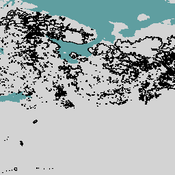
欧洲原始森林数据整合了 48 个不同的原始森林数据集(大部分基于实地调查),包含分布在 33 个国家/地区的 18,411 个单独的斑块(4,110 万公顷)。它主要包括原始森林、演替后期森林,但也包括一些在自然扰动后形成的早期演替阶段森林和幼林… europe forest forest-biomass table -
FORMA 提醒阈值

WRI 的注意事项:WRI 决定停止更新 FORMA 提醒。目标是简化 Global Forest Watch 用户体验并减少冗余。我们发现,Terra-i 和 GLAD 的使用频率更高。此外,使用 GLAD 作为标准,发现 Terra-i 的性能优于 FORMA… 每日 森林砍伐 火灾 森林 FORMA gfw -
FORMA 提醒

WRI 的注意事项:WRI 决定停止更新 FORMA 提醒。目标是简化 Global Forest Watch 用户体验并减少冗余。我们发现,Terra-i 和 GLAD 的使用频率更高。此外,使用 GLAD 作为标准,发现 Terra-i 的性能优于 FORMA… 每日 森林砍伐 火灾 森林 FORMA gfw -
FORMA 原始输出 FIRMS

WRI 的注意事项:WRI 决定停止更新 FORMA 提醒。目标是简化 Global Forest Watch 用户体验并减少冗余。我们发现,Terra-i 和 GLAD 的使用频率更高。此外,使用 GLAD 作为标准,发现 Terra-i 的性能优于 FORMA… 每日 森林砍伐 火灾 森林 FORMA gfw -
FORMA 原始输出 NDVI

WRI 的注意事项:WRI 决定停止更新 FORMA 提醒。目标是简化 Global Forest Watch 用户体验并减少冗余。我们发现,Terra-i 和 GLAD 的使用频率更高。此外,使用 GLAD 作为标准,发现 Terra-i 的性能优于 FORMA… 每日 森林砍伐 森林 森林生物质 FORMA gfw -
FORMA 植被 T 统计信息

WRI 的注意事项:WRI 决定停止更新 FORMA 提醒。目标是简化 Global Forest Watch 用户体验并减少冗余。我们发现,Terra-i 和 GLAD 的使用频率更高。此外,使用 GLAD 作为标准,发现 Terra-i 的性能优于 FORMA… 每日 森林砍伐 森林 森林生物质 FORMA gfw -
Farmscapes 2020
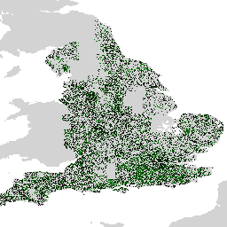
Farmscapes 2020 数据集提供了英格兰农业景观中三种关键半自然特征(树篱、林地和石墙)的高分辨率 (25 厘米) 概率地图。此数据集是与 Oxford Leverhulme Centre for Nature Recovery 合作开发的,可作为多种应用(包括…)的基准。 biodiversity climate conservation forest landuse-landcover nature-trace -
森林邻近人群 (FPP) 1.0

“森林附近的人口”(FPP) 数据集是促成森林合作伙伴关系 (CPF) 全球核心森林相关指标集 (GCS) 中第 13 项指标(“极度贫困的森林依赖人口数量”)开发的数据层之一。FPP 数据集提供了一个… 农业 粮农组织 森林 全球 植物生产力 人口 -
全球 2020 年森林分类,用于 IPCC 地上生物量第 1 级估计,版本 1

此数据集提供 2020 年按状态/条件划分的全球森林类别,分辨率约为 30 米。这些数据有助于根据 2019 年修订版《2006 年 IPCC 国家温室气体清单指南》生成 1 级估计值,以估算天然森林中的地上干木质生物质密度 (AGBD)。 地上 生物质 碳 分类 森林 森林生物质 -
全球三类 PALSAR-2/PALSAR 森林/非森林地图
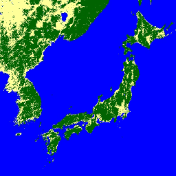
您可以在 JAXA/ALOS/PALSAR/YEARLY/FNF4 中找到此数据集的更新版本,其中包含 2017-2020 年的 4 个类别。全球森林/非森林地图 (FNF) 是通过对全球 25 米分辨率 PALSAR-2/PALSAR SAR 镶嵌中的 SAR 图像(后向散射系数)进行分类而生成的,以便将强后向散射像素和低后向散射像素… ALOS alos2 分类 eroc 森林 森林生物质 -
全球 4 类 PALSAR-2/PALSAR 森林/非森林地图

全球森林/非森林 (FNF) 地图是通过对全球 25 米分辨率 PALSAR-2/PALSAR SAR 镶嵌图中的 SAR 图像(后向散射系数)进行分类而生成的,以便将强后向散射像素和低后向散射像素分别指定为“森林”和“非森林”。其中,“森林”是指具有以下特征的天然森林… ALOS alos2 分类 eroc 森林 森林生物质 -
全球地上和地下生物质碳密度地图

此数据集以 300 米的空间分辨率提供了 2010 年地上和地下生物质碳密度的时序一致且协调的全球地图。地上生物量地图整合了木本、草地、农田和苔原生物量的特定地表覆盖遥感地图。输入源映射为… 地上 生物质 碳 密度 森林 森林生物质 -
全球森林冠层高度,2005 年

此数据集基于地球科学激光测高计系统 (GLAS) 的机载激光雷达数据 (2005) 和辅助地理空间数据的融合,表示全球树高。如需了解详情,请参阅 Simard 等人 (2011)。 冠层 森林 森林生物质 地球物理 jpl NASA -
全球森林覆盖变化 (GFCC) 多年全球 30 米树木覆盖率

Landsat 植被连续场 (VCF) 树木覆盖层包含对每个 30 米像素中被高度超过 5 米的木本植被覆盖的水平地面百分比的估计值。该数据集包含 4 个以 2000 年、2005 年、2010 年为中心的时间段的数据… 森林 森林生物质 glcf Landsat 衍生数据 NASA UMD -
2020 年全球森林类型地图

森林类型全球地图以空间显式方式呈现了 2020 年的原始森林、天然再生林和人工林(包括种植园林),空间分辨率为 10 米。用于绘制这些森林类型的基本层是森林覆盖范围… eudr 森林 森林生物质 jrc 土地覆盖 原始森林 -
网格化 GEDI 植被结构指标和生物质密度(包含 COUNTS 指标),像素大小为 12 公里

此数据集包含近乎全球范围的、可直接用于分析的多分辨率网格化植被结构指标,这些指标源自 NASA 全球生态系统动态调查 (GEDI) 2 级和 4A 级产品,与直径为 25 米的激光雷达足迹相关联。此数据集全面展示了近乎全球的植被结构,其中包括… 生物质 树冠 森林 森林生物质 GEDI LARSE -
网格化 GEDI 植被结构指标和生物质密度(包含 COUNTS 指标),像素大小为 1 公里

此数据集包含近乎全球范围的、可直接用于分析的多分辨率网格化植被结构指标,这些指标源自 NASA 全球生态系统动态调查 (GEDI) 2 级和 4A 级产品,与直径为 25 米的激光雷达足迹相关联。此数据集全面展示了近乎全球的植被结构,其中包括… 生物质 树冠 森林 森林生物质 GEDI LARSE -
网格化 GEDI 植被结构指标和生物质密度(包含 COUNTS 指标),像素大小为 6 公里

此数据集包含近乎全球范围的、可直接用于分析的多分辨率网格化植被结构指标,这些指标源自 NASA 全球生态系统动态调查 (GEDI) 2 级和 4A 级产品,与直径为 25 米的激光雷达足迹相关联。此数据集全面展示了近乎全球的植被结构,其中包括… 生物质 树冠 森林 森林生物质 GEDI LARSE -
网格化 GEDI 植被结构指标和生物质密度,12 公里像素大小

此数据集包含近乎全球范围的、可直接用于分析的多分辨率网格化植被结构指标,这些指标源自 NASA 全球生态系统动态调查 (GEDI) 2 级和 4A 级产品,与直径为 25 米的激光雷达足迹相关联。此数据集全面展示了近乎全球的植被结构,其中包括… 生物质 树冠 森林 森林生物质 GEDI LARSE -
网格化 GEDI 植被结构指标和生物质密度,1 公里像素大小
此数据集包含近乎全球范围的、可直接用于分析的多分辨率网格化植被结构指标,这些指标源自 NASA 全球生态系统动态调查 (GEDI) 2 级和 4A 级产品,与直径为 25 米的激光雷达足迹相关联。此数据集全面展示了近乎全球的植被结构,其中包括… 生物质 树冠 森林 森林生物质 GEDI LARSE -
网格化 GEDI 植被结构指标和生物质密度,像素大小为 6 公里

此数据集包含近乎全球范围的、可直接用于分析的多分辨率网格化植被结构指标,这些指标源自 NASA 全球生态系统动态调查 (GEDI) 2 级和 4A 级产品,与直径为 25 米的激光雷达足迹相关联。此数据集全面展示了近乎全球的植被结构,其中包括… 生物质 树冠 森林 森林生物质 GEDI LARSE -
Hansen 全球森林变化 v1.12(2000 年至 2024 年)

通过对 Landsat 图像进行时序分析,表征全球森林范围和变化。“first”和“last”波段是参考多光谱影像,分别来自 Landsat 光谱波段(对应于红色、近红外、短波红外 1 和短波红外 2)的第一个和最后一个可用年份。参考合成影像表示… 森林 森林生物质 地球物理 Landsat 衍生数据 马里兰大学 -
加拿大 2019 年基于 Landsat 的森林年龄数据

加拿大原始森林数据集是一份基于卫星数据的森林年龄地图,涵盖加拿大所有森林生态区,空间分辨率为 30 米,时间为 2019 年。我们利用来自 Landsat(扰动、地表反射率合成影像、森林结构)和 MODIS(初级生产总值)的遥感数据来确定年龄。森林年龄可以是… 加拿大 森林 森林生物质 -
监测烧伤严重程度趋势 (MTBS) 烧伤严重程度图片

火灾严重程度镶嵌图包含美国本土、阿拉斯加、夏威夷和波多黎各所有当前已完成的 MTBS 火灾的 MTBS 火灾严重程度类别的专题栅格图像。镶嵌的烧伤严重程度图像每年都会按美国各州和… EROS 火灾 森林 gtac 土地覆盖 Landsat 衍生 -
NEON 冠层高度模型 (CHM)

冠层顶部相对于裸地的海拔高度(冠层高度模型;CHM)。CHM 源自 NEON LiDAR 点云,通过在 LiDAR 调查的整个空间域内创建连续的冠层高度估计值表面来生成。… 机载 冠层 森林 森林生物质 激光雷达 NEON -
NEON 数字高程模型 (DEM)
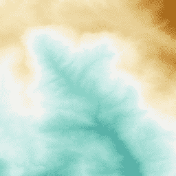
根据 NEON LiDAR 数据得出的地表 (DSM) 和地形 (DTM) 数字模型。DSM:地表特征(包含植被和人造结构的地形信息)。DTM:裸地高程(已移除植被和人造结构的地面地形信息)。图片以平均海平面以上的高度(以米为单位)表示。 机载 dem 海拔地形 森林 激光雷达 neon -
NEON RGB 相机影像

高分辨率红绿蓝 (RGB) 正射校正相机图像,使用最近邻重采样技术拼接并输出到固定的均匀空间网格上;空间分辨率为 0.1 米。数码相机是 NEON 机载观测平台 (AOP) 上的一组仪器之一,该平台还包括… airborne forest highres neon neon-prod-earthengine orthophoto -
NEON 表面双向反射

NEON AOP 地表双向反射率是一种高光谱 VSWIR(可见光到短波红外)数据产品,包含 426 个波段,波长范围约为 380 nm 到 2510 nm。反射率按 10000 的系数进行缩放。将 1340-1445 nm 和 1790-1955 nm 之间的波长设置为… 机载 森林 高光谱 neon neon-prod-earthengine publisher-dataset -
NEON 表面定向反射率

NEON AOP 地表定向反射率是一种高光谱 VSWIR(可见光到短波红外)数据产品,包含 426 个波段,波长范围约为 380 nm 至 2510 nm。反射率按 10000 的系数进行缩放。将 1340-1445 nm 和 1790-1955 nm 之间的波长设置为… 机载 森林 高光谱 neon neon-prod-earthengine publisher-dataset -
NICFI 卫星数据计划热带森林监测底图 - 非洲
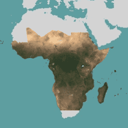
此图片集提供对热带地区的高分辨率卫星监测数据,主要目的是减少和扭转热带森林的损失,从而有助于应对气候变化、保护生物多样性、促进森林再生、恢复和增强,以及促进可持续发展,所有这些都… 基础地图 forest nicfi planet planet-nicfi publisher-dataset -
NICFI 卫星数据计划热带森林监测基本地图 - 美洲
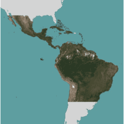
此图片集提供对热带地区的高分辨率卫星监测数据,主要目的是减少和扭转热带森林的损失,从而有助于应对气候变化、保护生物多样性、促进森林再生、恢复和增强,以及促进可持续发展,所有这些都… 基础地图 forest nicfi planet planet-nicfi publisher-dataset -
NICFI 卫星数据计划热带森林监测基本地图 - 亚洲
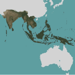
此图片集提供对热带地区的高分辨率卫星监测数据,主要目的是减少和扭转热带森林的损失,从而有助于应对气候变化、保护生物多样性、促进森林再生、恢复和增强,以及促进可持续发展,所有这些都… 基础地图 forest nicfi planet planet-nicfi publisher-dataset -
2020 年世界天然森林

《Natural Forests of the World 2020》提供了一张 2020 年全球天然森林概率地图,分辨率为 10 米。该 API 的开发旨在支持欧盟的《森林砍伐法规》(EUDR) 等举措,以及其他森林保护和监测工作。地图… 生物多样性 气候 保护 森林砍伐 EUDR 森林 -
原生湿润热带森林

原生湿热带森林可提供众多全球生态系统服务,但仍面临因经济因素而持续遭到砍伐的威胁。为了促进国家土地利用规划,并平衡经济发展和维护生态系统服务的目标,我们创建了一张主要的热带雨林地图… 森林 森林生物质 全球 Landsat 衍生 UMD -
SCANFI:加拿大空间化国家森林清查数据产品 1.2

此数据发布包含一组 30 米分辨率的栅格文件,表示 2020 年加拿大全境的广义土地覆盖类型、森林树冠高度、郁闭度和地上树木生物量地图,以及几种主要树种的物种组成。The Spatialized CAnadian National … 加拿大 森林 森林生物质 发布者-数据集 树木覆盖率 -
树木邻近人群 (TPP) 1.0

“Tree Proximate People”(TPP) 是一个数据集,有助于开发森林合作伙伴关系 (CPF) 全球核心森林相关指标集 (GCS) 中的指标 13(极度贫困的森林依赖人口数量)。TPP 数据集提供了 4 种不同的估计值… 农业 粮农组织 森林 全球 植物生产力 人口 -
美国林务局景观变化监控系统 v2024.10(美国本土和美国境外)
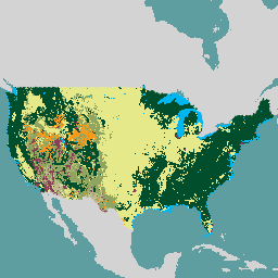
此产品是景观变化监测系统 (LCMS) 数据套件的一部分。该数据集显示了每个年份的 LCMS 建模变化、土地覆盖和/或土地利用类别,涵盖美国本土 (CONUS) 以及 CONUS 以外的地区 (OCONUS),包括阿拉斯加 (AK)、波多黎各… change-detection forest gtac landcover landuse landuse-landcover -
美国林务局树冠覆盖率 v2023-5(CONUS 和 OCONUS)

概览树冠覆盖率 (TCC) 数据套件由美国农业部林务局 (USFS) 制作,是基于遥感的年度地图输出,涵盖 1985 年至 2023 年。这些数据支持美国地质调查局 (US Geological … 森林 gtac landuse-landcover redcastle-resources usda usfs -
美国林务局 TreeMap v2016(美国本土)

此产品是 TreeMap 数据套件的一部分。该数据集提供了 2016 年美国大陆整个森林覆盖范围内的森林特征(包括活树和死树的数量、生物量和碳)的详细空间信息。TreeMap v2016 包含一张图片,即… 生物质 碳 气候变化 美国本土 森林 森林生物质 -
美国林务局树形图 v2020
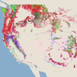
此产品是 TreeMap 数据套件的一部分。该数据集提供了 2020 年美国整个森林覆盖范围内的森林特征(包括活树和死树的数量、生物量和碳)的详细空间信息。TreeMap v2020 包含 22 个波段,分辨率为 30 x 30 米… 地上 生物质 碳 气候变化 美国本土 森林 -
USFS TreeMap v2022
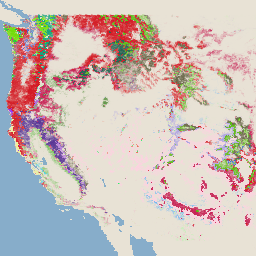
此产品是 TreeMap 数据套件的一部分。该数据集提供了 2022 年美国整个森林覆盖范围内的森林特征(包括活树和死树的数量、生物量和碳)的详细空间信息。TreeMap v2022 包含 22 个波段的 30 x 30 米… 地上 生物质 碳 气候变化 美国本土 森林 -
WRI/Google DeepMind 全球森林损失驱动因素 2001-2022 年 v1.0

此数据集以 1 公里分辨率在全球范围内绘制了 2001 年至 2022 年间森林覆盖率下降的主要驱动因素。该数据由世界资源研究所 (WRI) 和 Google DeepMind 共同制作,是使用在全球范围内收集的一组样本训练的全球神经网络模型 (ResNet) 开发而成… 农业 森林砍伐 森林 森林生物质 Google landandcarbon -
WRI/Google DeepMind 全球森林损失驱动因素 2001-2023 年 v1.1

此数据集以 1 公里分辨率在全球范围内呈现了 2001 年至 2023 年间森林覆盖率下降的主要驱动因素。该数据由世界资源研究所 (WRI) 和 Google DeepMind 共同制作,是使用在全球范围内收集的一组样本训练的全球神经网络模型 (ResNet) 开发而成… 农业 森林砍伐 森林 森林生物质 Google landandcarbon -
WRI/Google DeepMind,“2001-2024 年全球森林损失驱动因素”v1.2

此数据集以 1 公里分辨率在全球范围内绘制了 2001 年至 2024 年间森林覆盖损失的主要驱动因素。该数据由世界资源研究所 (WRI) 和 Google DeepMind 共同制作,是使用在全球范围内收集的一组样本训练的全球神经网络模型 (ResNet) 开发而成… 农业 森林砍伐 森林 森林生物质 Google landandcarbon
Datasets tagged forest in Earth Engine
[null,null,[],[],[]]
