-
GPW Annual Dominant Class of Grasslands v1
Cet ensemble de données fournit des cartes mondiales annuelles des classes dominantes de prairies (cultivées et naturelles/semi-naturelles) de 2000 à 2022, avec une résolution spatiale de 30 m. Produite par l'initiative Land & Carbon Lab Global Pasture Watch, l'étendue des prairies cartographiée comprend tout type de couverture terrestre contenant au moins 30 % de… global global-pasture-watch land landcover landuse landuse-landcover -
GPW Annual Probabilities of Cultivated Grasslands v1
Cet ensemble de données fournit des cartes de probabilité annuelles mondiales des prairies cultivées de 2000 à 2022, avec une résolution spatiale de 30 m. Produite par l'initiative Land & Carbon Lab Global Pasture Watch, l'étendue des prairies cartographiée inclut tout type de couverture terrestre contenant au moins 30 % de matière sèche ou… global global-pasture-watch land landcover landuse landuse-landcover -
GPW Annual Probabilities of Natural/Semi-natural Grasslands v1
Cet ensemble de données fournit des cartes de probabilité annuelles mondiales des prairies naturelles/semi-naturelles de 2000 à 2022, avec une résolution spatiale de 30 m. Produite par l'initiative Land & Carbon Lab Global Pasture Watch, l'étendue des prairies cartographiée inclut tout type de couverture terrestre contenant au moins 30 % de matière sèche ou… global global-pasture-watch land landcover landuse landuse-landcover -
GPW Annual uncalibrated Gross Primary Productivity (uGPP) v1
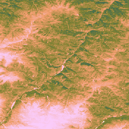
Cet ensemble de données fournit la productivité primaire brute mondiale non calibrée basée sur l'observation de la Terre depuis 2000, avec une résolution spatiale de 30 m. Produit par l'initiative Land & Carbon Lab Global Pasture Watch, l'ensemble de données actuel fournit des valeurs de productivité primaire brute (PPB) à l'échelle mondiale avec une résolution spatiale de 30 mètres à partir de l'an 2000. Les valeurs GPP sont… global global-pasture-watch land landcover landuse plant-productivity
Datasets tagged global-pasture-watch in Earth Engine
[null,null,[],[[["\u003cp\u003eThe Global Pasture Watch (GPW) initiative provides annual global maps of grassland types at 30-meter resolution from 2000 to 2022.\u003c/p\u003e\n"],["\u003cp\u003eThe datasets include probabilities of cultivated, natural/semi-natural, and dominant class of grasslands.\u003c/p\u003e\n"],["\u003cp\u003eGrassland extent is defined as any land cover with at least 30% dry or photosynthetic vegetation.\u003c/p\u003e\n"],["\u003cp\u003eThese datasets are produced by the Land & Carbon Lab and are available for global analysis.\u003c/p\u003e\n"]]],[],null,["# Datasets tagged global-pasture-watch in Earth Engine\n\n-\n\n |-------------------------------------------------------------------------------------------------------------------------------------------------------------------------------------------------------------------------------------------------------------------------------------------------------------------------------------|\n | [### GPW Annual Dominant Class of Grasslands v1](/earth-engine/datasets/catalog/projects_global-pasture-watch_assets_ggc-30m_v1_grassland_c) |\n | This dataset provides global annual dominant class maps of grasslands (cultivated and natural/semi-natural) from 2000 to 2022 at 30-m spatial resolution. Produced by Land \\& Carbon Lab Global Pasture Watch initiative, the mapped grassland extent includes any land cover type, which contains at least 30% ... |\n | [global](/earth-engine/datasets/tags/global) [global-pasture-watch](/earth-engine/datasets/tags/global-pasture-watch) [land](/earth-engine/datasets/tags/land) [landcover](/earth-engine/datasets/tags/landcover) [landuse](/earth-engine/datasets/tags/landuse) [landuse-landcover](/earth-engine/datasets/tags/landuse-landcover) |\n\n-\n\n |-------------------------------------------------------------------------------------------------------------------------------------------------------------------------------------------------------------------------------------------------------------------------------------------------------------------------------------|\n | [### GPW Annual Probabilities of Cultivated Grasslands v1](/earth-engine/datasets/catalog/projects_global-pasture-watch_assets_ggc-30m_v1_cultiv-grassland_p) |\n | This dataset provides global annual probability maps of cultivated grassland from 2000 to 2022 at 30-m spatial resolution. Produced by Land \\& Carbon Lab Global Pasture Watch initiative, the mapped grassland extent includes any land cover type, which contains at least 30% of dry or ... |\n | [global](/earth-engine/datasets/tags/global) [global-pasture-watch](/earth-engine/datasets/tags/global-pasture-watch) [land](/earth-engine/datasets/tags/land) [landcover](/earth-engine/datasets/tags/landcover) [landuse](/earth-engine/datasets/tags/landuse) [landuse-landcover](/earth-engine/datasets/tags/landuse-landcover) |\n\n-\n\n |-------------------------------------------------------------------------------------------------------------------------------------------------------------------------------------------------------------------------------------------------------------------------------------------------------------------------------------|\n | [### GPW Annual Probabilities of Natural/Semi-natural Grasslands v1](/earth-engine/datasets/catalog/projects_global-pasture-watch_assets_ggc-30m_v1_nat-semi-grassland_p) |\n | This dataset provides global annual probability maps of natural/semi-natural grassland from 2000 to 2022 at 30-m spatial resolution. Produced by Land \\& Carbon Lab Global Pasture Watch initiative, the mapped grassland extent includes any land cover type, which contains at least 30% of dry or ... |\n | [global](/earth-engine/datasets/tags/global) [global-pasture-watch](/earth-engine/datasets/tags/global-pasture-watch) [land](/earth-engine/datasets/tags/land) [landcover](/earth-engine/datasets/tags/landcover) [landuse](/earth-engine/datasets/tags/landuse) [landuse-landcover](/earth-engine/datasets/tags/landuse-landcover) |\n\n-\n\n |---------------------------------------------------------------------------------------------------------------------------------------------------------------------------------------------------------------------------------------------------------------------------------------------------------------------------------------|\n | [### GPW Annual uncalibrated Gross Primary Productivity (uGPP) v1](/earth-engine/datasets/catalog/projects_global-pasture-watch_assets_ggpp-30m_v1_ugpp_m) |\n | This dataset provides global uncalibrated EO-based Gross Primary Productivity from 2000 at 30-m spatial resolution. Produced by Land \\& Carbon Lab Global Pasture Watch initiative, the current dataset provides Gross Primary Productivity (GPP) values globally at 30-m spatial resolution from 2000 onwards. GPP values are ... |\n | [global](/earth-engine/datasets/tags/global) [global-pasture-watch](/earth-engine/datasets/tags/global-pasture-watch) [land](/earth-engine/datasets/tags/land) [landcover](/earth-engine/datasets/tags/landcover) [landuse](/earth-engine/datasets/tags/landuse) [plant-productivity](/earth-engine/datasets/tags/plant-productivity) |"]]