-
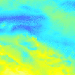
GPM: 글로벌 강수량 측정 (GPM) 버전 07
글로벌 강수량 측정 (GPM)은 전 세계의 비와 눈에 관한 차세대 관측 정보를 3시간마다 제공하는 국제 위성 임무입니다. GPM용 통합 다중위성 검색 (IMERG)은 GPM의 모든 수동 마이크로파 기기의 데이터를 결합하여 강수량 추정치를 제공하는 통합 알고리즘입니다. climate geophysical gpm imerg jaxa nasa -
GPM: 월별 글로벌 강수량 측정 (GPM) v6
IMERG 최종 버전 '06'은 2021년 9월에 더 이상 생성되지 않습니다. 버전 '07'은 2022년 9월에 출시될 예정입니다. 글로벌 강수량 측정 (GPM)은 전 세계의 비와 눈에 관한 차세대 관측 정보를 3시간마다 제공하는 국제 위성 임무입니다. …을 위한 통합 다중 위성 검색 climate geophysical gpm imerg jaxa monthly -
GPM: 월별 글로벌 강수량 측정 (GPM) vRelease 07
글로벌 강수량 측정 (GPM)은 전 세계의 비와 눈에 관한 차세대 관측 정보를 3시간마다 제공하는 국제 위성 임무입니다. GPM용 통합 다중위성 검색 (IMERG)은 GPM의 모든 수동 마이크로파 기기의 데이터를 결합하여 강수량 추정치를 제공하는 통합 알고리즘입니다. climate geophysical gpm imerg jaxa monthly -
OpenLandMap Precipitation Monthly
SM2RAIN-ASCAT 2007~2018, IMERG, CHELSA Climate, WorldClim을 기반으로 한 월별 강수량(mm, 1km 해상도) gdalwarp (3차 스플라인) 및 WorldClim, CHELSA Climate, IMERG 월간 제품의 평균을 사용하여 1km 해상도로 축소했습니다 (예: '3B-MO-L.GIS.IMERG.20180601.V05B.tif' 참고). 3배 더 높은 가중치가 적용됩니다. envirometrix imerg 월간 opengeohub openlandmap 강수량
Datasets tagged imerg in Earth Engine
[null,null,[],[[["\u003cp\u003eGPM (Global Precipitation Measurement) is an international satellite mission providing observations of rain and snow globally every three hours.\u003c/p\u003e\n"],["\u003cp\u003eIMERG (Integrated Multi-satellitE Retrievals for GPM) is the algorithm used to produce rainfall estimates by combining data from various instruments.\u003c/p\u003e\n"],["\u003cp\u003eGPM data is available in different versions and temporal resolutions, including monthly and near-real-time, with IMERG v06 being discontinued and v07 as its successor.\u003c/p\u003e\n"],["\u003cp\u003eOpenLandMap offers monthly precipitation data at 1 km resolution, integrating data from various sources, including IMERG.\u003c/p\u003e\n"]]],["The Global Precipitation Measurement (GPM) mission uses satellites to observe global rain and snow every three hours. The Integrated Multi-satellitE Retrievals for GPM (IMERG) algorithm estimates rainfall by combining data from various passive-microwave instruments. Version 06 of IMERG-Final production stopped in September 2021. OpenLandMap offers monthly precipitation data at 1 km resolution using SM2RAIN-ASCAT, IMERG, CHELSA Climate, and WorldClim.\n"],null,["# Datasets tagged imerg in Earth Engine\n\n-\n\n |-------------------------------------------------------------------------------------------------------------------------------------------------------------------------------------------------------------------------------------------------------------------------------------------------------------------------------------------------------------|\n | [### GPM: Global Precipitation Measurement (GPM) Release 07](/earth-engine/datasets/catalog/NASA_GPM_L3_IMERG_V07) |\n | Global Precipitation Measurement (GPM) is an international satellite mission to provide next-generation observations of rain and snow worldwide every three hours. The Integrated Multi-satellitE Retrievals for GPM (IMERG) is the unified algorithm that provides rainfall estimates combining data from all passive-microwave instruments in the GPM ... |\n | [climate](/earth-engine/datasets/tags/climate) [geophysical](/earth-engine/datasets/tags/geophysical) [gpm](/earth-engine/datasets/tags/gpm) [imerg](/earth-engine/datasets/tags/imerg) [jaxa](/earth-engine/datasets/tags/jaxa) [nasa](/earth-engine/datasets/tags/nasa) |\n\n-\n\n |----------------------------------------------------------------------------------------------------------------------------------------------------------------------------------------------------------------------------------------------------------------------------------------------------------------------------------------------------|\n | [### GPM: Monthly Global Precipitation Measurement (GPM) v6](/earth-engine/datasets/catalog/NASA_GPM_L3_IMERG_MONTHLY_V06) |\n | IMERG-Final version \"06\" stopped being produced in September, 2021. Version \"07\" is expected to be released in September 2022 Global Precipitation Measurement (GPM) is an international satellite mission to provide next-generation observations of rain and snow worldwide every three hours. The Integrated Multi-satellitE Retrievals for ... |\n | [climate](/earth-engine/datasets/tags/climate) [geophysical](/earth-engine/datasets/tags/geophysical) [gpm](/earth-engine/datasets/tags/gpm) [imerg](/earth-engine/datasets/tags/imerg) [jaxa](/earth-engine/datasets/tags/jaxa) [monthly](/earth-engine/datasets/tags/monthly) |\n\n-\n\n |-------------------------------------------------------------------------------------------------------------------------------------------------------------------------------------------------------------------------------------------------------------------------------------------------------------------------------------------------------------|\n | [### GPM: Monthly Global Precipitation Measurement (GPM) vRelease 07](/earth-engine/datasets/catalog/NASA_GPM_L3_IMERG_MONTHLY_V07) |\n | Global Precipitation Measurement (GPM) is an international satellite mission to provide next-generation observations of rain and snow worldwide every three hours. The Integrated Multi-satellitE Retrievals for GPM (IMERG) is the unified algorithm that provides rainfall estimates combining data from all passive-microwave instruments in the GPM ... |\n | [climate](/earth-engine/datasets/tags/climate) [geophysical](/earth-engine/datasets/tags/geophysical) [gpm](/earth-engine/datasets/tags/gpm) [imerg](/earth-engine/datasets/tags/imerg) [jaxa](/earth-engine/datasets/tags/jaxa) [monthly](/earth-engine/datasets/tags/monthly) |\n\n-\n\n |--------------------------------------------------------------------------------------------------------------------------------------------------------------------------------------------------------------------------------------------------------------------------------------------------------------------------------------------------|\n | [### OpenLandMap Precipitation Monthly](/earth-engine/datasets/catalog/OpenLandMap_CLM_CLM_PRECIPITATION_SM2RAIN_M_v01) |\n | Monthly precipitation in mm at 1 km resolution based on SM2RAIN-ASCAT 2007-2018, IMERG, CHELSA Climate, and WorldClim. Downscaled to 1 km resolution using gdalwarp (cubic splines) and an average between WorldClim, CHELSA Climate, and IMERG monthly product (see, e.g, \"3B-MO-L.GIS.IMERG.20180601.V05B.tif\"). 3x higher weight is given ... |\n | [envirometrix](/earth-engine/datasets/tags/envirometrix) [imerg](/earth-engine/datasets/tags/imerg) [monthly](/earth-engine/datasets/tags/monthly) [opengeohub](/earth-engine/datasets/tags/opengeohub) [openlandmap](/earth-engine/datasets/tags/openlandmap) [precipitation](/earth-engine/datasets/tags/precipitation) |"]]