-
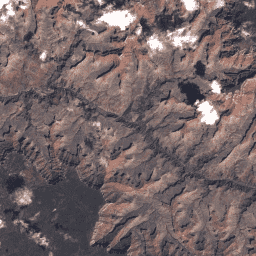
USGS Landsat 4 MSS Collection 2 Tier 1 원시 장면
확장 및 보정된 센서 전 방사도를 나타내는 Landsat 4 MSS 컬렉션 2 Tier 1 DN 값입니다. 사용 가능한 데이터 품질이 가장 우수한 Landsat 장면은 Tier 1로 분류되며 시계열 처리 분석에 적합한 것으로 간주됩니다. Tier 1에는 다음과 같은 Level-1 Precision Terrain (L1TP) 처리 데이터가 포함됩니다. c2 global l4 landsat lm4 mss -
USGS Landsat 4 MSS Collection 2 Tier 2 원시 장면
확장 및 보정된 센서 전 방사도를 나타내는 Landsat 4 MSS 컬렉션 2 Tier 2 DN 값입니다. 처리 중에 Tier 1 기준을 충족하지 않는 장면은 Tier 2에 할당됩니다. 여기에는 체계적 지형 (L1GT) 및 체계적 (L1GS) 처리된 장면과 … c2 global l4 landsat lm4 mss -
USGS Landsat 4 TM Collection 2 Tier 1 원시 장면
Landsat 4 TM 컬렉션 2 Tier 1 DN 값으로, 보정된 감지기 전 방사도를 나타냅니다. 사용 가능한 데이터 품질이 가장 우수한 Landsat 장면은 Tier 1로 분류되며 시계열 처리 분석에 적합한 것으로 간주됩니다. Tier 1에는 다음과 같은 Level-1 Precision Terrain (L1TP) 처리 데이터가 포함됩니다. c2 전역 l4 landsat lt4 radiance -
USGS Landsat 4 TM Collection 2 Tier 2 원시 장면
Landsat 4 TM Collection 2 Tier 2 DN 값으로, 확장 및 보정된 센서 전 방사도를 나타냅니다. 처리 중에 Tier 1 기준을 충족하지 않는 장면은 Tier 2에 할당됩니다. 여기에는 체계적 지형 (L1GT) 및 체계적 (L1GS) 처리된 장면과 … c2 전역 l4 landsat lt4 radiance
Datasets tagged l4 in Earth Engine
[null,null,[],[[["\u003cp\u003eThis page provides access to USGS Landsat 4 Collection 2 Raw Scenes, including both MSS and TM sensor data.\u003c/p\u003e\n"],["\u003cp\u003eThe datasets are categorized into Tier 1 (highest quality, suitable for time-series analysis) and Tier 2 (lower quality, may contain geometric errors).\u003c/p\u003e\n"],["\u003cp\u003eAll scenes contain DN values representing scaled, calibrated at-sensor radiance.\u003c/p\u003e\n"],["\u003cp\u003eLandsat 4 Collection 2 offers global coverage.\u003c/p\u003e\n"]]],[],null,["# Datasets tagged l4 in Earth Engine\n\n-\n\n |--------------------------------------------------------------------------------------------------------------------------------------------------------------------------------------------------------------------------------------------------------------------------------------------------------------------------|\n | [### USGS Landsat 4 MSS Collection 2 Tier 1 Raw Scenes](/earth-engine/datasets/catalog/LANDSAT_LM04_C02_T1) |\n | Landsat 4 MSS Collection 2 Tier 1 DN values, representing scaled, calibrated at-sensor radiance. Landsat scenes with the highest available data quality are placed into Tier 1 and are considered suitable for time-series processing analysis. Tier 1 includes Level-1 Precision Terrain (L1TP) processed data that ... |\n | [c2](/earth-engine/datasets/tags/c2) [global](/earth-engine/datasets/tags/global) [l4](/earth-engine/datasets/tags/l4) [landsat](/earth-engine/datasets/tags/landsat) [lm4](/earth-engine/datasets/tags/lm4) [mss](/earth-engine/datasets/tags/mss) |\n\n-\n\n |------------------------------------------------------------------------------------------------------------------------------------------------------------------------------------------------------------------------------------------------------------------------------------------------------|\n | [### USGS Landsat 4 MSS Collection 2 Tier 2 Raw Scenes](/earth-engine/datasets/catalog/LANDSAT_LM04_C02_T2) |\n | Landsat 4 MSS Collection 2 Tier 2 DN values, representing scaled, calibrated at-sensor radiance. Scenes not meeting Tier 1 criteria during processing are assigned to Tier 2. This includes Systematic terrain (L1GT) and Systematic (L1GS) processed scenes, as well as any L1TP scenes that do ... |\n | [c2](/earth-engine/datasets/tags/c2) [global](/earth-engine/datasets/tags/global) [l4](/earth-engine/datasets/tags/l4) [landsat](/earth-engine/datasets/tags/landsat) [lm4](/earth-engine/datasets/tags/lm4) [mss](/earth-engine/datasets/tags/mss) |\n\n-\n\n |-------------------------------------------------------------------------------------------------------------------------------------------------------------------------------------------------------------------------------------------------------------------------------------------------------------------------|\n | [### USGS Landsat 4 TM Collection 2 Tier 1 Raw Scenes](/earth-engine/datasets/catalog/LANDSAT_LT04_C02_T1) |\n | Landsat 4 TM Collection 2 Tier 1 DN values, representing scaled, calibrated at-sensor radiance. Landsat scenes with the highest available data quality are placed into Tier 1 and are considered suitable for time-series processing analysis. Tier 1 includes Level-1 Precision Terrain (L1TP) processed data that ... |\n | [c2](/earth-engine/datasets/tags/c2) [global](/earth-engine/datasets/tags/global) [l4](/earth-engine/datasets/tags/l4) [landsat](/earth-engine/datasets/tags/landsat) [lt4](/earth-engine/datasets/tags/lt4) [radiance](/earth-engine/datasets/tags/radiance) |\n\n-\n\n |-----------------------------------------------------------------------------------------------------------------------------------------------------------------------------------------------------------------------------------------------------------------------------------------------------|\n | [### USGS Landsat 4 TM Collection 2 Tier 2 Raw Scenes](/earth-engine/datasets/catalog/LANDSAT_LT04_C02_T2) |\n | Landsat 4 TM Collection 2 Tier 2 DN values, representing scaled, calibrated at-sensor radiance. Scenes not meeting Tier 1 criteria during processing are assigned to Tier 2. This includes Systematic terrain (L1GT) and Systematic (L1GS) processed scenes, as well as any L1TP scenes that do ... |\n | [c2](/earth-engine/datasets/tags/c2) [global](/earth-engine/datasets/tags/global) [l4](/earth-engine/datasets/tags/l4) [landsat](/earth-engine/datasets/tags/landsat) [lt4](/earth-engine/datasets/tags/lt4) [radiance](/earth-engine/datasets/tags/radiance) |"]]