-
ECOSTRESS 平铺辅助 NDVI 和反照率 L2 全球 70 米 V002

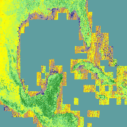
ECOSTRESS Tiled Ancillary NDVI and Albedo (ECO_L2T_STARS) V002 数据集以 70 米的空间分辨率提供归一化差值植被指数 (NDVI) 和反照率数据。这种辅助产品对于了解植物的需水量和水分胁迫至关重要,它通过数据融合流程创建,该流程将可见光… 反照率 陆地 ndvi 植物生产力 -
GCOM-C/SGLI L3 地表温度 (V1)

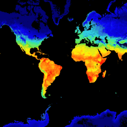
此产品是陆地表面的温度。此数据集还提供了一个更新的版本 JAXA/GCOM-C/L3/LAND/LST/V3,该版本使用此算法进行处理。GCOM-C 会进行长期持续的全球观测和数据收集,以阐明辐射收支波动背后的机制,并… 气候 g-portal gcom gcom-c jaxa 陆地 -
GCOM-C/SGLI L3 地表温度 (V2)

此产品是陆地表面的温度。对于 2021 年 11 月 28 日之后的数据,请参阅 V3 数据集。GCOM-C 会进行长期持续的全球观测和数据收集,以阐明辐射预算和碳循环波动背后的机制,从而准确预测… 气候 g-portal gcom gcom-c jaxa 陆地 -
GCOM-C/SGLI L3 地表温度(版本 3)

此产品是陆地表面的温度。这是一个持续更新的数据集,延迟时间为 3-4 天。GCOM-C 会进行长期持续的全球观测和数据收集,以阐明辐射预算和碳循环波动背后的机制,从而做出… 气候 g-portal gcom gcom-c jaxa 陆地 -
GCOM-C/SGLI L3 叶面积指数(版本 1)

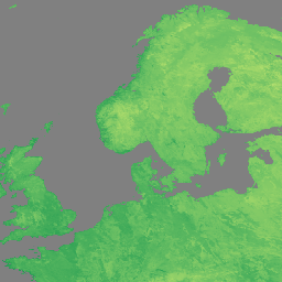
此产品是指单位地面面积的单侧绿叶面积之和。此数据集还提供了一个较新的版本 JAXA/GCOM-C/L3/LAND/LAI/V3,该版本使用此算法进行处理。GCOM-C 进行长期持续的全球观测和数据收集,以阐明以下机制… g-portal gcom gcom-c jaxa lai land -
GCOM-C/SGLI L3 叶面积指数 (V2)

此产品是指单位地面面积的单侧绿叶面积之和。对于 2021 年 11 月 28 日之后的数据,请参阅 V3 数据集。GCOM-C 会进行长期持续的全球观测和数据收集,以阐明辐射预算和碳循环波动背后的机制… g-portal gcom gcom-c jaxa lai land -
GCOM-C/SGLI L3 叶面积指数 (V3)

此产品是指单位地面面积的单侧绿叶面积之和。这是一个持续更新的数据集,延迟时间为 3-4 天。GCOM-C 会进行长期持续的全球观测和数据收集,以阐明辐射收支波动背后的机制… g-portal gcom gcom-c jaxa lai land -
GPW Annual Dominant Class of Grasslands v1

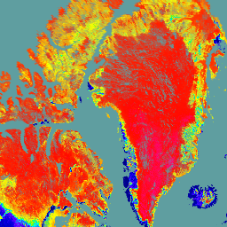
此数据集以 30 米的空间分辨率提供 2000 年至 2022 年的全球年度草地(人工和天然/半天然)主要类别地图。该地图由 Land & Carbon Lab Global Pasture Watch 计划制作,其中显示的草地范围包括任何地表覆盖类型,只要其中包含至少 … 全球 全球牧场监测 土地 土地覆盖 土地利用 土地利用和土地覆盖 -
GPW 耕作草地年概率 v1

此数据集以 30 米的空间分辨率提供 2000 年至 2022 年的全球年度耕作草地概率地图。该地图由 Land & Carbon Lab Global Pasture Watch 计划制作,其中包含的草地范围包括任何土地覆盖类型,其中至少包含 30% 的干… 全球 全球牧场监测 土地 土地覆盖 土地利用 土地利用和土地覆盖 -
GPW 天然/半天然草地的年概率 v1

此数据集提供 2000 年至 2022 年全球天然/半天然草地的年度概率地图,空间分辨率为 30 米。该地图由 Land & Carbon Lab Global Pasture Watch 计划制作,其中包含的草地范围包括任何土地覆盖类型,其中至少包含 30% 的干… 全球 全球牧场监测 土地 土地覆盖 土地利用 土地利用和土地覆盖 -
GPW 年短植被高度 v1

此数据集提供 2000 年以来全球中值植被高度,空间分辨率为 30 米。此数据集由 Land & Carbon Lab 的 Global Pasture Watch 计划生成,提供自 2000 年以来全球 30 米空间分辨率的中值植被高度值(第 50 百分位)。该数据集基于… 冠层 全球 全球牧场监测 土地 土地覆盖 植物生产力 -
GPW Annual uncalibrated Gross Primary Productivity (uGPP) v1

此数据集提供 2000 年以来全球未校准的基于 EO 的初级生产总力,空间分辨率为 30 米。当前数据集由 Land & Carbon Lab Global Pasture Watch 计划生成,提供自 2000 年以来全球范围内的总初级生产力 (GPP) 值,空间分辨率为 30 米。GPP 值… 全球 global-pasture-watch land landcover landuse plant-productivity -
GRACE 月度质量网格版本 06 版本 04 - 陆地

月度陆地网格包含水质量异常,以等效水厚度表示,该厚度是根据指定时间跨度内 GRACE 和 GRACE-FO 时变重力观测结果得出的,并且相对于指定的时间平均参考周期。等效水厚度表示陆地总储水异常值… crs gfz grace gravity jpl land -
NOAA CDR AVHRR LAI FAPAR:叶面积指数和光合有效辐射吸收分数,版本 5

AVHRR 叶面积指数 (LAI) 和光合有效辐射吸收分数 (FAPAR) 数据集的 NOAA 气候数据记录 (CDR) 包含表征植物冠层和光合作用活动的派生值。此数据集派生自 NOAA AVHRR 地表反射率产品,并且… avhrr cdr daily fapar lai land -
NOAA CDR AVHRR NDVI:归一化差值植被指数,版本 5

AVHRR 常态化差值植生指标 (NDVI) 的 NOAA 气候数据记录 (CDR) 包含从 NOAA AVHRR 地表反射率产品中得出的网格化日 NDVI。它提供了一种地表植被覆盖活动测量方法,以 0.05° 的分辨率进行网格化,并在全球陆地上进行计算… avhrr cdr daily land ndvi noaa -
NOAA CDR AVHRR:地表反射率,版本 5

AVHRR 地表反射率的 NOAA 气候数据记录 (CDR) 包含网格化每日地表反射率和亮度温度,这些数据是从七颗 NOAA 极地轨道卫星上搭载的高级甚高分辨率辐射计 (AVHRR) 传感器获取的。数据以 0.05° 的分辨率进行网格化,并计算… avhrr cdr daily land noaa reflectance -
NOAA CDR VIIRS LAI FAPAR:叶面积指数和光合有效辐射吸收分数,版本 1

此气候数据记录 (CDR) 结合了叶面积指数 (LAI) 和光合有效辐射吸收分数 (FAPAR) 的数据集,这两个生物物理变量可用于评估植被压力、预测农业产量以及其他建模和资源管理应用。LAI 跟踪单侧… cdr daily fapar lai land noaa -
NOAA CDR VIIRS NDVI:归一化差值植被指数,版本 1

此数据集包含网格化日归一化差值植被指数 (NDVI),该指数源自 NOAA 可见光红外成像辐射计套件 (VIIRS) 地表反射率的气候数据记录 (CDR)。数据记录涵盖了 2014 年至今,使用的是 NOAA 极地轨道卫星的数据。这些数据是根据…预测的 cdr daily land ndvi noaa vegetation-indices -
VNP14A1.002:热异常/火灾每日 L3 全球 1km SIN 网格

Suomi 国家极地轨道合作伙伴关系 NASA 可见红外成像辐射计套件 (VIIRS) 热异常/火点 (VNP14A1) 版本 1 数据产品提供有关活跃火点和其他热异常的每日信息。VNP14A1 数据产品是全球 1 公里网格化合成数据,包含从 … 检测到的火灾像素 火灾 陆地 nasa noaa 表面 viirs -
VNP15A2H:LAI/FPAR 8 天 L4 全球 500 米 SIN 网格

可见光红外成像辐射计套件 (VIIRS) 叶面积指数 (LAI) 和光合有效辐射分数 (FPAR) 第 1 版数据产品以 500 米分辨率 (VNP15A2H) 提供有关植被冠层的信息。VIIRS 传感器位于 NOAA/NASA 联合 Suomi 国家极轨轨道卫星上,… land nasa noaa surface vegetation-indices viirs -
VNP21A1D.002:每日 1 公里白天陆地表面温度和发射率

NASA Suomi 国家极地轨道合作伙伴计划 (Suomi NPP) 可见光红外成像辐射仪套件 (VIIRS) 地表温度和发射率 (LST&E) 日间版本 1 产品 (VNP21A1D) 每天根据白天 2 级网格化 (L2G) 中间产品编译而成。L2G 流程可将每日 VNP21 轨道粒度数据映射到 … 气候 每日 天 陆地 nasa noaa -
VNP21A1N.002:夜间地表温度和发射率每日 1 公里

NASA Suomi 国家极地轨道合作伙伴计划 (Suomi NPP) 可见光红外成像辐射仪套件 (VIIRS) 地表温度和发射率 (LST&E) 夜间版本 1 产品 (VNP21A1N) 每天从夜间 2 级网格化 (L2G) 中间产品编译而成。L2G 流程可将每日 VNP21 轨道粒度数据映射到 … 气候 每日 陆地 美国宇航局 (NASA) 夜间 美国国家海洋和大气管理局 (NOAA) -
VNP22Q2:陆地表面物候年度 L3 全球 500 米 SIN 网格

Suomi 国家极地轨道合作伙伴计划 (Suomi NPP) NASA 可见光红外成像辐射仪套件 (VIIRS) 地表覆盖动态数据产品以年度间隔提供全球陆地表面物候 (GLSP) 指标。VNP22Q2 数据产品源自双波段增强型植被指数 (EVI2) 的时间序列… land landuse-landcover nasa ndvi noaa npp -
VNP43IA1:BRDF/反照率模型参数每日 L3 全球 500 米 SIN 网格

Suomi 国家极地轨道合作伙伴计划 (Suomi NPP) NASA 可见光红外成像辐射仪套件 (VIIRS) 双向反射率分布函数 (BRDF) 和反照率模型参数 (VNP43IA1) 版本 1 产品以 500 分辨率提供核权重(参数)。VNP43IA1 产品每天使用 16 天的 VIIRS 数据生成… 陆地 nasa noaa 卫星图像 表面 viirs -
VNP43IA2:BRDF/反照率质量每日 L3 全球 500 米 SIN 网格

Suomi 国家极地轨道合作伙伴计划 (Suomi NPP) NASA 可见红外成像辐射计套件 (VIIRS) 双向反射率分布函数 (BRDF) 和反照率质量 (VNP43IA2) 第 1 版产品以 500 米分辨率提供 BRDF 和反照率质量。VNP43IA2 产品每天使用 16 天的 VIIRS 数据生成… 陆地 nasa noaa 卫星图像 表面 viirs -
VNP43IA4:BRDF/反照率质量每日 L3 全球 500 米 SIN 网格

NASA/NOAA Suomi 国家极地轨道合作伙伴关系 (Suomi NPP) 可见光红外成像辐射仪套件 (VIIRS) 天底双向反射率分布函数 (BRDF) 调整后的反射率 (NBAR) 版本 2 产品提供 500 米分辨率的 NBAR 估计值。VNP43IA4 产品每天使用 16 天的 VIIRS 数据生成… brdf land nasa noaa satellite-imagery surface -
VNP64A1:月度 L4 全球 500 米 SIN 网格中的烧毁区域

Suomi 国家极地轨道合作伙伴计划 (Suomi NPP) NASA 可见红外成像辐射计套件 (VIIRS) 每日烧毁面积 (VNP64A1) 版本 1 数据产品是一种每月更新的全球网格化 500 米产品,包含每个像素的烧毁面积和质量信息。VNP64 烧毁区域测绘方法采用 750 米 VIIRS … 烧毁 变化检测 火灾 土地 nasa noaa
Datasets tagged land in Earth Engine
[null,null,[],[],["Several datasets from GCOM-C/SGLI, NASA, NOAA, and GPW track land surface and vegetation properties. GCOM-C data measures leaf area index (LAI) and land surface temperature (LST), updating to V3. NASA's VIIRS monitors thermal anomalies, fire, LAI, FPAR, LST, and surface reflectance. NOAA's CDR provides data on AVHRR and VIIRS metrics like LAI, FAPAR, and NDVI. GPW offers annual grassland probability and classification maps. These datasets provide time-series information for global observation and research.\n"]]
