-
可可概率模型 2025a

注意:此数据集尚未经过同行评审。如需了解详情,请参阅此 GitHub README。此影像集提供估计的每像素概率,表示相应区域被商品占据的可能性。概率估计值以 10 米为单位进行划分,由…生成 农业 生物多样性 保护 作物 eudr forestdatapartnership -
咖啡概率模型 2025a

注意:此数据集尚未经过同行评审。如需了解详情,请参阅此 GitHub README。此影像集提供估计的每像素概率,表示相应区域被商品占据的可能性。概率估计值以 10 米为单位进行划分,由…生成 农业 生物多样性 保护 作物 eudr forestdatapartnership -
DESS China Terrace Map v1

此数据集是 2018 年中国分辨率为 30 米的梯田地图。该模型基于 Google Earth Engine 平台,通过使用多源和多时相数据进行监督像素级分类来开发。总体准确率和 Kappa 系数分别达到 94% 和 0.72。这第一个… 农业 土地覆盖 土地利用 土地利用和土地覆盖 清华 -
Dynamic World V1

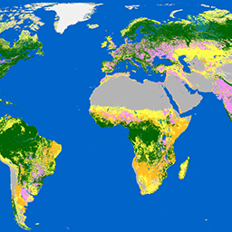
Dynamic World 是一个分辨率为 10 米的近乎实时 (NRT) 土地使用/土地覆盖 (LULC) 数据集,其中包含九个类别的类别概率和标签信息。Dynamic World 预测数据覆盖从 2015 年 6 月 27 日至今的 Sentinel-2 L1C 数据集。Sentinel-2 的重访频率为 2-5 天… 全球 google landcover landuse landuse-landcover nrt -
ESA WorldCover 10m v100

欧洲空间局 (ESA) WorldCover 10 米 2020 年产品基于 Sentinel-1 和 Sentinel-2 数据,提供 2020 年全球土地覆盖地图,分辨率为 10 米。WorldCover 产品包含 11 个土地覆盖类别,是在以下框架中生成的… esa landcover landuse landuse-landcover sentinel1-derived sentinel2-derived -
ESA WorldCover 10m v200

欧洲空间局 (ESA) WorldCover 10 m 2021 产品基于 Sentinel-1 和 Sentinel-2 数据,提供 2021 年全球土地覆盖地图,分辨率为 10 米。WorldCover 产品包含 11 个土地覆盖类别,是在以下框架中生成的… esa landcover landuse landuse-landcover sentinel1-derived sentinel2-derived -
GPW 草地年度优势类 v1

此数据集以 30 米的空间分辨率提供 2000 年至 2022 年的全球年度草地(人工和天然/半天然)主要类别地图。此地图由 Land & Carbon Lab Global Pasture Watch 计划制作,其中显示的草地范围包括任何地表覆盖类型,只要其中包含至少 … 全球 全球牧场监测 土地 土地覆盖 土地利用 土地利用和土地覆盖 -
GPW 耕种草地的年概率 v1

此数据集以 30 米的空间分辨率提供 2000 年至 2022 年的全球耕作草地年度概率地图。此地图由 Land & Carbon Lab 的 Global Pasture Watch 计划制作,其中显示的草地范围包括任何土地覆盖类型,只要其中至少包含 30% 的干… 全球 全球牧场监测 土地 土地覆盖 土地利用 土地利用和土地覆盖 -
GPW 天然/半天然草地的年概率 v1

此数据集以 30 米的空间分辨率提供 2000 年至 2022 年的全球天然/半天然草地年度概率地图。此地图由 Land & Carbon Lab 的 Global Pasture Watch 计划制作,其中显示的草地范围包括任何土地覆盖类型,只要其中至少包含 30% 的干… 全球 全球牧场监测 土地 土地覆盖 土地利用 土地利用和土地覆盖 -
GPW Annual uncalibrated Gross Primary Productivity (uGPP) v1

此数据集提供 2000 年以来全球未校准的基于 EO 的初级生产总力,空间分辨率为 30 米。当前数据集由 Land & Carbon Lab Global Pasture Watch 计划生成,提供自 2000 年以来全球范围内的总初级生产力 (GPP) 值,空间分辨率为 30 米。GPP 值… 全球 global-pasture-watch land landcover landuse plant-productivity -
全球油棕榈种植园地图

该数据集是 2019 年全球 10 米工业和小农油棕榈地图。它涵盖了检测到油棕榈种植园的区域。分类后的图像是基于 Sentinel-1 和 Sentinel-2 半年合成数据的卷积神经网络的输出。如需了解更多…,请参阅相关文章 农业 生物多样性 保护 作物 全球 土地利用 -
Google 基于 Landsat 的全球 CCDC 分段(1999 年至 2019 年)

此集合包含对 20 年的 Landsat 地表反射率数据运行持续变化检测和分类 (CCDC) 算法后预先计算的结果。CCDC 是一种断点查找算法,它使用谐波拟合和动态 RMSE 阈值来检测时间序列数据中的断点。… change-detection google landcover landsat-derived landuse landuse-landcover -
LUCAS Copernicus(带属性的多边形,2018 年)V1

欧盟 (EU) 的土地利用/覆盖面积框架调查 (LUCAS) 旨在提供统计信息。该计划每三年开展一次原位地表覆盖和土地利用数据收集工作,覆盖整个欧盟地区。LUCAS 收集有关土地覆被和…的信息 哥白尼 欧盟 jrc 土地覆盖 土地利用 土地利用和土地覆盖 -
LUCAS Harmonized(理论位置,2006-2018 年)V1

欧盟 (EU) 的土地利用/覆盖面积框架调查 (LUCAS) 旨在提供统计信息。该计划每三年开展一次原位地表覆盖和土地利用数据收集工作,覆盖整个欧盟地区。LUCAS 收集有关土地覆被和…的信息 eu jrc landcover landuse landuse-landcover lucas -
LUCAS THLOC(具有属性的点,2022 年)V1

欧盟 (EU) 的土地利用/覆盖面积框架调查 (LUCAS) 旨在提供统计信息。该计划每三年开展一次原位地表覆盖和土地利用数据收集工作,覆盖整个欧盟地区。LUCAS 收集有关土地覆被和…的信息 eu jrc landcover landuse landuse-landcover lucas -
Palm Probability 模型 2025a

注意:此数据集尚未经过同行评审。如需了解详情,请参阅此 GitHub README。此影像集提供估计的每像素概率,表示相应区域被商品占据的可能性。概率估计值以 10 米为单位进行划分,由…生成 农业 生物多样性 保护 作物 eudr forestdatapartnership -
Rubber Tree Probability 模型 2025a

注意:此数据集尚未经过同行评审。如需了解详情,请参阅此 GitHub README。此影像集提供估计的每像素概率,表示相应区域被商品占据的可能性。概率估计值以 10 米为单位进行划分,由…生成 农业 生物多样性 保护 作物 eudr forestdatapartnership -
美国林务局景观变化监控系统 v2024.10(美国本土和美国境外)

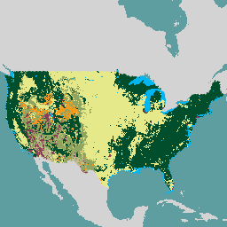
此产品是景观变化监测系统 (LCMS) 数据套件的一部分。该数据集显示了每个年份的 LCMS 建模变化、土地覆盖和/或土地利用类别,涵盖美国本土 (CONUS) 以及 CONUS 以外的地区 (OCONUS),包括阿拉斯加 (AK)、波多黎各… change-detection forest gtac landcover landuse landuse-landcover -
WRI/Google DeepMind 全球森林损失驱动因素 2001-2022 年 v1.0

此数据集以 1 公里分辨率在全球范围内绘制了 2001 年至 2022 年间森林覆盖损失的主要驱动因素。该数据由世界资源研究所 (WRI) 和 Google DeepMind 共同制作,使用基于一组收集的样本训练的全球神经网络模型 (ResNet) 开发而成… 农业 森林砍伐 森林 森林生物质 Google landandcarbon -
WRI/Google DeepMind 全球森林损失驱动因素 2001-2023 年 v1.1

此数据集以 1 公里分辨率在全球范围内绘制了 2001 年至 2023 年间树木覆盖损失的主要驱动因素。该数据由世界资源研究所 (WRI) 和 Google DeepMind 共同制作,使用基于一组收集的样本训练的全球神经网络模型 (ResNet) 开发而成… 农业 森林砍伐 森林 森林生物质 Google landandcarbon -
WRI/Google DeepMind,“2001-2024 年全球森林损失驱动因素”v1.2

此数据集以 1 公里分辨率在全球范围内绘制了 2001 年至 2024 年间森林覆盖损失的主要驱动因素。该数据由世界资源研究所 (WRI) 和 Google DeepMind 共同制作,使用基于一组收集的样本训练的全球神经网络模型 (ResNet) 开发而成… 农业 森林砍伐 森林 森林生物质 Google landandcarbon
Datasets tagged landuse in Earth Engine
[null,null,[],[],["This compilation presents various land-use and land-cover datasets. Key actions include mapping global oil palm plantations for 2019, creating global land cover maps at 10m resolution for 2020 and 2021, and providing near-real-time land use/land cover data from 2015 to present. Other datasets offer information on land-cover change detection over 20 years, EU land-use surveys, a 2018 China terrace map, and probabilities of cocoa, palm, rubber trees, cultivated grasslands and dominant class of grasslands.\n"]]
