Page Summary
-
Orthophoto maps in Latvia are prepared in the LKS-92 TM coordinate system based on the TKS-93 map sheet division.
-
Both Color InfraRed (CIR) and RGB orthophotos are available for the entire territory of Latvia.
-
A 1:10000 scale map sheet corresponds to 5 x 5 kilometers in nature.
-
Latvia Color InfraRed (CIR) orthophotos
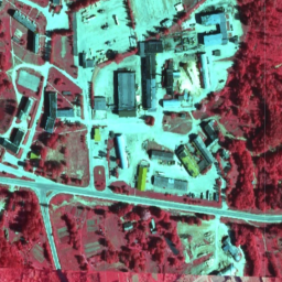
In Latvia, orthophoto maps are prepared in the Latvian coordinate system LKS-92 TM according to the TKS-93 map sheet division (scale 1:10000 map sheet corresponds to 5 x 5 kilometers in nature). Orthophoto maps are prepared for the whole territory of Latvia at the scale … latvia nrg orthophotos -
Latvia RGB orthophotos
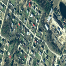
In Latvia, orthophoto maps are prepared in the Latvian coordinate system LKS-92 TM according to the TKS-93 map sheet division (scale 1:10000 map sheet corresponds to 5 x 5 kilometers in nature). Orthophoto maps are prepared for the whole territory of Latvia at the scale … latvia orthophotos rgb