-
Google 스트리트 뷰 공기질: 캘리포니아의 고해상도 대기오염 지도

이 대규모 벡터 데이터 세트에는 2015년 6월부터 2019년 6월까지 캘리포니아의 NO, NO2, O3, CH4, CO2, BC, PN2.5, UFP 농도의 고해상도 대기 오염 매핑이 포함되어 있습니다. 데이터 세트는 Aclima가 장착된 Google 스트리트 뷰 차량 4대를 사용하여 수집된 측정값으로 구성됩니다. air-quality atmosphere nitrogen-dioxide pollution table -
Sentinel-5P NRTI NO2: 준실시간 이산화질소

NRTI/L3_NO2 이 데이터 세트는 NO2 농도의 거의 실시간 고해상도 이미지를 제공합니다. 질소 산화물 (NO2 및 NO)은 대류권과 성층권 모두에 존재하는 지구 대기의 중요한 미량 기체입니다. 이러한 물질은 인위적 활동 (특히 화석 연료 … air-quality atmosphere copernicus esa eu knmi -
Sentinel-5P OFFL NO2: 오프라인 이산화질소

OFFL/L3_NO2 이 데이터 세트는 NO2 농도의 오프라인 고해상도 이미지를 제공합니다. 질소 산화물 (NO2 및 NO)은 대류권과 성층권 모두에 존재하는 지구 대기의 중요한 미량 기체입니다. 이러한 물질은 인위적 활동 (특히 화석 연료 연소 … air-quality atmosphere copernicus esa eu knmi -
TEMPO 격자화된 NO2 (QA 필터링됨) 대류권 및 성층권 기둥 V03
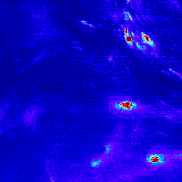
이산화질소 레벨 3 파일은 명목상 TEMPO 관측을 위한 TEMPO 관심 분야를 포함하는 정규 그리드에 대한 미량 기체 정보를 제공합니다. 레벨 3 파일은 TEMPO 동서 스캔 주기를 구성하는 모든 레벨 2 파일의 정보를 결합하여 파생됩니다. 래스터에는 다음이 포함됩니다. air-quality nasa nitrogen-dioxide pollution satellite-imagery tropomi -
TEMPO 격자화된 NO2 대류권 및 성층권 기둥 V03

이산화질소 레벨 3 파일은 명목상 TEMPO 관측을 위한 TEMPO 관심 분야를 포함하는 정규 그리드에 대한 미량 기체 정보를 제공합니다. 레벨 3 파일은 TEMPO 동서 스캔 주기를 구성하는 모든 레벨 2 파일의 정보를 결합하여 파생됩니다. 래스터에는 다음이 포함됩니다. air-quality nasa nitrogen-dioxide pollution satellite-imagery tropomi
Datasets tagged nitrogen-dioxide in Earth Engine
[null,null,[],[],[]]