-
GRIDMET 가뭄: 미국 본토 가뭄 지수

이 데이터 세트에는 4km 일일 격자형 지표면 기상 (GRIDMET) 데이터 세트에서 파생된 가뭄 지수가 포함되어 있습니다. 제공되는 가뭄 지수에는 표준화된 강수 지수 (SPI), 증발 가뭄 수요 지수 (EDDI), 표준화된 강수 증발 지수 (SPEI), 파머 가뭄 심각도 지수 (PDSI), 파머 … 기후 conus 농작물 가뭄 증발산량 지구물리학 -
SPEIbase: 표준화된 강수-증발산량 지수 데이터베이스, 버전 2.10
글로벌 SPEI 데이터베이스 (SPEIbase)는 0.5도 픽셀 크기와 월별 주기로 전 세계 가뭄 상태에 관한 장기적이고 강력한 정보를 제공합니다. 1~48개월의 SPEI 시간 척도를 제공합니다. 표준화된 강수-증발산 지수 (SPEI)는 표준화된 변수로 … 날씨 기후 변화 가뭄 증발산 전역 월별 -
TerraClimate: 전 세계 지표면의 월별 기후 및 기후 물 균형, 아이다호 대학교

TerraClimate는 전 세계 지표면의 월별 기후 및 기후 수분 균형 데이터 세트입니다. 기후 지원 보간법을 사용하여 WorldClim 데이터 세트의 높은 공간 해상도 기후학적 표준과 CRU Ts4.0 및 일본 55년 재분석 (JRA55)의 더 낮은 공간 해상도지만 시간 변동 데이터를 결합합니다. … 기후 가뭄 증발산량 지구물리학 전역 머시드
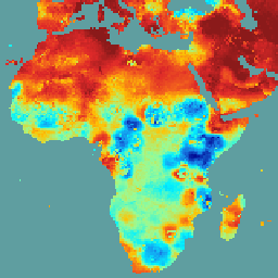
Datasets tagged palmer in Earth Engine
[null,null,[],[],["The datasets provide drought condition information. SPEIbase offers global drought data with a 0.5-degree resolution and monthly updates, using the Standardized Precipitation-Evapotranspiration Index (SPEI) across 1 to 48-month time scales. GRIDMET DROUGHT provides drought indices like SPI, EDDI, SPEI, and PDSI from 4-km daily Gridded Surface Meteorological data. TerraClimate offers monthly climate and water balance data for global surfaces by interpolating WorldClim, CRU Ts4.0, and JRA55 datasets.\n"]]