-
GRIDMET DROUGHT: CONUS 가뭄 지수
이 데이터 세트에는 4km 일일 그리드 표면 기상 (GRIDMET) 데이터 세트에서 파생된 가뭄 지수가 포함되어 있습니다. 제공되는 가뭄 지수에는 표준화된 강수 지수(SPI), 증발 가뭄 수요 지수(EDDI), 표준화된 강수 증발 지수(SPEI), 파머 가뭄 심각도 지수(PDSI), 파머 가뭄 지수(SPI)가 포함됩니다. 기후 conus 작물 가뭄 증발산 지구물리학 -
GRIDMET: 아이다호 대학교 그리드 표면 기상학 데이터 세트
그리드형 지표 기상 데이터 세트는 1979년부터 미국 본토 전역의 기온, 강수량, 풍속, 습도, 방사량에 대한 높은 공간 해상도 (~4km)의 일일 지표 필드를 제공합니다. 이 데이터 세트는 PRISM의 고해상도 공간 데이터와 … climate gridmet humidity merced metdata precipitation -
TerraClimate: 전 세계 지표면의 월별 기후 및 기후수분 균형, 아이다호 대학교
TerraClimate는 전 세계 지표면의 월별 기후 및 기후수분 균형 데이터 세트입니다. WorldClim 데이터 세트의 높은 공간 해상도의 기후학적 표준을 더 낮은 공간 해상도이지만 시간에 따라 변하는 CRU Ts4.0 및 일본 55년 재분석 (JRA55) 데이터와 결합하는 기후 보조 보간을 사용합니다. … 기후 가뭄 증발산 지구물리학 전 세계 메르세드
Datasets tagged merced in Earth Engine
[null,null,[],[[["\u003cp\u003eThe GRIDMET DROUGHT dataset offers various drought indices like SPI, EDDI, SPEI, and PDSI derived from the 4-km daily Gridded Surface Meteorological (GRIDMET) dataset for the contiguous US.\u003c/p\u003e\n"],["\u003cp\u003eThe GRIDMET dataset provides daily surface fields of temperature, precipitation, winds, humidity, and radiation across the contiguous United States from 1979 at ~4-km resolution.\u003c/p\u003e\n"],["\u003cp\u003eTerraClimate offers monthly climate and climatic water balance data for global terrestrial surfaces, combining high-spatial resolution with time-varying data.\u003c/p\u003e\n"]]],[],null,["# Datasets tagged merced in Earth Engine\n\n-\n\n |---------------------------------------------------------------------------------------------------------------------------------------------------------------------------------------------------------------------------------------------------------------------------------------------------------------------------------------------------------------------------|\n | [### GRIDMET DROUGHT: CONUS Drought Indices](/earth-engine/datasets/catalog/GRIDMET_DROUGHT) |\n | This dataset contains drought indices derived from the 4-km daily Gridded Surface Meteorological (GRIDMET) dataset. The drought indices provided include the standardized precipitation index (SPI), the evaporative drought demand index (EDDI), the standardized precipitation evapotranspiration index (SPEI), the Palmer Drought Severity Index (PDSI) and Palmer ... |\n | [climate](/earth-engine/datasets/tags/climate) [conus](/earth-engine/datasets/tags/conus) [crop](/earth-engine/datasets/tags/crop) [drought](/earth-engine/datasets/tags/drought) [evapotranspiration](/earth-engine/datasets/tags/evapotranspiration) [geophysical](/earth-engine/datasets/tags/geophysical) |\n\n-\n\n |------------------------------------------------------------------------------------------------------------------------------------------------------------------------------------------------------------------------------------------------------------------------------------------------------------------------------------------|\n | [### GRIDMET: University of Idaho Gridded Surface Meteorological Dataset
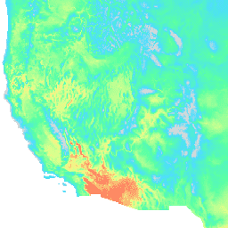
](/earth-engine/datasets/catalog/IDAHO_EPSCOR_GRIDMET) |\n | The Gridded Surface Meteorological dataset provides high spatial resolution (\\~4-km) daily surface fields of temperature, precipitation, winds, humidity and radiation across the contiguous United States from 1979. The dataset blends the high resolution spatial data from PRISM with the high temporal resolution data from the ... |\n | [climate](/earth-engine/datasets/tags/climate) [gridmet](/earth-engine/datasets/tags/gridmet) [humidity](/earth-engine/datasets/tags/humidity) [merced](/earth-engine/datasets/tags/merced) [metdata](/earth-engine/datasets/tags/metdata) [precipitation](/earth-engine/datasets/tags/precipitation) |\n\n-\n\n |----------------------------------------------------------------------------------------------------------------------------------------------------------------------------------------------------------------------------------------------------------------------------------------------------------------------------------------------------------------|\n | [### TerraClimate: Monthly Climate and Climatic Water Balance for Global Terrestrial Surfaces, University of Idaho](/earth-engine/datasets/catalog/IDAHO_EPSCOR_TERRACLIMATE) |\n | TerraClimate is a dataset of monthly climate and climatic water balance for global terrestrial surfaces. It uses climatically aided interpolation, combining high-spatial resolution climatological normals from the WorldClim dataset, with coarser spatial resolution, but time-varying data from CRU Ts4.0 and the Japanese 55-year Reanalysis (JRA55). ... |\n | [climate](/earth-engine/datasets/tags/climate) [drought](/earth-engine/datasets/tags/drought) [evapotranspiration](/earth-engine/datasets/tags/evapotranspiration) [geophysical](/earth-engine/datasets/tags/geophysical) [global](/earth-engine/datasets/tags/global) [merced](/earth-engine/datasets/tags/merced) |"]]