Page Summary
-
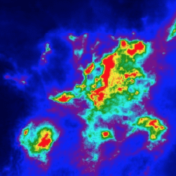
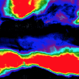
Several datasets provide high-resolution imagery and data on various atmospheric components and pollutants, including aerosol optical thickness, UV aerosol index and layer height, and concentrations of carbon monoxide, formaldehyde, nitrogen dioxide, ozone, and sulfur dioxide.
-
These datasets originate from different sources such as Google Street View, NOAA, and Copernicus Sentinel-5P missions.
-
Data types include both near real-time and offline measurements, available at varying resolutions and coverages, including specific regions like California and global oceans.
-
The datasets are tagged with relevant keywords such as air-quality, atmosphere, aerosol, pollution, and specific chemical compounds.
-
Some datasets provide trace gas information on a regular grid derived from satellite observations, such as TEMPO data from NASA.
-
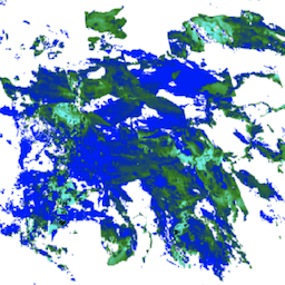
Google Street View Air Quality: High Resolution Air Pollution Mapping in California
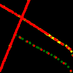
This large vector dataset contains high resolution air pollution mapping of NO, NO2, O3, CH4, CO2, BC, PN2.5, and UFP concentrations in California between June 2015 and June 2019. The dataset consists of measurements collected using four Google Street View vehicles equipped with the Aclima … air-quality atmosphere nitrogen-dioxide pollution table -
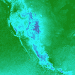
NOAA CDR AVHRR AOT: Daily Aerosol Optical Thickness Over Global Oceans, v04
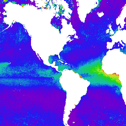
The NOAA Climate Data Record (CDR) of Aerosol Optical Thickness (AOT) is a collection of global daily 0.1 degree derived data from the PATMOS-x AVHRR level-2b channel 1 (0.63 micron) orbital clear-sky radiance. The aerosol product is generated from AVHRR imagery in cloud-free conditions during … aerosol atmosphere atmospheric avhrr cdr daily -
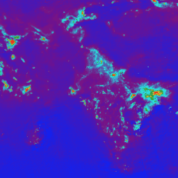
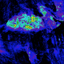
Sentinel-5P NRTI AER AI: Near Real-Time UV Aerosol Index
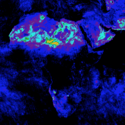
NRTI/L3_AER_AI This dataset provides near real-time high-resolution imagery of the UV Aerosol Index (UVAI), also called the Absorbing Aerosol Index (AAI). The AAI is based on wavelength-dependent changes in Rayleigh scattering in the UV spectral range for a pair of wavelengths. The difference between observed … aai aerosol air-quality atmosphere copernicus esa -
Sentinel-5P NRTI AER LH: Near Real-Time UV Aerosol Layer Height
NRTI/L3_AER_LH This dataset provides offline high-resolution imagery of the UV Aerosol Index (UVAI), also called the Absorbing Layer Height (ALH). The ALH is very sensitive to cloud contamination. However, aerosols and clouds can be difficult to distinguish, and ALH is computed for all FRESCO effective … aerosol air-quality alh atmosphere copernicus esa -
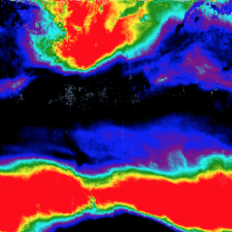
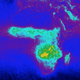
Sentinel-5P NRTI CO: Near Real-Time Carbon Monoxide
NRTI/L3_CO This dataset provides near real-time high-resolution imagery of CO concentrations. Carbon monoxide (CO) is an important atmospheric trace gas for understanding tropospheric chemistry. In certain urban areas, it is a major atmospheric pollutant. Main sources of CO are combustion of fossil fuels, biomass burning, … air-quality atmosphere carbon-monoxide copernicus esa eu -
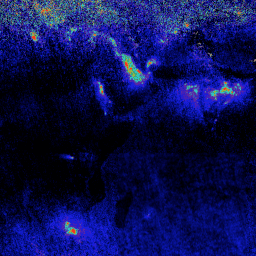
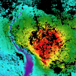
Sentinel-5P NRTI HCHO: Near Real-Time Formaldehyde

NRTI/L3_HCHO This dataset provides near real-time high-resolution imagery of atmospheric formaldehyde (HCHO) concentrations. Formaldehyde is an intermediate gas in almost all oxidation chains of non-methane volatile organic compounds (NMVOC), leading eventually to CO2. Non-Methane Volatile Organic Compounds (NMVOCs) are, together with NOx, CO and CH4, … air-quality atmosphere bira copernicus dlr esa -
Sentinel-5P NRTI NO2: Near Real-Time Nitrogen Dioxide
NRTI/L3_NO2 This dataset provides near real-time high-resolution imagery of NO2 concentrations. Nitrogen oxides (NO2 and NO) are important trace gases in the Earth's atmosphere, present in both the troposphere and the stratosphere. They enter the atmosphere as a result of anthropogenic activities (notably fossil fuel … air-quality atmosphere copernicus esa eu knmi -
Sentinel-5P NRTI O3: Near Real-Time Ozone
NRTI/L3_O3 This dataset provides near-real-time high-resolution imagery of total column ozone concentrations. See also COPERNICUS/S5P/OFFL/L3_O3_TCL for the tropospheric column data. In the stratosphere, the ozone layer shields the biosphere from dangerous solar ultraviolet radiation. In the troposphere, it acts as an efficient cleansing agent, but … air-quality atmosphere copernicus esa eu o3 -
Sentinel-5P NRTI SO2: Near Real-Time Sulfur Dioxide
NRTI/L3_SO2 This dataset provides near real-time high-resolution imagery of atmospheric sulfur dioxide (SO2) concentrations. Sulfur dioxide (SO2) enters the Earth's atmosphere through both natural and anthropogenic processes. It plays a role in chemistry on a local and global scale and its impact ranges from short-term … air-quality atmosphere bira copernicus dlr esa -
Sentinel-5P OFFL AER AI: Offline UV Aerosol Index
OFFL/L3_AER_AI This dataset provides offline high-resolution imagery of the UV Aerosol Index (UVAI), also called the Absorbing Aerosol Index (AAI). The AAI is based on wavelength-dependent changes in Rayleigh scattering in the UV spectral range for a pair of wavelengths. The difference between observed and … aai aerosol air-quality atmosphere copernicus esa -
Sentinel-5P OFFL AER LH: Offline UV Aerosol Layer Height
OFFL/L3_AER_LH This dataset provides offline high-resolution imagery of the UV Aerosol Index (UVAI), also called the Absorbing Layer Height (ALH). The ALH is very sensitive to cloud contamination. However, aerosols and clouds can be difficult to distinguish, and ALH is computed for all FRESCO effective … aerosol air-quality alh atmosphere copernicus esa -
Sentinel-5P OFFL CO: Offline Carbon Monoxide
OFFL/L3_CO This dataset provides offline high-resolution imagery of CO concentrations. Carbon monoxide (CO) is an important atmospheric trace gas for understanding tropospheric chemistry. In certain urban areas, it is a major atmospheric pollutant. Main sources of CO are combustion of fossil fuels, biomass burning, and … air-quality atmosphere carbon-monoxide copernicus esa eu -
Sentinel-5P OFFL HCHO: Offline Formaldehyde
OFFL/L3_HCHO This dataset provides offline high-resolution imagery of atmospheric formaldehyde (HCHO) concentrations. Formaldehyde is an intermediate gas in almost all oxidation chains of non-methane volatile organic compounds (NMVOC), leading eventually to CO2. Non-Methane Volatile Organic Compounds (NMVOCs) are, together with NOx, CO and CH4, among … air-quality atmosphere bira copernicus dlr esa -
Sentinel-5P OFFL NO2: Offline Nitrogen Dioxide
OFFL/L3_NO2 This dataset provides offline high-resolution imagery of NO2 concentrations. Nitrogen oxides (NO2 and NO) are important trace gases in the Earth's atmosphere, present in both the troposphere and the stratosphere. They enter the atmosphere as a result of anthropogenic activities (notably fossil fuel combustion … air-quality atmosphere copernicus esa eu knmi -
Sentinel-5P OFFL O3 TCL: Offline Tropospheric Ozone
OFFL/L3_O3_TCL This dataset provides offline tropospheric high-resolution imagery of ozone concentrations between 20N and 20S. See also COPERNICUS/S5P/OFFL/L3_O3 and COPERNICUS/S5P/NRTI/L3_O3 for the total column data. In the stratosphere, the ozone layer shields the biosphere from dangerous solar ultraviolet radiation. In the troposphere, it acts as … air-quality atmosphere copernicus esa eu o3 -
Sentinel-5P OFFL O3: Offline Ozone

OFFL/L3_O3 This dataset provides offline high-resolution imagery of total column ozone concentrations. See also COPERNICUS/S5P/OFFL/L3_O3_TCL for the tropospheric column data. In the stratosphere, the ozone layer shields the biosphere from dangerous solar ultraviolet radiation. In the troposphere, it acts as an efficient cleansing agent, but … air-quality atmosphere copernicus esa eu o3 -
Sentinel-5P OFFL SO2: Offline Sulfur Dioxide
OFFL/L3_SO2 This dataset provides offline high-resolution imagery of atmospheric sulfur dioxide (SO2) concentrations. Sulfur dioxide (SO2) enters the Earth's atmosphere through both natural and anthropogenic processes. It plays a role in chemistry on a local and global scale and its impact ranges from short-term pollution … air-quality atmosphere bira copernicus dlr esa