Слои земного покрова мира Copernicus: Коллекция CGLS-LC100 3 Глобальная земельная служба Коперника (CGLS) выделена в качестве компонента Земельной службы для управления многоцелевым сервисным компонентом, который предоставляет серию биогеофизических продуктов о состоянии и эволюции земной поверхности в глобальном масштабе. Карта динамического растительного покрова на… Коперник ЕЭЗ ЕКА ЕС PROBA-V C1 Top Of Canopy Ежедневный синтез 100 м Проба-В — это спутниковая миссия, которой поручено составить карту растительного покрова и роста растительности. Он был разработан для обеспечения непрерывности работы оптического прибора VGT миссий SPOT-4 и SPOT-5. Датчик собирает данные в трех диапазонах VNIR (видимый и ближний инфракрасный) и одном SWIR (коротковолновом… Многоспектральные спутниковые снимки ЕКА NIR Proba PROBA-V C1 Top Of Canopy Daily Synthesis 333 м Проба-В — это спутниковая миссия, которой поручено составить карту растительного покрова и роста растительности. Он был разработан для обеспечения непрерывности работы оптического прибора VGT миссий SPOT-4 и SPOT-5. Датчик собирает данные в трех диапазонах VNIR (видимый и ближний инфракрасный) и одном SWIR (коротковолновом… Многоспектральные спутниковые снимки ЕКА NIR Proba
Datasets tagged proba in Earth Engine
[null,null,[],[[["\u003cp\u003eThe Copernicus Global Land Service provides bio-geophysical products on the status and evolution of land surface at a global scale, including a dynamic land cover map.\u003c/p\u003e\n"],["\u003cp\u003eThe Proba-V satellite mission maps land cover and vegetation growth, providing continuity for the SPOT missions' VGT instrument.\u003c/p\u003e\n"],["\u003cp\u003eProba-V collects data in three visible and near-infrared (VNIR) bands and one short-wave infrared (SWIR) band, offering daily top-of-canopy synthesis at both 100m and 333m resolutions.\u003c/p\u003e\n"]]],[],null,["# Datasets tagged proba in Earth Engine\n\n-\n\n |-----------------------------------------------------------------------------------------------------------------------------------------------------------------------------------------------------------------------------------------------------------------------------------------------|\n | [### Copernicus Global Land Cover Layers: CGLS-LC100 Collection 3](/earth-engine/datasets/catalog/COPERNICUS_Landcover_100m_Proba-V-C3_Global) |\n | The Copernicus Global Land Service (CGLS) is earmarked as a component of the Land service to operate a multi-purpose service component that provides a series of bio-geophysical products on the status and evolution of land surface at global scale. The Dynamic Land Cover map at ... |\n | [copernicus](/earth-engine/datasets/tags/copernicus) [eea](/earth-engine/datasets/tags/eea) [esa](/earth-engine/datasets/tags/esa) [eu](/earth-engine/datasets/tags/eu) [landcover](/earth-engine/datasets/tags/landcover) [landuse-landcover](/earth-engine/datasets/tags/landuse-landcover) |\n\n-\n\n |-----------------------------------------------------------------------------------------------------------------------------------------------------------------------------------------------------------------------------------------------------------------------------------------------------|\n | [### PROBA-V C1 Top Of Canopy Daily Synthesis 100m](/earth-engine/datasets/catalog/VITO_PROBAV_C1_S1_TOC_100M) |\n | Proba-V is a satellite mission tasked to map land cover and vegetation growth. It was designed to provide continuity for the VGT optical instrument from the SPOT-4 and SPOT-5 missions. The sensor collects data in three VNIR (visible and near-infrared) bands and one SWIR (short-wave ... |\n | [esa](/earth-engine/datasets/tags/esa) [multispectral](/earth-engine/datasets/tags/multispectral) [nir](/earth-engine/datasets/tags/nir) [proba](/earth-engine/datasets/tags/proba) [probav](/earth-engine/datasets/tags/probav) [satellite-imagery](/earth-engine/datasets/tags/satellite-imagery) |\n\n-\n\n |-----------------------------------------------------------------------------------------------------------------------------------------------------------------------------------------------------------------------------------------------------------------------------------------------------|\n | [### PROBA-V C1 Top Of Canopy Daily Synthesis 333m
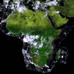
](/earth-engine/datasets/catalog/VITO_PROBAV_C1_S1_TOC_333M) |\n | Proba-V is a satellite mission tasked to map land cover and vegetation growth. It was designed to provide continuity for the VGT optical instrument from the SPOT-4 and SPOT-5 missions. The sensor collects data in three VNIR (visible and near-infrared) bands and one SWIR (short-wave ... |\n | [esa](/earth-engine/datasets/tags/esa) [multispectral](/earth-engine/datasets/tags/multispectral) [nir](/earth-engine/datasets/tags/nir) [proba](/earth-engine/datasets/tags/proba) [probav](/earth-engine/datasets/tags/probav) [satellite-imagery](/earth-engine/datasets/tags/satellite-imagery) |"]]