Page Summary
-
OpenLandMap provides global sand content data at 6 standard depths and 250m resolution, based on machine learning predictions.
-
iSDAsoil offers sand content data for Africa at two soil depths (0-20 cm and 20-50 cm), including predicted mean and standard deviation, with potential banding artifacts in dense jungle areas.
-
OpenLandMap Sand Content
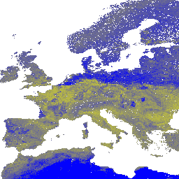
Sand content in % (kg / kg) at 6 standard depths (0, 10, 30, 60, 100 and 200 cm) at 250 m resolution Based on machine learning predictions from global compilation of soil profiles and samples. Processing steps are described in detail here. Antarctica is … envirometrix opengeohub openlandmap sand soil usda -
iSDAsoil Sand Content
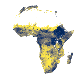
Sand content at soil depths of 0-20 cm and 20-50 cm,\npredicted mean and standard deviation. In areas of dense jungle (generally over central Africa), model accuracy is low and therefore artifacts such as banding (striping) might be seen. Soil property predictions were made by Innovative … africa isda sand soil