-
SPL3SMP_E.005 SMAP L3 Radiometer Global Daily 9 km Soil Moisture
2023년 12월 4일부터의 데이터는 NASA/SMAP/SPL3SMP_E/006 컬렉션에서 확인할 수 있습니다. 이 레벨 3 (L3) 토양 수분 제품은 토양 수분 능동 수동 (SMAP) L-밴드 방사계로 검색된 전 세계 지표면 조건의 일일 합성물을 제공합니다. 여기에서 일일 데이터는 내림차순 (로컬 … drought nasa smap soil soil-moisture surface -
SPL3SMP_E.006 SMAP L3 Radiometer Global Daily 9 km Soil Moisture

2023년 12월 4일 이전 데이터는 이전 NASA/SMAP/SPL3SMP_E/005 컬렉션에서 확인할 수 있습니다. 결국 다시 처리되어 이 컬렉션에 추가됩니다. 이 레벨 3 (L3) 토양 수분 제품은 토양 수분 능동 수동 (SMAP) L-밴드 … drought nasa smap soil soil-moisture surface -
SPL4SMGP.008 SMAP L4 전역 3시간 간격 9km 표면 및 근권 토양 수분

SMAP 레벨 4 (L4) 토양 수분 제품에는 표면 토양 수분 (0~5cm 수직 평균), 뿌리 영역 토양 수분 (0~100cm 수직 평균), 표면 기상 강제 변수, 토양 온도, 증발산량, 순복사 등 추가 연구 제품 (검증되지 않음)이 포함됩니다. 이 데이터 세트는 공식적으로 … drought nasa smap soil soil-moisture surface
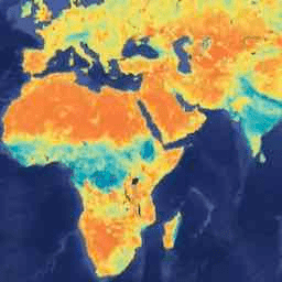
Datasets tagged smap in Earth Engine
[null,null,[],[],[]]