-
HUC02:USGS 区域流域边界数据集

流域边界数据集 (WBD) 是水文单元 (HU) 数据的综合汇总集合,符合国家划界和分辨率标准。它定义了地表水排泄到某个点的面积范围,但在沿海或湖滨地区除外,因为这些地区… 水文 地表-地下-水位 USGS 水 流域 水文 -
HUC04:USGS 子区域流域边界数据集
流域边界数据集 (WBD) 是水文单元 (HU) 数据的综合汇总集合,符合国家划界和分辨率标准。它定义了地表水排泄到某个点的面积范围,但在沿海或湖滨地区除外,因为这些地区… 水文 地表-地下-水位 USGS 水 流域 水文 -
HUC06:USGS 流域边界数据集

流域边界数据集 (WBD) 是水文单元 (HU) 数据的综合汇总集合,符合国家划界和分辨率标准。它定义了地表水排泄到某个点的面积范围,但在沿海或湖滨地区除外,因为这些地区… 水文 地表-地下-水位 USGS 水 流域 水文 -
HUC08:USGS 子流域边界数据集

流域边界数据集 (WBD) 是水文单元 (HU) 数据的综合汇总集合,符合国家划界和分辨率标准。它定义了地表水排泄到某个点的面积范围,但在沿海或湖滨地区除外,因为这些地区… 水文 地表-地下-水位 USGS 水 流域 水文 -
HUC10:USGS 流域边界数据集

流域边界数据集 (WBD) 是水文单元 (HU) 数据的综合汇总集合,符合国家划界和分辨率标准。它定义了地表水排泄到某个点的面积范围,但在沿海或湖滨地区除外,因为这些地区… 水文 地表-地下-水位 USGS 水 流域 水文 -
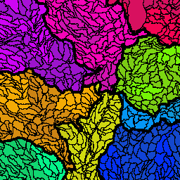
HUC12:USGS 子流域边界数据集

流域边界数据集 (WBD) 是水文单元 (HU) 数据的综合汇总集合,符合国家划界和分辨率标准。它定义了地表水排泄到某个点的面积范围,但在沿海或湖滨地区除外,因为这些地区… 水文 地表-地下-水位 USGS 水 流域 水文
Datasets tagged wbd in Earth Engine
[null,null,[],[],[]]