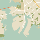
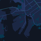
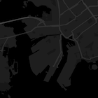
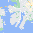
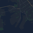
นอกจากจะเปลี่ยนรูปแบบของฟีเจอร์บนแผนที่แล้ว คุณยังซ่อนฟีเจอร์เหล่านั้นทั้งหมดได้ด้วย ตัวอย่างนี้แสดงวิธีซ่อนจุดที่น่าสนใจ (POI) ของธุรกิจ และไอคอนขนส่งสาธารณะบนแผนที่
การจัดรูปแบบจะใช้ได้กับkGMSTypeNormalประเภทแผนที่เท่านั้น
การใช้รูปแบบกับแผนที่
หากต้องการใช้รูปแบบแผนที่ที่กำหนดเองกับแผนที่ ให้เรียกใช้ GMSMapStyle(...) เพื่อสร้างอินสแตนซ์ GMSMapStyle โดยส่ง URL สำหรับไฟล์ JSON ในเครื่อง หรือสตริง JSON ที่มีคำจำกัดความของรูปแบบ กำหนดอินสแตนซ์ GMSMapStyle ให้กับพร็อพเพอร์ตี้
mapStyle ของแผนที่
การใช้ไฟล์ JSON
ตัวอย่างต่อไปนี้แสดงการเรียก GMSMapStyle(...) และการส่ง URL สำหรับ
ไฟล์ในเครื่อง
ตัวอย่างโค้ดต่อไปนี้ถือว่าโปรเจ็กต์ของคุณมีไฟล์ชื่อ
style.json
Swift
import GoogleMaps

class MapStyling: UIViewController {

  // Set the status bar style to complement night-mode.
  override var preferredStatusBarStyle: UIStatusBarStyle {
    return .lightContent
  }

  override func loadView() {
    let camera = GMSCameraPosition.camera(withLatitude: -33.86, longitude: 151.20, zoom: 14.0)
    let mapView = GMSMapView.map(withFrame: CGRect.zero, camera: camera)

    do {
      // Set the map style by passing the URL of the local file.
      if let styleURL = Bundle.main.url(forResource: "style", withExtension: "json") {
        mapView.mapStyle = try GMSMapStyle(contentsOfFileURL: styleURL)
      } else {
        NSLog("Unable to find style.json")
      }
    } catch {
      NSLog("One or more of the map styles failed to load. \(error)")
    }

    self.view = mapView
  }
}
Objective-C
#import "MapStyling.h"
@import GoogleMaps;

@interface MapStyling ()

@end

@implementation MapStyling

// Set the status bar style to complement night-mode.
- (UIStatusBarStyle)preferredStatusBarStyle {
  return UIStatusBarStyleLightContent;
}

- (void)loadView {
  GMSCameraPosition *camera = [GMSCameraPosition cameraWithLatitude:-33.86
                                                          longitude:151.20
                                                               zoom:12];
  GMSMapView *mapView = [GMSMapView mapWithFrame:CGRectZero camera:camera];
  mapView.myLocationEnabled = YES;

  NSBundle *mainBundle = [NSBundle mainBundle];
  NSURL *styleUrl = [mainBundle URLForResource:@"style" withExtension:@"json"];
  NSError *error;

  // Set the map style by passing the URL for style.json.
  GMSMapStyle *style = [GMSMapStyle styleWithContentsOfFileURL:styleUrl error:&error];

  if (!style) {
    NSLog(@"The style definition could not be loaded: %@", error);
  }

  mapView.mapStyle = style;
  self.view = mapView;
}

@end
หากต้องการกำหนดตัวเลือกสไตล์ ให้เพิ่มไฟล์ใหม่ลงในโปรเจ็กต์ชื่อ style.json
แล้ววางการประกาศสไตล์ JSON ต่อไปนี้เพื่อซ่อนจุดที่น่าสนใจ (POI) ของธุรกิจและไอคอนระบบขนส่งสาธารณะ
การใช้ทรัพยากรสตริง
ตัวอย่างต่อไปนี้แสดงการเรียก GMSMapStyle() และการส่งสตริง
ทรัพยากร
Swift
class MapStylingStringResource: UIViewController {

  let MapStyle = "JSON_STYLE_GOES_HERE"

  // Set the status bar style to complement night-mode.
  override var preferredStatusBarStyle: UIStatusBarStyle {
    return .lightContent
  }

  override func loadView() {
    let camera = GMSCameraPosition.camera(withLatitude: -33.86, longitude: 151.20, zoom: 14.0)
    let mapView = GMSMapView.map(withFrame: CGRect.zero, camera: camera)

    do {
      // Set the map style by passing a valid JSON string.
      mapView.mapStyle = try GMSMapStyle(jsonString: MapStyle)
    } catch {
      NSLog("One or more of the map styles failed to load. \(error)")
    }

    self.view = mapView
  }
}
Objective-C
@implementation MapStylingStringResource

// Paste the JSON string to use.
static NSString *const kMapStyle = @"JSON_STYLE_GOES_HERE";

// Set the status bar style to complement night-mode.
- (UIStatusBarStyle)preferredStatusBarStyle {
  return UIStatusBarStyleLightContent;
}

- (void)loadView {
  GMSCameraPosition *camera = [GMSCameraPosition cameraWithLatitude:-33.86
                                                          longitude:151.20
                                                               zoom:12];
  GMSMapView *mapView = [GMSMapView mapWithFrame:CGRectZero camera:camera];
  mapView.myLocationEnabled = YES;

  NSError *error;

  // Set the map style by passing a valid JSON string.
  GMSMapStyle *style = [GMSMapStyle styleWithJSONString:kMapStyle error:&error];

  if (!style) {
    NSLog(@"The style definition could not be loaded: %@", error);
  }

  mapView.mapStyle = style;
  self.view = mapView;
}

@end
การประกาศรูปแบบต่อไปนี้จะซ่อนจุดที่น่าสนใจ (POI) ของธุรกิจและไอคอนระบบขนส่งสาธารณะ
วางสตริงรูปแบบต่อไปนี้เป็นค่าของตัวแปร kMapStyle
การประกาศรูปแบบ JSON
แผนที่ที่มีการจัดรูปแบบใช้แนวคิด 2 อย่างในการใช้สีและการเปลี่ยนแปลงรูปแบบอื่นๆ กับแผนที่
- ตัวเลือกจะระบุองค์ประกอบทางภูมิศาสตร์ที่คุณจัดรูปแบบได้ในแผนที่ ซึ่งรวมถึงถนน สวนสาธารณะ แหล่งน้ำ และ
อื่นๆ รวมถึงป้ายกำกับ ตัวเลือกประกอบด้วยฟีเจอร์
และองค์ประกอบที่ระบุเป็นพร็อพเพอร์ตี้
featureTypeและelementType - Stylers คือพร็อพเพอร์ตี้สีและการมองเห็นที่คุณใช้กับองค์ประกอบของแผนที่ได้ โดยจะกำหนดสีที่แสดงผ่าน การรวมค่าเฉดสี สี และความสว่าง/แกมมา
ดูคำอธิบายโดยละเอียดเกี่ยวกับ ตัวเลือกการจัดรูปแบบ JSON ได้ที่ข้อมูลอ้างอิงสไตล์
วิซาร์ดการจัดรูปแบบ Maps Platform
ใช้วิซาร์ดการจัดรูปแบบ Maps Platform เป็นวิธีที่รวดเร็ว ในการสร้างออบเจ็กต์การจัดรูปแบบ JSON Maps SDK สำหรับ iOS รองรับ การประกาศรูปแบบเดียวกันกับ Maps JavaScript API
ตัวอย่างโค้ดแบบเต็ม
ที่เก็บ ApiDemos ใน GitHub มีตัวอย่างที่แสดงการใช้การจัดรูปแบบ


