Sie möchten erweiterte Funktionen für Ihre Karten implementieren? Die Maps SDK for iOS-Dienstprogrammbibliothek auf GitHub ist eine Open-Source-Bibliothek mit Klassen, die für eine Reihe von Anwendungen nützlich sind. Das GitHub-Repository enthält die Dienstprogrammklassen und eine Demoanwendung, in der die Verwendung der einzelnen Klassen veranschaulicht wird.
Die Dienstprogramme
Markierungscluster
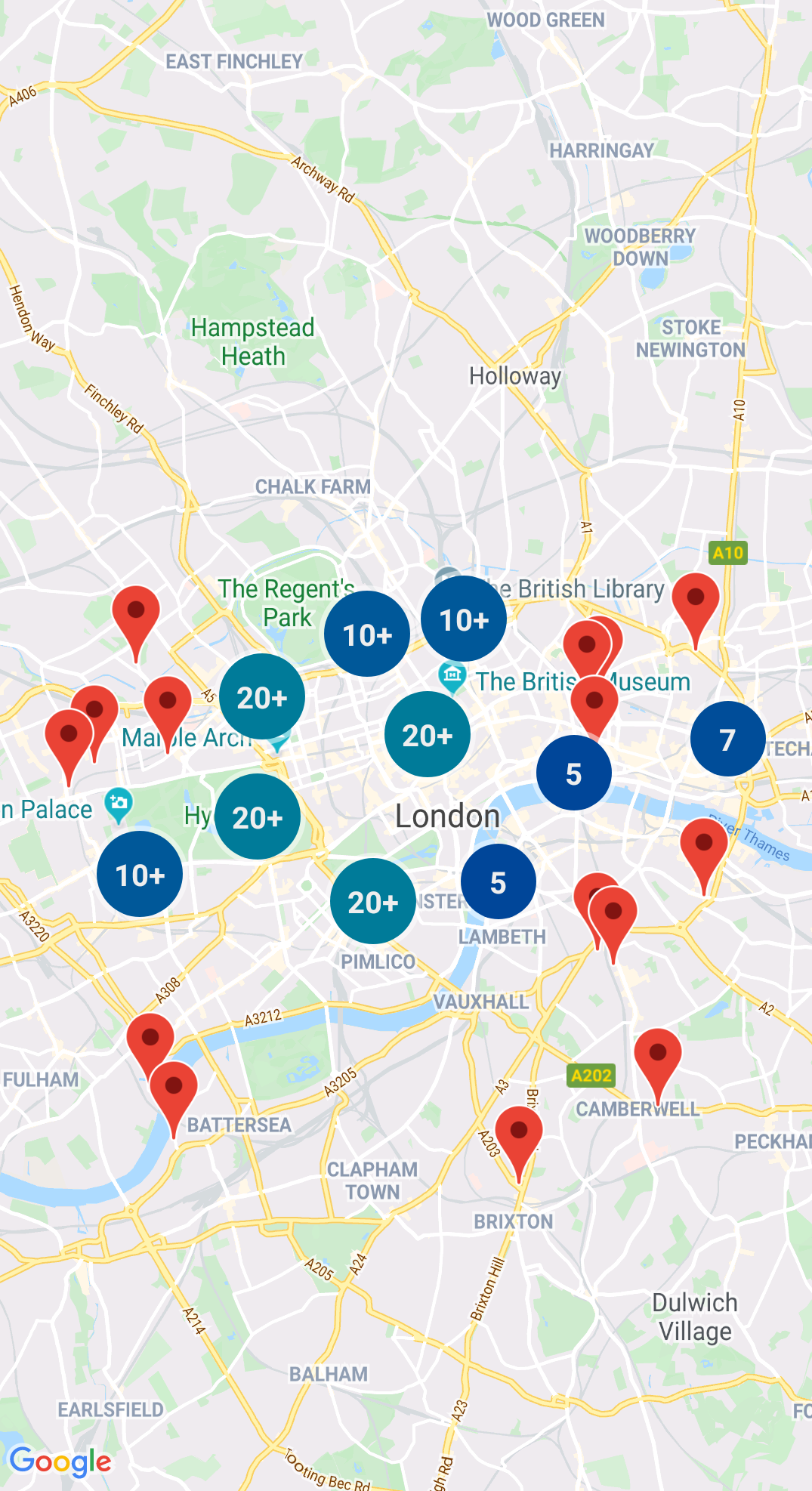
Mit GMUClusterManager können Sie mehrere Markierungen bei verschiedenen Zoomfaktoren verwalten. Sie können also eine große Anzahl Markierungen auf einer Karte einfügen, ohne die Lesbarkeit der Karte zu beeinträchtigen. Wenn ein Nutzer die Karte mit einer hohen Zoomstufe ansieht, werden die einzelnen Markierungen auf der Karte angezeigt. Zoomt der Nutzer heraus, werden die Markierungen zu Clustern zusammengefügt, um die Lesbarkeit der Karte zu verbessern.
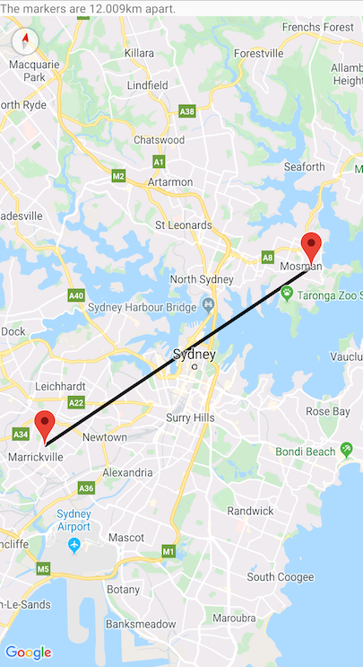
Ein Quadtree ist eine Datenstruktur, die nützlich ist, um Punkte in der Nähe eines einzelnen Punkts zu finden, indem innerhalb eines Bereichs um den POI herum gesucht wird.
KML ist ein beliebtes Format zum Rendern geografischer Daten wie Punkte, Linien und Polygone. Mit GMUKMLParser können Sie geografische Daten im KML-Format parsen und rendern.
Sie können Elemente im GeoJSON speichern und sie mit diesem Dienstprogramm als Ebene über einer Karte rendern.
Rendern Sie geografische Daten im GeoJSON-Format mit GMUGeoJSONParser in Verbindung mit GMUGeometryRenderer.
Weitere Informationen finden Sie in der Dokumentation zu GeoJSON.
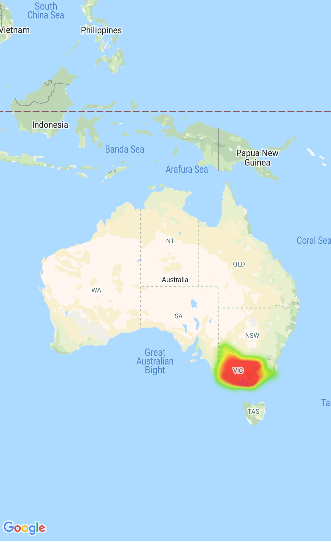
Heatmaps
Mit Heatmaps ist es einfacher, die Verteilung und relative Intensität von Datenpunkten auf einer Karte zu erkennen. Statt eine Markierung an jedem Standort zu platzieren, werden bei Heatmaps Farben und Formen verwendet, um die Verteilung von Daten darzustellen.
Weitere Informationen finden Sie in der Dokumentation zu Heatmaps.
Benutzerdefinierte Markierungen
Mit dem Delegaten GMUClusterRendererDelegate für GMUDefaultClusterRenderer können Sie die Eigenschaften einer Markierung vor und nach dem Hinzufügen zur Karte anpassen.
Geometrie-Dienstprogramme
Eine Reihe von Swift-Dienstfunktionen für sphärische Geometrie des Moduls GMSGeometryUtils des Maps SDK for iOS. Mit diesen Erweiterungen können Sie viele Arten von geometrischen Operationen ausführen, darunter:
Den Großkreisabstand zwischen den Koordinaten bestimmen
Bestimmen, ob sich eine Koordinate innerhalb eines Polygons befindet
Bestimmen, ob eine Koordinate innerhalb einer angegebenen Toleranz auf oder in der Nähe eines Pfades liegt
[null,null,["Zuletzt aktualisiert: 2025-07-26 (UTC)."],[[["\u003cp\u003eThe Maps SDK for iOS Utility Library is an open-source library providing advanced features for your maps.\u003c/p\u003e\n"],["\u003cp\u003eThis library offers utilities for marker clustering, quadtrees, KML parsing, GeoJSON rendering, heatmaps, custom markers, and geometry operations.\u003c/p\u003e\n"],["\u003cp\u003eThe library includes a demo app demonstrating the use of each class.\u003c/p\u003e\n"],["\u003cp\u003eAccess the Maps SDK for iOS Utility Library and its documentation on GitHub.\u003c/p\u003e\n"]]],["The Maps SDK for iOS Utility Library offers tools for enhancing maps, including marker clustering via `GMUClusterManager` for managing numerous markers at different zoom levels. It also supports quadtrees for proximity searches, KML and GeoJSON format parsing for rendering geographic data, and heatmaps for visualizing data density. The library allows custom marker properties through `GMUClusterRendererDelegate` and provides geometry utilities (`GMSGeometryUtils`) for tasks like distance calculation and polygon analysis.\n"],null,["Select platform: [Android](/maps/documentation/android-sdk/utility \"View this page for the Android platform docs.\") [iOS](/maps/documentation/ios-sdk/utility \"View this page for the iOS platform docs.\")\n\nLooking for advanced features to add to your maps? The\n[Maps SDK for iOS\nUtility Library](https://github.com/googlemaps/google-maps-ios-utils) on GitHub is an open-source library of classes that are\nuseful for a range of applications. The GitHub repository includes the utility\nclasses and a demo app that illustrates the use of each class.\n\nThe utilities\n\n|----------------------------|----------------------------------------------------------------------------------------------------------------------------------------------------------------------------------------------------------------------------------------------------------------------------------------------------------------------------------------------------------------------------------------------------------------------------------------------------------------------------------------------------------------------------------------------|\n| | Marker Clustering The `GMUClusterManager` helps you manage multiple markers at different zoom levels. This means you can put a large number of markers on a map without making the map hard to read. When a user views the map at a high zoom level, the individual markers show on the map. When the user zooms out to a lower zoom level, the markers gather together into clusters, to make viewing the map easier. For details, see the documentation on the [Marker Clustering](/maps/documentation/ios-sdk/utility/marker-clustering). |\n| No image for this utility. | Quadtree A quadtree is a data structure that's useful for finding points near a single point, by searching inside an area surrounding the point of interest. For details, see the documentation on the [Quadtree](/maps/documentation/ios-sdk/utility/quadtree). |\n| | KML KML is a popular format for rendering geographic data such as points, lines, and polygons. The `GMUKMLParser` lets you parse and render geographic data in the KML format. For details, see the documentation on the [KML](/maps/documentation/ios-sdk/utility/kml). |\n| | Import GeoJSON onto your map You can store features in [GeoJSON](http://geojson.org/) format and use this utility to render them as a layer on top of a map. Render geographic data in the GeoJSON format using `GMUGeoJSONParser` in conjunction with `GMUGeometryRenderer`. For details, see the documentation on the [GeoJSON](/maps/documentation/ios-sdk/utility/geojson). |\n| | Heatmaps Heatmaps make it easy for viewers to understand the distribution and relative intensity of data points on a map. Rather than placing a marker at each location, heatmaps use color and shape to represent the distribution of data. For details, see the documentation on the [Heatmaps](/maps/documentation/ios-sdk/utility/heatmap). |\n| | Custom markers Use the delegate [`GMUClusterRendererDelegate`](https://github.com/googlemaps/google-maps-ios-utils/blob/master/src/Clustering/View/GMUDefaultClusterRenderer.h) on `GMUDefaultClusterRenderer` to customize the properties of a marker before and after it is added to the map. |\n| | Geometry utilities A set of Swift spherical geometry utility functions of the [`GMSGeometryUtils`](/maps/documentation/ios-sdk/reference/objc/Functions) module of the Maps SDK for iOS. Use these extensions to perform many types of geometric operations, including: - Determine the great circle distance between coordinates - Determine if a coordinate is inside a polygon - Determine if a coordinate lies on or near a path within a specified tolerance - Determine the area of this polygon - many others |"]]