Cerchi funzionalità avanzate da aggiungere alle tue mappe? La libreria di utilità di Maps SDK for iOS su GitHub è una libreria open source di classi utili per una serie di applicazioni. Il repository GitHub include le classi di utilità e un'app demo che illustra l'utilizzo di ogni classe.
Le utilità
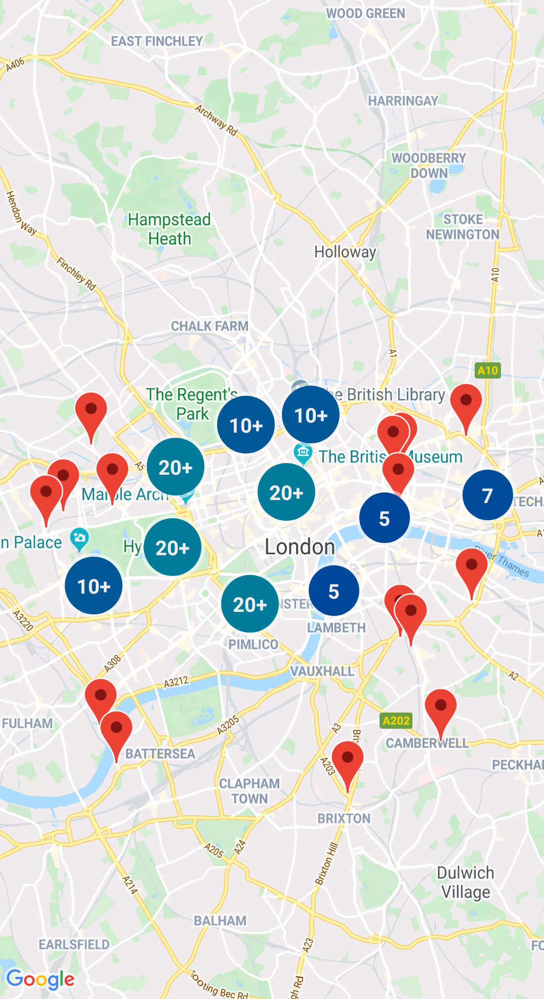
Clustering degli indicatori
GMUClusterManager consente di gestire più indicatori a diversi livelli di zoom. Ciò significa che puoi posizionare un gran numero di indicatori
sulla mappa senza renderla difficile da leggere. Quando un utente visualizza la mappa a un livello di zoom elevato, i singoli indicatori vengono visualizzati sulla mappa. Quando l'utente riduce lo zoom a un livello di zoom inferiore, gli indicatori vengono raggruppati in cluster, per facilitare la visualizzazione della mappa.
Un quadrato è una struttura di dati utile per trovare punti vicini a un singolo punto, eseguendo ricerche all'interno di un'area circostante il punto d'interesse.
Per maggiori dettagli, consulta la documentazione su Quadtree.
KML
Il formato KML è un formato molto utilizzato per il rendering di dati geografici, come punti, linee e poligoni. GMUKMLParser consente di analizzare e visualizzare i dati geografici in formato KML.
Per maggiori dettagli, consulta la documentazione relativa al file KML.
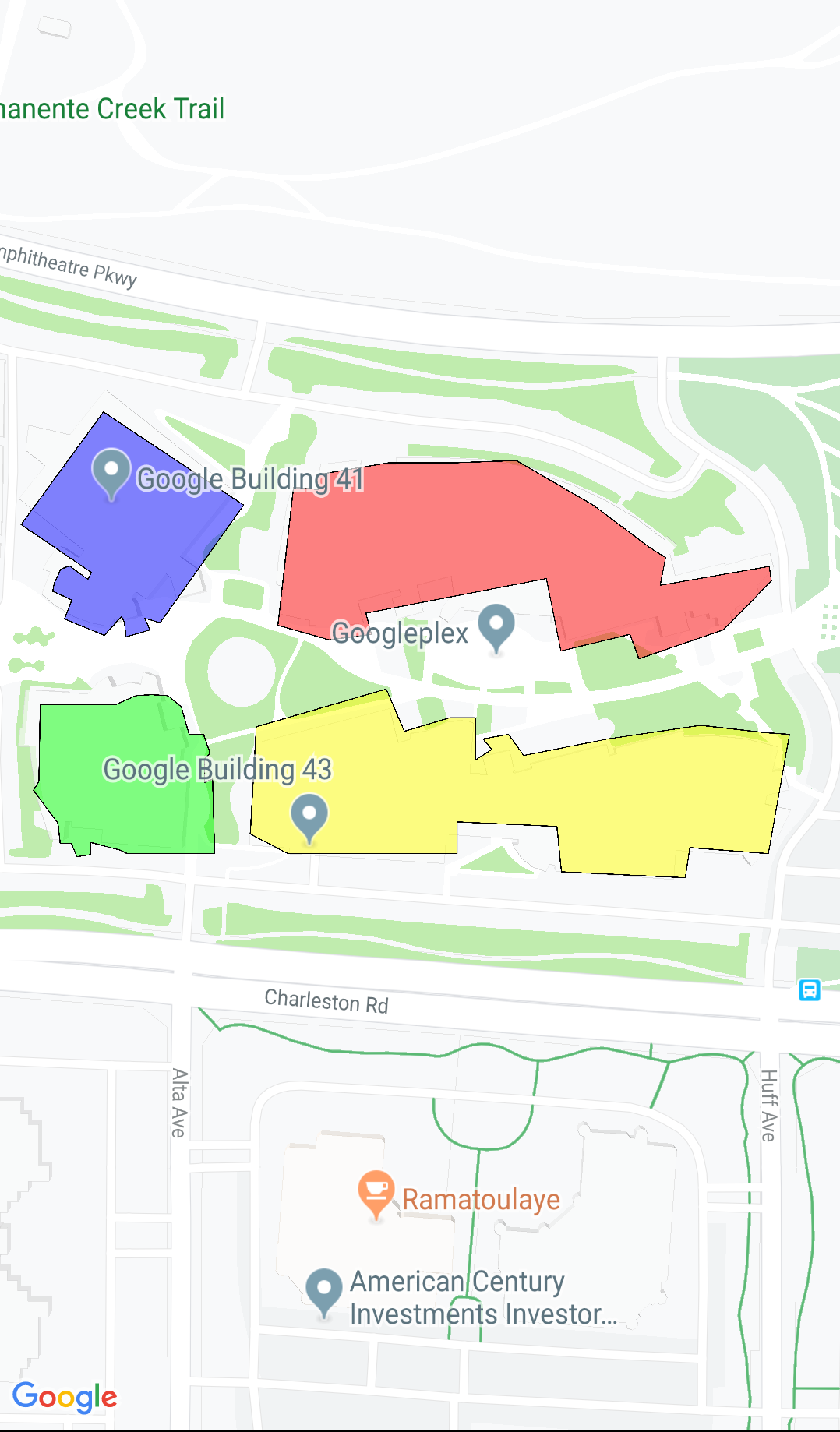
Importa GeoJSON sulla tua mappa
Puoi archiviare gli elementi in formato GeoJSON e utilizzare questa utilità per visualizzarli come un livello sopra una mappa.
Esegui il rendering dei dati geografici in formato GeoJSON utilizzando GMUGeoJSONParser insieme a GMUGeometryRenderer.
Per maggiori dettagli, consulta la documentazione sul file GeoJSON.
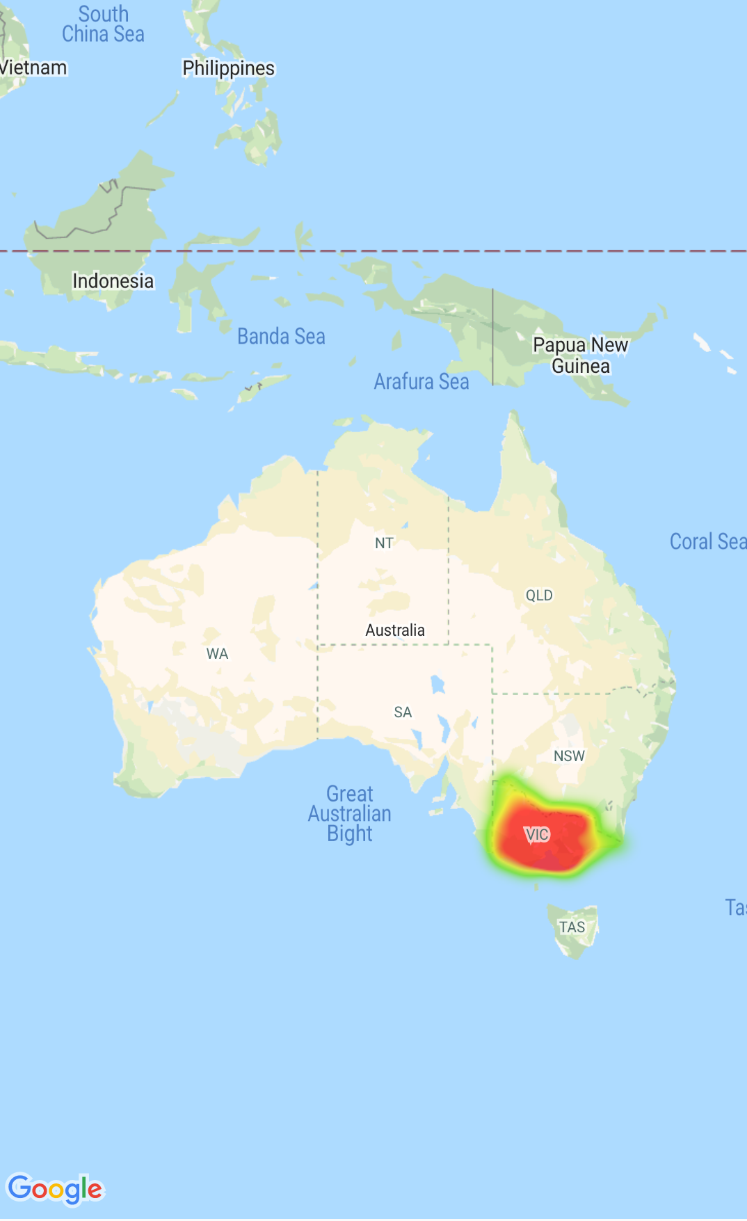
Mappe termiche
Le mappe termiche consentono agli utenti di comprendere facilmente la distribuzione e
l'intensità relativa dei punti dati su una mappa. Anziché posizionare un indicatore in ogni posizione, le mappe termiche utilizzano il colore e la forma per rappresentare la distribuzione dei dati.
Per maggiori dettagli, consulta la documentazione relativa alle mappe termiche.
Indicatori personalizzati
Utilizza il delegato GMUClusterRendererDelegate su GMUDefaultClusterRenderer per personalizzare le proprietà di un indicatore prima e dopo averlo aggiunto alla mappa.
Utilità di geometria
Un insieme di funzioni di utilità per la geometria sferica Swift del modulo
GMSGeometryUtils
dell'SDK Maps per iOS. Utilizza queste estensioni per eseguire molti tipi di operazioni geometriche, tra cui:
Determinare la distanza del cerchio tra le coordinate
Determinare se una coordinata si trova all'interno di un poligono
Stabilire se una coordinata si trova su o vicino a un percorso all'interno di una tolleranza specificata
[null,null,["Ultimo aggiornamento 2025-07-26 UTC."],[[["\u003cp\u003eThe Maps SDK for iOS Utility Library is an open-source library providing advanced features for your maps.\u003c/p\u003e\n"],["\u003cp\u003eThis library offers utilities for marker clustering, quadtrees, KML parsing, GeoJSON rendering, heatmaps, custom markers, and geometry operations.\u003c/p\u003e\n"],["\u003cp\u003eThe library includes a demo app demonstrating the use of each class.\u003c/p\u003e\n"],["\u003cp\u003eAccess the Maps SDK for iOS Utility Library and its documentation on GitHub.\u003c/p\u003e\n"]]],["The Maps SDK for iOS Utility Library offers tools for enhancing maps, including marker clustering via `GMUClusterManager` for managing numerous markers at different zoom levels. It also supports quadtrees for proximity searches, KML and GeoJSON format parsing for rendering geographic data, and heatmaps for visualizing data density. The library allows custom marker properties through `GMUClusterRendererDelegate` and provides geometry utilities (`GMSGeometryUtils`) for tasks like distance calculation and polygon analysis.\n"],null,["Select platform: [Android](/maps/documentation/android-sdk/utility \"View this page for the Android platform docs.\") [iOS](/maps/documentation/ios-sdk/utility \"View this page for the iOS platform docs.\")\n\nLooking for advanced features to add to your maps? The\n[Maps SDK for iOS\nUtility Library](https://github.com/googlemaps/google-maps-ios-utils) on GitHub is an open-source library of classes that are\nuseful for a range of applications. The GitHub repository includes the utility\nclasses and a demo app that illustrates the use of each class.\n\nThe utilities\n\n|----------------------------|----------------------------------------------------------------------------------------------------------------------------------------------------------------------------------------------------------------------------------------------------------------------------------------------------------------------------------------------------------------------------------------------------------------------------------------------------------------------------------------------------------------------------------------------|\n| | Marker Clustering The `GMUClusterManager` helps you manage multiple markers at different zoom levels. This means you can put a large number of markers on a map without making the map hard to read. When a user views the map at a high zoom level, the individual markers show on the map. When the user zooms out to a lower zoom level, the markers gather together into clusters, to make viewing the map easier. For details, see the documentation on the [Marker Clustering](/maps/documentation/ios-sdk/utility/marker-clustering). |\n| No image for this utility. | Quadtree A quadtree is a data structure that's useful for finding points near a single point, by searching inside an area surrounding the point of interest. For details, see the documentation on the [Quadtree](/maps/documentation/ios-sdk/utility/quadtree). |\n| | KML KML is a popular format for rendering geographic data such as points, lines, and polygons. The `GMUKMLParser` lets you parse and render geographic data in the KML format. For details, see the documentation on the [KML](/maps/documentation/ios-sdk/utility/kml). |\n| | Import GeoJSON onto your map You can store features in [GeoJSON](http://geojson.org/) format and use this utility to render them as a layer on top of a map. Render geographic data in the GeoJSON format using `GMUGeoJSONParser` in conjunction with `GMUGeometryRenderer`. For details, see the documentation on the [GeoJSON](/maps/documentation/ios-sdk/utility/geojson). |\n| | Heatmaps Heatmaps make it easy for viewers to understand the distribution and relative intensity of data points on a map. Rather than placing a marker at each location, heatmaps use color and shape to represent the distribution of data. For details, see the documentation on the [Heatmaps](/maps/documentation/ios-sdk/utility/heatmap). |\n| | Custom markers Use the delegate [`GMUClusterRendererDelegate`](https://github.com/googlemaps/google-maps-ios-utils/blob/master/src/Clustering/View/GMUDefaultClusterRenderer.h) on `GMUDefaultClusterRenderer` to customize the properties of a marker before and after it is added to the map. |\n| | Geometry utilities A set of Swift spherical geometry utility functions of the [`GMSGeometryUtils`](/maps/documentation/ios-sdk/reference/objc/Functions) module of the Maps SDK for iOS. Use these extensions to perform many types of geometric operations, including: - Determine the great circle distance between coordinates - Determine if a coordinate is inside a polygon - Determine if a coordinate lies on or near a path within a specified tolerance - Determine the area of this polygon - many others |"]]