- 数据集可用时间
- 2000-01-01T01:00:00Z–2019-12-31T16:45:00Z
- 数据集生产者
- 德国柏林洪堡大学地理系
- 标签
说明
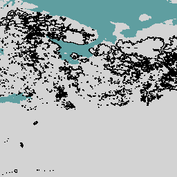
欧洲原始森林数据整合了 48 个不同的原始森林数据集(大多基于实地调查),包含分布在 33 个国家/地区的 18,411 个单独的斑块(4,110 万公顷)。它主要包括原始的晚期演替森林,但也包括一些早期演替阶段和在自然扰动和自然再生后形成的年轻森林,而没有后续管理。
如需了解详情(包括作者及其所属机构的完整列表),请参阅数据集文档。此数据集基于多边形,其中每个多边形都代表一个有边界的原始森林。
表格结构
表格结构
| 名称 | 类型 | 说明 |
|---|---|---|
| BIOGEOGRAP | STRING | 生物地理区域由欧洲环境署定义,可以是以下区域之一:阿尔卑斯、北极、大西洋、黑海、北方、大陆、马卡罗尼西亚、地中海、潘诺尼亚或草原。 |
| CONTACT_PE | STRING | 联系人 |
| DOMINANT_1 | STRING | 上层林冠中优势树种的物种(拉丁名称) |
| DOMINANT_2 | STRING | 上层林冠中第二种主要树种的拉丁名称(如有) |
| DOMINANT_T | STRING | 上层林冠中第三种主要树种的拉丁名称(如有) |
| FOREST_NAM | STRING | 森林地块的名称(如果适用,否则可以是更广阔区域的名称) |
| FOREST_SHA | 双精度 | 假设高自然度等级且面积较大的原始森林可能包含暂时或永久未被森林覆盖的土地,则森林覆盖的多边形实际所占的份额。 |
| FOREST_TYP | INT | 根据欧洲环境署定义的森林类别,基于欧洲潜在植被类型地图的主要森林类型。可能的值:
|
| FOREST_T_1 | INT | 根据欧洲环境署定义的森林类别,基于欧洲潜在植被类型地图的第二种主要森林类型 |
| ID_Dataset | STRING | 数据集的 ID |
| LAST_DISTU | STRING | LAST_DISTURBANCE1_TYPE,上次干扰事件的类型。可能的值:
|
| LAST_DIS_1 | INT | LAST_DISTURBANCE1_YEAR,干扰事件 1 发生的年份 |
| LAST_DIS_2 | INT | LAST_DISTURBANCE1_INTENSITY,干扰事件 1 的强度。可能的值:
|
| LAST_DIS_3 | STRING | LAST_DISTURBANCE2_TYPE,倒数第二个干扰事件的类型 可能的值:
|
| LAST_DIS_4 | INT | LAST_DISTURBANCE2_YEAR,干扰事件 2 发生的年份 |
| LAST_DIS_5 | INT | LAST_DISTURBANCE2_INTENSITY,干扰事件 2 的强度。可能的值:
|
| 位置 | STRING | 主要森林残余物所在的自治市、保护区或地区 |
| NATURALNES | INT | 原生森林残余的自然度:可能的值:
|
| 备注 | STRING | 森林点/多边形的可选其他备注 |
| OBJECTID | STRING | 对象 ID |
| 保护 | INT | 森林地块的法律保护状态,数据源自世界保护区数据库。最初的 IUCN 分类简化为三个类别:
如果我们的数据贡献者提供了更新/更精确的信息,我们会优先考虑这些信息。可能的值:
|
| RELEVANT_L | STRING | 描述森林残余的任何相关信息来源(包括期刊文章、本地报告和网站) |
| 来源 | STRING | 森林残余数据的直接可归因来源/所有权归因 |
| THREATS_1 | INT | 最有可能危及原生森林残余的威胁(如有)。可能的值:
|
| THREATS_2 | INT | 最有可能危及原生森林残余的威胁(如有)。 |
| Area_ha | 双精度 | 森林多边形的面积(以公顷为单位) |
| SHAPE_Area | 双精度 | 多边形的面积 |
| SHAPE_Leng | 双精度 | 多边形的长度 |
使用条款
使用条款
欧洲原始森林数据集根据 CC BY 4.0 许可提供,该许可允许大多数商业、非商业和学术用途。请参阅提供商使用条款。
通过 Earth Engine 探索
代码编辑器 (JavaScript)
var dataset = ee.FeatureCollection('HU_BERLIN/EPFD/V2/polygons');

Map.setCenter(39.64, 61.11, 4);

var styleParams = {
  fillColor: '0F7209',
  color: '000000',
  width: 1.0,
};

dataset = dataset.style(styleParams);

Map.addLayer(dataset, {}, 'European Primary Forest Polygons');