그리드화된 지표 기상 데이터 세트는 1979년부터 미국 본토 전역의 온도, 강수량, 바람, 습도, 복사열의 공간 해상도 (~4km)가 높은 일일 지표 필드를 제공합니다. 이 데이터 세트는 PRISM의 고해상도 공간 데이터와 National Land Data Assimilation System (NLDAS)의 높은 시간 해상도 데이터를 혼합하여 추가 지표면 모델링에 적합한 공간 및 시간적으로 연속적인 필드를 생성합니다.
이 데이터 세트에는 전체 소스 데이터를 사용할 수 있게 되면 업데이트된 버전으로 대체되는 임시 제품이 포함되어 있습니다.
제품은 'status' 속성 값으로 구분할 수 있습니다.
처음에는 status='early'로 애셋이 인그레스됩니다. 며칠 후 상태가'임시'인 애셋으로 대체됩니다.
약 2개월 후에는 status='permanent'인 최종 애셋으로 대체됩니다.
대역
픽셀 크기 4638.3m
대역
이름
단위
최소
최대
픽셀 크기
설명
pr
mm, 일일 합계
0*
690.44*
미터
강수량
rmax
%
1.05*
100*
미터
최대 상대 습도
rmin
%
0*
100*
미터
최소 상대 습도
sph
질량 분율
0*
0.02*
미터
비습
srad
W/m^2
0*
455.61*
미터
표면 하향 단파 복사
th
deg
미터
풍향
tmmn
K
225.54*
314.88*
미터
최저 온도
tmmx
K
233.08*
327.14*
미터
최고 온도
vs
m/s
0.14*
29.13*
미터
10m에서의 풍속
erc
NFDRS 화재 위험 지수
0*
131.85*
미터
에너지 방출 구성요소
eto
mm
0*
17.27*
미터
일일 잔디 기준 증발산량
bi
NFDRS 화재 위험 지수
0*
214.2*
미터
연소 지수
fm100
%
0.28*
33.2*
미터
100시간 고사 연료 수분
fm1000
%
0.36*
47.52*
미터
1,000시간 고사 연료 수분
etr
mm
0*
27.02*
미터
일일 알파파 기준 증발산량
vpd
kPa
0*
9.83*
미터
평균 증기압 부족
* 예상 최솟값 또는 최댓값
이미지 속성
이미지 속성
이름
유형
설명
상태
문자열
'early', 'provisional', 'permanent'
이용약관
이용약관
이 저작물 (John Abatzoglou의 METDATA)은 퍼블릭 도메인에 있으며 알려진 저작권 제한이 없습니다. 사용자는 이 데이터 세트의 사용으로 생성된 보고서 및 간행물에 사용된 소스를 적절하게 인용하고 데이터가 획득된 날짜를 기록해야 합니다.
인용
인용:
Abatzoglou J. T., Development of gridded surface meteorological
data for ecological applications and modelling, International Journal
of Climatology. (2012) doi:10.1002/joc.3413
그리드화된 지표 기상 데이터 세트는 1979년부터 미국 본토 전역의 온도, 강수량, 바람, 습도, 복사열에 관한 높은 공간 해상도 (~4km)의 일일 지표 필드를 제공합니다. 이 데이터 세트는 PRISM의 고해상도 공간 데이터와 National Land Data Assimilation System의 고시간 해상도 데이터를 혼합합니다.
[null,null,[],[[["\u003cp\u003eThe Gridded Surface Meteorological (GRIDMET) dataset provides daily surface data for climate variables such as temperature, precipitation, wind, humidity, and radiation across the contiguous US from 1979 to near present.\u003c/p\u003e\n"],["\u003cp\u003eGRIDMET data is at a 4-km resolution and blends high-resolution spatial data from PRISM with high temporal resolution data from NLDAS.\u003c/p\u003e\n"],["\u003cp\u003eThe dataset includes provisional products that are updated to permanent status after approximately 2 months and users should note the 'status' property.\u003c/p\u003e\n"],["\u003cp\u003eData is freely available for research, education, and nonprofit use; appropriate citation is requested when using this public domain dataset.\u003c/p\u003e\n"]]],[],null,["Dataset Availability\n: 1979-01-01T00:00:00Z--2025-09-01T06:00:00Z\n\nDataset Provider\n:\n\n\n [University of California Merced](http://www.climatologylab.org/gridmet.html)\n\nCadence\n: 1 Day\n\nTags\n:\n [climate](/earth-engine/datasets/tags/climate) [gridmet](/earth-engine/datasets/tags/gridmet) [humidity](/earth-engine/datasets/tags/humidity) [merced](/earth-engine/datasets/tags/merced) [metdata](/earth-engine/datasets/tags/metdata) [precipitation](/earth-engine/datasets/tags/precipitation) [radiation](/earth-engine/datasets/tags/radiation) [temperature](/earth-engine/datasets/tags/temperature) [water-vapor](/earth-engine/datasets/tags/water-vapor) [wind](/earth-engine/datasets/tags/wind) \n fireburning \nnfdrs \n\nDescription \nThe Gridded Surface Meteorological dataset provides\nhigh spatial resolution (\\~4-km) daily surface fields of temperature,\nprecipitation, winds, humidity and radiation across the contiguous\nUnited States from 1979. The dataset blends the high resolution\nspatial data from PRISM with the high temporal resolution data\nfrom the National Land Data Assimilation System (NLDAS) to produce\nspatially and temporally continuous fields that lend themselves\nto additional land surface modeling.\n\nThis dataset contains provisional products that are replaced with\nupdated versions when the complete source data become available.\nProducts can be distinguished by the value of the 'status' property.\nAt first, assets are ingested with status='early'. After several\ndays, they are replaced by assets with status='provisional'.\nAfter about 2 months, they are replaced by the final assets with\nstatus='permanent'.\n\nBands\n\n\n**Pixel Size**\n\n4638.3 meters\n\n**Bands**\n\n| Name | Units | Min | Max | Pixel Size | Description |\n|----------|-------------------------|----------|----------|------------|--------------------------------------------|\n| `pr` | mm, daily total | 0\\* | 690.44\\* | meters | Precipitation amount |\n| `rmax` | % | 1.05\\* | 100\\* | meters | Maximum relative humidity |\n| `rmin` | % | 0\\* | 100\\* | meters | Minimum relative humidity |\n| `sph` | Mass fraction | 0\\* | 0.02\\* | meters | Specific humididy |\n| `srad` | W/m\\^2 | 0\\* | 455.61\\* | meters | Surface downward shortwave radiation |\n| `th` | deg | | | meters | Wind direction |\n| `tmmn` | K | 225.54\\* | 314.88\\* | meters | Minimum temperature |\n| `tmmx` | K | 233.08\\* | 327.14\\* | meters | Maximum temperature |\n| `vs` | m/s | 0.14\\* | 29.13\\* | meters | Wind velocity at 10m |\n| `erc` | NFDRS fire danger index | 0\\* | 131.85\\* | meters | Energy release component |\n| `eto` | mm | 0\\* | 17.27\\* | meters | Daily grass reference evapotranspiration |\n| `bi` | NFDRS fire danger index | 0\\* | 214.2\\* | meters | Burning index |\n| `fm100` | % | 0.28\\* | 33.2\\* | meters | 100-hour dead fuel moisture |\n| `fm1000` | % | 0.36\\* | 47.52\\* | meters | 1000-hour dead fuel moisture |\n| `etr` | mm | 0\\* | 27.02\\* | meters | Daily alfalfa reference evapotranspiration |\n| `vpd` | kPa | 0\\* | 9.83\\* | meters | Mean vapor pressure deficit |\n\n\\* estimated min or max value\n\nImage Properties\n\n**Image Properties**\n\n| Name | Type | Description |\n|--------|--------|----------------------------------------|\n| status | STRING | 'early', 'provisional', or 'permanent' |\n\nTerms of Use\n\n**Terms of Use**\n\nThis work (METDATA, by John Abatzoglou) is in the public\ndomain and is free of known copyright restrictions. Users should\nproperly cite the source used in the creation of any reports and\npublications resulting from the use of this dataset and note the\ndate when the data was acquired.\n\nCitations \nCitations:\n\n- Abatzoglou J. T., Development of gridded surface meteorological\n data for ecological applications and modelling, International Journal\n of Climatology. (2012) [doi:10.1002/joc.3413](https://doi.org/10.1002/joc.3413)\n\nExplore with Earth Engine **Important:** Earth Engine is a platform for petabyte-scale scientific analysis and visualization of geospatial datasets, both for public benefit and for business and government users. Earth Engine is free to use for research, education, and nonprofit use. To get started, please [register for Earth Engine access.](https://console.cloud.google.com/earth-engine)\n\nCode Editor (JavaScript) \n\n```javascript\n
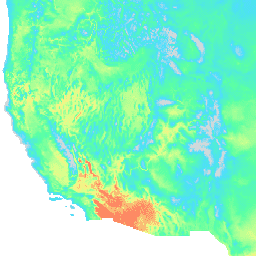
var dataset = ee.ImageCollection('IDAHO_EPSCOR/GRIDMET')\n .filter(ee.Filter.date('2018-08-01', '2018-08-15'));\nvar maximumTemperature = dataset.select('tmmx');\nvar maximumTemperatureVis = {\n min: 290.0,\n max: 314.0,\n palette: ['d8d8d8', '4addff', '5affa3', 'f2ff89', 'ff725c'],\n};\nMap.setCenter(-115.356, 38.686, 5);\nMap.addLayer(maximumTemperature, maximumTemperatureVis, 'Maximum Temperature');\n```\n[Open in Code Editor](https://code.earthengine.google.com/?scriptPath=Examples:Datasets/IDAHO_EPSCOR/IDAHO_EPSCOR_GRIDMET) \n[GRIDMET: University of Idaho Gridded Surface Meteorological Dataset](/earth-engine/datasets/catalog/IDAHO_EPSCOR_GRIDMET) \nThe Gridded Surface Meteorological dataset provides high spatial resolution (\\~4-km) daily surface fields of temperature, precipitation, winds, humidity and radiation across the contiguous United States from 1979. The dataset blends the high resolution spatial data from PRISM with the high temporal resolution data from the National Land Data Assimilation System ... \nIDAHO_EPSCOR/GRIDMET, climate,gridmet,humidity,merced,metdata,precipitation,radiation,temperature,water-vapor,wind \n1979-01-01T00:00:00Z/2025-09-01T06:00:00Z \n24.9 -124.9 49.6 -66.8 \nGoogle Earth Engine \nhttps://developers.google.com/earth-engine/datasets\n\n- [](https://doi.org/http://www.climatologylab.org/gridmet.html)\n- [](https://doi.org/https://developers.google.com/earth-engine/datasets/catalog/IDAHO_EPSCOR_GRIDMET)"]]