The MACAv2-METDATA dataset is a collection of 20 global
climate models covering the conterminous USA. The Multivariate Adaptive
Constructed Analogs (MACA) method is a statistical downscaling
method which utilizes a training dataset (i.e. a meteorological
observation dataset) to remove historical biases and match spatial
patterns in climate model output.
The MACA method was used to downscale the model output from 20
global climate models (GCMs) of the Coupled Model Inter-Comparison
Project 5 (CMIP5) for the historical GCM forcings (1950-2005) and
the future Representative Concentration Pathways (RCPs) RCP 4.5
and RCP 8.5 scenarios (2006-2100) from the native resolution of
the GCMS to 4km.
Maximum daily relative humidity near surface, not present in models CCSM4 or NorESM1-M
rhsmin
%
1*
100*
meters
Minimum daily relative humidity near surface, not present in models CCSM4 or NorESM1-M
huss
Mass fraction
0*
0.05*
meters
Average daily specific humidity near surface
pr
mm
0*
1609.77*
meters
Average daily precipitation amount at surface
rsds
W/m^2
9.06*
455.61*
meters
Average daily downward shortwave radiation at surface
uas
m/s
-29.74*
25.96*
meters
Average daily eastward component of wind near surface
vas
m/s
-29.26*
33.06*
meters
Average daily northward component of wind near surface
* estimated min or max value
Image Properties
Image Properties
Name
Type
Description
scenario
STRING
Name of the CMIP5 scenario, one of 'rcp85', 'rcp45', or 'historical'
model
STRING
Name of the CMIP5 model, eg 'inmcm4'
ensemble
STRING
Either 'r1i1p1' or 'r6i1p1'
Terms of Use
Terms of Use
The MACA datasets were created with funding from the
US government and are in the public domain in the United States.
For further clarity, unless otherwise noted, the MACA datasets
are made available with a Creative Commons CC0 1.0 Universal dedication.
In short, John Abatzoglou waives all rights to the work worldwide
under copyright law, including all related and neighboring rights,
to the extent allowed by law. You can copy, modify, distribute,
and perform the work, even for commercial purposes, all without
asking permission. John Abatzoglou makes no warranties about the
work, and disclaims liability for all uses of the work, to the
fullest extent permitted by applicable law. Users should properly
cite the source used in the creation of any reports and publications
resulting from the use of this dataset and note the date when the
data was acquired. For more information refer to the MACA References
and License
page.
Citations
Citations:
Abatzoglou J.T. and Brown T.J., A comparison of statistical downscaling
methods suited for wildfire applications, International Journal
of Climatology(2012) doi:10.1002/joc.2312.
The MACAv2-METDATA dataset is a collection of 20 global climate models covering the conterminous USA. The Multivariate Adaptive Constructed Analogs (MACA) method is a statistical downscaling method which utilizes a training dataset (i.e. a meteorological observation dataset) to remove historical biases and match spatial patterns in climate model output. The …
[null,null,[],[[["\u003cp\u003eMACAv2-METDATA offers downscaled climate data from 20 global climate models for the conterminous US, spanning from 1950 to 2100.\u003c/p\u003e\n"],["\u003cp\u003eIt utilizes the MACA method to enhance the accuracy and spatial patterns of climate model output.\u003c/p\u003e\n"],["\u003cp\u003eThe dataset includes daily maximum/minimum temperature, humidity, precipitation, radiation, and wind data at a 4km resolution.\u003c/p\u003e\n"],["\u003cp\u003eData is available for historical periods (1950-2005) and future RCP 4.5 and RCP 8.5 scenarios (2006-2100).\u003c/p\u003e\n"],["\u003cp\u003eMACAv2-METDATA is publicly available and can be accessed and analyzed using Google Earth Engine.\u003c/p\u003e\n"]]],[],null,["# MACAv2-METDATA: University of Idaho, Multivariate Adaptive Constructed Analogs Applied to Global Climate Models\n\nDataset Availability\n: 1900-01-01T00:00:00Z--2100-12-31T00:00:00Z\n\nDataset Provider\n:\n\n\n [University of California Merced](http://www.climatologylab.org/maca.html)\n\nCadence\n: 1 Day\n\nTags\n:\n[climate](/earth-engine/datasets/tags/climate) [conus](/earth-engine/datasets/tags/conus) [geophysical](/earth-engine/datasets/tags/geophysical) [idaho](/earth-engine/datasets/tags/idaho) [maca](/earth-engine/datasets/tags/maca) [monthly](/earth-engine/datasets/tags/monthly) \n\n#### Description\n\nThe MACAv2-METDATA dataset is a collection of 20 global\nclimate models covering the conterminous USA. The Multivariate Adaptive\nConstructed Analogs (MACA) method is a statistical downscaling\nmethod which utilizes a training dataset (i.e. a meteorological\nobservation dataset) to remove historical biases and match spatial\npatterns in climate model output.\n\nThe MACA method was used to downscale the model output from 20\nglobal climate models (GCMs) of the Coupled Model Inter-Comparison\nProject 5 (CMIP5) for the historical GCM forcings (1950-2005) and\nthe future Representative Concentration Pathways (RCPs) RCP 4.5\nand RCP 8.5 scenarios (2006-2100) from the native resolution of\nthe GCMS to 4km.\n\nThe full list of models can be found at:\n\u003chttps://climate.northwestknowledge.net/MACA/GCMs.php\u003e\n\n### Bands\n\n\n**Pixel Size**\n\n4638.3 meters\n\n**Bands**\n\n| Name | Units | Min | Max | Pixel Size | Description |\n|----------|---------------|----------|-----------|------------|----------------------------------------------------------------------------------------|\n| `tasmax` | K | 222.4\\* | 334.92\\* | meters | Maximum daily temperature near surface |\n| `tasmin` | K | 215.33\\* | 315.61\\* | meters | Minimum daily temperature near surface |\n| `rhsmax` | % | 1\\* | 100\\* | meters | Maximum daily relative humidity near surface, not present in models CCSM4 or NorESM1-M |\n| `rhsmin` | % | 1\\* | 100\\* | meters | Minimum daily relative humidity near surface, not present in models CCSM4 or NorESM1-M |\n| `huss` | Mass fraction | 0\\* | 0.05\\* | meters | Average daily specific humidity near surface |\n| `pr` | mm | 0\\* | 1609.77\\* | meters | Average daily precipitation amount at surface |\n| `rsds` | W/m\\^2 | 9.06\\* | 455.61\\* | meters | Average daily downward shortwave radiation at surface |\n| `uas` | m/s | -29.74\\* | 25.96\\* | meters | Average daily eastward component of wind near surface |\n| `vas` | m/s | -29.26\\* | 33.06\\* | meters | Average daily northward component of wind near surface |\n\n\\* estimated min or max value\n\n### Image Properties\n\n**Image Properties**\n\n| Name | Type | Description |\n|----------|--------|----------------------------------------------------------------------|\n| scenario | STRING | Name of the CMIP5 scenario, one of 'rcp85', 'rcp45', or 'historical' |\n| model | STRING | Name of the CMIP5 model, eg 'inmcm4' |\n| ensemble | STRING | Either 'r1i1p1' or 'r6i1p1' |\n\n### Terms of Use\n\n**Terms of Use**\n\nThe MACA datasets were created with funding from the\nUS government and are in the public domain in the United States.\nFor further clarity, unless otherwise noted, the MACA datasets\nare made available with a Creative Commons CC0 1.0 Universal dedication.\nIn short, John Abatzoglou waives all rights to the work worldwide\nunder copyright law, including all related and neighboring rights,\nto the extent allowed by law. You can copy, modify, distribute,\nand perform the work, even for commercial purposes, all without\nasking permission. John Abatzoglou makes no warranties about the\nwork, and disclaims liability for all uses of the work, to the\nfullest extent permitted by applicable law. Users should properly\ncite the source used in the creation of any reports and publications\nresulting from the use of this dataset and note the date when the\ndata was acquired. For more information refer to the [MACA References\nand License](https://climate.northwestknowledge.net/MACA/MACAreferences.php)\npage.\n\n### Citations\n\nCitations:\n\n- Abatzoglou J.T. and Brown T.J., A comparison of statistical downscaling\n methods suited for wildfire applications, International Journal\n of Climatology(2012) [doi:10.1002/joc.2312](https://doi.org/10.1002/joc.2312).\n\n### Explore with Earth Engine\n\n| **Important:** Earth Engine is a platform for petabyte-scale scientific analysis and visualization of geospatial datasets, both for public benefit and for business and government users. Earth Engine is free to use for research, education, and nonprofit use. To get started, please [register for Earth Engine access.](https://console.cloud.google.com/earth-engine)\n\n### Code Editor (JavaScript)\n\n```javascript\n
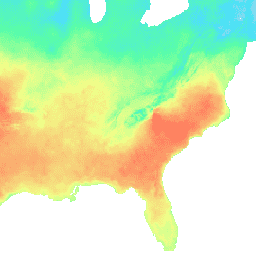
var dataset = ee.ImageCollection('IDAHO_EPSCOR/MACAv2_METDATA')\n .filter(ee.Filter.date('2018-08-01', '2018-08-15'));\nvar maximumTemperature = dataset.select('tasmax');\nvar maximumTemperatureVis = {\n min: 290.0,\n max: 314.0,\n palette: ['d8d8d8', '4addff', '5affa3', 'f2ff89', 'ff725c'],\n};\nMap.setCenter(-84.37, 33.5, 5);\nMap.addLayer(maximumTemperature, maximumTemperatureVis, 'Maximum Temperature');\n```\n[Open in Code Editor](https://code.earthengine.google.com/?scriptPath=Examples:Datasets/IDAHO_EPSCOR/IDAHO_EPSCOR_MACAv2_METDATA) \n[MACAv2-METDATA: University of Idaho, Multivariate Adaptive Constructed Analogs Applied to Global Climate Models](/earth-engine/datasets/catalog/IDAHO_EPSCOR_MACAv2_METDATA) \nThe MACAv2-METDATA dataset is a collection of 20 global climate models covering the conterminous USA. The Multivariate Adaptive Constructed Analogs (MACA) method is a statistical downscaling method which utilizes a training dataset (i.e. a meteorological observation dataset) to remove historical biases and match spatial patterns in climate model output. The ... \nIDAHO_EPSCOR/MACAv2_METDATA, climate,conus,geophysical,idaho,maca,monthly \n1900-01-01T00:00:00Z/2100-12-31T00:00:00Z \n24.9 -124.9 49.6 -67 \nGoogle Earth Engine \nhttps://developers.google.com/earth-engine/datasets\n\n- [](https://doi.org/http://www.climatologylab.org/maca.html)\n- [](https://doi.org/https://developers.google.com/earth-engine/datasets/catalog/IDAHO_EPSCOR_MACAv2_METDATA)"]]