-
呼吸地球系统模拟器 (BESS) 辐射 v1

呼吸地球系统模拟器 (BESS) 是一种简化的基于过程的模型,可耦合大气和冠层辐射传输、冠层光合作用、蒸腾作用和能量平衡。该模型将大气辐射传输模型和人工神经网络与 MODIS 大气产品的强迫相结合,以生成 5 公里的每日产品。… 气候 蒸发蒸腾 gpp modis-derived par 辐射 -
CFSR:气候预测系统再分析

美国国家环境预测中心 (NCEP) 气候预测系统再分析 (CFSR) 旨在提供 32 年记录期(从 1979 年 1 月到 2010 年 12 月)内这些耦合域状态的最佳估计值,并以全球高分辨率耦合大气-海洋-陆地表面-海冰系统执行。 气候 日光 通量 预报 地球物理 ncep -
CFSV2:NCEP 气候预测系统第 2 版,6 小时产品

美国国家环境预报中心 (NCEP) 气候预报系统 (CFS) 是一种完全耦合的模型,可表示地球大气、海洋、陆地和海冰之间的相互作用。CFS 是在 NCEP 的环境模型中心 (EMC) 开发的。将运行中的 CFS 升级到了 … 气候 日光 通量 预报 地球物理 ncep -
CHIRPS Daily:气候危害中心红外降水与站数据(版本 2.0 最终版)

Climate Hazards Center InfraRed Precipitation with Station data (CHIRPS) 是一项准全球性降雨数据集,包含 30 多年的数据。CHIRPS 将 0.05° 分辨率的卫星图像与实地观测站数据相结合,创建网格化降雨时序,用于趋势分析和季节性干旱监测。 chg climate geophysical precipitation ucsb weather -
CHIRPS 五日:Climate Hazards Center InfraRed Precipitation With Station Data(气候危害中心红外降水与地面站数据)(版本 2.0 最终版)

Climate Hazards Center InfraRed Precipitation with Station data (CHIRPS) 是一项准全球性降雨数据集,包含 30 多年的数据。CHIRPS 将 0.05° 分辨率的卫星图像与实地观测站数据相结合,创建网格化降雨时序,用于趋势分析和季节性干旱监测。 chg climate geophysical precipitation ucsb weather -
CHIRPS 降水五日:气候危害中心红外降水与地面站数据(版本 3.0)

气候危害中心红外降水与站点 (CHIRPS v3) 是一个覆盖 40 多年的高分辨率准全球降雨数据集。该数据集涵盖了从 60°N 到 60°S 的纬度范围,以及所有经度,并提供从 1981 年至今的数据。CHIRPS v3 将基于卫星的热红外降雨量估计值与实地观测站的观测数据相结合… chg climate geophysical precipitation ucsb weather -
CHIRTS-daily:气候危害中心红外温度与观测站每日温度数据产品

Climate Hazards Center InfraRed Temperature with Stations daily temperature data product(CHIRTS-daily;Verdin 等人,2020 年)是一种准全球性高分辨率网格化数据集(分辨率为 0.05° × 0.05°,范围为 60°S - 70°N),可提供每日最低温度 (Tmin) 和最高 2 米温度 (Tmax),以及四个派生变量:饱和蒸汽… chg climate daily era5 geophysical reanalysis -
CPC 全球统一温度

此数据集提供全球陆地表面每日气温的网格化分析,包括每日最高气温 (Tmax) 和最低气温 (Tmin)。这些数据跨越 1979 年至今,以 0.5 度纬度/经度网格呈现,与 CPC 基于地面观测站的全球每日…的分辨率保持一致 气候 每日 noaa 降水 天气 -
哥白尼大气监测服务 (CAMS) 全球近乎实时

哥白尼大气监测服务能够持续监测全球和区域范围内地球大气的组成。主要全球近实时生产系统是一个数据同化和预报套件,每天提供两次 5 天的气溶胶和化学预报… 气溶胶 大气 气候 哥白尼 ecmwf 预报 -
Daymet V4:每日地面天气和气候学摘要

Daymet V4 提供北美洲大陆、夏威夷和波多黎各的网格化每日天气参数估计值(波多黎各的数据从 1950 年开始提供)。它源自所选气象站数据和各种支持性数据源。与之前版本相比,Daymet … 气候 每日 日光 通量 地球物理 nasa -
排水有机土壤排放量(年)1.0
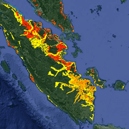
关于排水有机土壤的两个相关粮农组织数据集提供了以下估计值:DROSA-A:为农业活动(耕地和放牧草地)而排水的有机土壤面积(以公顷为单位);DROSE-A:有机土壤在…条件下的农业排水产生的碳 (C) 和一氧化二氮 (N2O) 估计值(以千兆克为单位) 农业 气候 气候变化 排放 fao ghg -
ECMWF 近乎实时的 IFS 大气预测
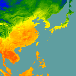
此数据集包含 ECMWF 综合预报系统 (IFS) 以 0.25 度分辨率生成的大气模型变量的 15 天预报。我们将这些数据称为“近实时 (NRT)”数据,因为新产品会在 ECMWF 实时预报发布后每天发布两次… 气候 ecmwf 预报 全球 湿度 -
ECMWF 近乎实时 IFS 海浪(短截断)预报
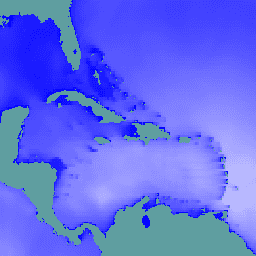
此数据集包含 ECMWF 综合预测系统 (IFS) 以 0.25 度分辨率生成的 6 天海浪模型场预报。我们将这些数据称为“近实时 (NRT)”数据,因为新产品会在 ECMWF 实时预报发布后每天发布两次… 气候 ecmwf 预报 全球 海洋 -
ECMWF 近乎实时的 IFS 海浪预报
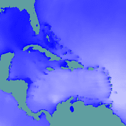
此数据集包含 ECMWF 综合预测系统 (IFS) 以 0.25 度分辨率生成的波浪模型场的 15 天预报。我们将这些数据称为“近实时 (NRT)”数据,因为新产品会在 ECMWF 实时预报发布后每天发布两次… 气候 ecmwf 预报 全球 海洋 -
ERA5 日聚合 - ECMWF / 哥白尼气候变化服务生成的最新气候再分析数据

ERA5 是 ECMWF 对全球气候的第五代大气再分析。重新分析将模型数据与全球观测数据相结合,形成一个全球完整且一致的数据集。ERA5 取代了之前的 ERA-Interim 再分析。ERA5 DAILY 提供了每天的汇总值,适用于以下变量… 气候 哥白尼 ecmwf era5 降水 -
ERA5 每小时 - ECMWF 气候再分析
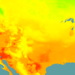
ERA5 是 ECMWF 对全球气候的第五代大气再分析。该数据集由 ECMWF 的哥白尼气候变化服务 (C3S) 生成。再分析将模型数据与全球观测数据相结合,利用物理定律… atmosphere climate copernicus ecmwf era5 hourly -
ERA5 月度汇总 - ECMWF / 哥白尼气候变化服务生成的最新气候再分析数据

ERA5 是 ECMWF 对全球气候的第五代大气再分析。重新分析将模型数据与全球观测数据相结合,形成一个全球完整且一致的数据集。ERA5 取代了之前的 ERA-Interim 再分析。ERA5 MONTHLY 提供每个月的汇总值,适用于以下变量… 气候 哥白尼 ecmwf era5 降水 -
ERA5-Land 每日汇总 - ECMWF 气候再分析

ERA5-Land 是一种再分析数据集,可提供数十年来陆地变量演变的一致视图,与 ERA5 相比,分辨率更高。ERA5-Land 是通过重放 ECMWF ERA5 气候再分析的陆地分量生成的。重新分析将模型数据与…相结合 cds climate copernicus ecmwf era5-land evaporation -
ERA5-Land 每小时 - ECMWF 气候再分析

ERA5-Land 是一种再分析数据集,可提供数十年来陆地变量演变的一致视图,与 ERA5 相比,分辨率更高。ERA5-Land 是通过重放 ECMWF ERA5 气候再分析的陆地分量生成的。重新分析将模型数据与…相结合 cds climate copernicus ecmwf era5-land evaporation -
ERA5-Land 月度汇总 - ECMWF 气候再分析

ERA5-Land 是一种再分析数据集,可提供数十年来陆地变量演变的一致视图,与 ERA5 相比,分辨率更高。ERA5-Land 是通过重放 ECMWF ERA5 气候再分析的陆地分量生成的。重新分析将模型数据与…相结合 cds climate copernicus ecmwf era5-land evaporation -
ERA5-Land 按小时平均的月度数据 - ECMWF 气候再分析

ERA5-Land 是一种再分析数据集,可提供数十年来陆地变量演变的一致视图,与 ERA5 相比,分辨率更高。ERA5-Land 是通过重放 ECMWF ERA5 气候再分析的陆地分量生成的。重新分析将模型数据与…相结合 cds climate copernicus ecmwf era5-land evaporation -
FLDAS:饥荒预警系统网络 (FEWS NET) 陆地数据同化系统

FLDAS 数据集(McNally 等人,2017 年)旨在帮助在数据稀疏的发展中国家环境中进行粮食安全评估。它包含许多与气候相关的变量的信息,包括含水量、湿度、蒸发蒸腾、平均土壤温度、总降水率等。FLDAS 数据集有多种不同的版本;… 气候 冰冻圈 蒸发蒸腾 湿度 ldas 月度 -
Farmscapes 2020
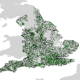
Farmscapes 2020 数据集提供了英格兰农业景观中三种关键半自然特征(树篱、林地和石墙)的高分辨率 (25 厘米) 概率地图。此数据集是与 Oxford Leverhulme Centre for Nature Recovery 合作开发的,可作为多种应用(包括…)的基准。 生物多样性 气候 保护 森林 土地利用和土地覆盖 自然轨迹 -
GCOM-C/SGLI L3 地表温度 (V1)

此产品是陆地表面的温度。此数据集还提供了一个较新的版本 JAXA/GCOM-C/L3/LAND/LST/V3,该版本使用此算法进行处理。GCOM-C 会进行长期持续的全球观测和数据收集,以阐明辐射收支波动背后的机制,并… 气候 g-portal gcom gcom-c jaxa 陆地 -
GCOM-C/SGLI L3 地表温度(版本 2)
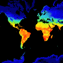
此产品是陆地表面的温度。对于 2021 年 11 月 28 日之后的数据,请参阅 V3 数据集。GCOM-C 会进行长期持续的全球观测和数据收集,以阐明辐射预算和碳循环波动背后的机制,从而准确预测… 气候 g-portal gcom gcom-c jaxa 陆地 -
GCOM-C/SGLI L3 地表温度 (V3)

此产品是陆地表面的温度。这是一个持续更新的数据集,延迟时间为 3-4 天。GCOM-C 会进行长期持续的全球观测和数据收集,以阐明辐射预算和碳循环波动背后的机制,从而做出… 气候 g-portal gcom gcom-c jaxa 陆地 -
GCOM-C/SGLI L3 海平面温度 (V1)

此产品是海面温度。此数据集还提供了一个更新的版本 JAXA/GCOM-C/L3/OCEAN/SST/V3,该版本使用此算法进行处理。GCOM-C 会进行长期持续的全球观测和数据收集,以阐明辐射预算和碳…… 气候 g-portal gcom gcom-c jaxa 海洋 -
GCOM-C/SGLI L3 海平面温度(版本 2)

此产品是海面温度。对于 2021 年 11 月 28 日之后的数据,请参阅 V3 数据集。GCOM-C 进行长期持续的全球观测和数据收集,以阐明辐射预算和碳循环波动背后的机制,从而准确预测未来… 气候 g-portal gcom gcom-c jaxa 海洋 -
GCOM-C/SGLI L3 海平面温度 (V3)

此产品是海面温度。这是一个持续更新的数据集,延迟时间为 3-4 天。GCOM-C 会进行长期持续的全球观测和数据收集,以阐明辐射收支和碳循环波动背后的机制,从而做出准确的… 气候 g-portal gcom gcom-c jaxa 海洋 -
GFS:全球预报系统 384 小时预测大气数据

全球预报系统 (GFS) 是由美国国家环境预报中心 (NCEP) 生成的天气预报模型。GFS 数据集由选定的模型输出(如下所述)组成,以网格化预报变量的形式呈现。384 小时预报,其中 1 小时(最长 120 小时)和 3 小时(之后… 气候 云 通量 预报 地球物理 湿度 -
GLDAS-2.1:全球陆地数据同化系统

NASA 全球陆地数据同化系统第 2 版 (GLDAS-2) 包含三个组成部分:GLDAS-2.0、GLDAS-2.1 和 GLDAS-2.2。GLDAS-2.0 完全由普林斯顿气象强迫输入数据强迫,并提供 1948 年至 2014 年的时间上一致的序列。GLDAS-2.1 采用模型… 3 小时 气候 冰冻圈 蒸发 强迫 地球物理 -
GLDAS-2.2:全球陆地数据同化系统

NASA 全球陆地数据同化系统第 2 版 (GLDAS-2) 包含三个组成部分:GLDAS-2.0、GLDAS-2.1 和 GLDAS-2.2。GLDAS-2.0 完全由普林斯顿气象强迫输入数据强迫,并提供 1948 年至 2014 年的时间上一致的序列。GLDAS-2.1 采用模型… 3 小时 气候 冰冻圈 蒸发 强迫 地球物理 -
GPM:全球降水测量任务 (GPM) 版本 07

全球降水测量 (GPM) 是一项国际卫星任务,旨在每三小时提供一次全球范围内的雨雪观测数据,以实现下一代观测。Integrated Multi-satellitE Retrievals for GPM (IMERG) 是一种统一的算法,可提供降雨估计值,并将 GPM 中所有被动微波仪器的数据相结合… 气候 地球物理 gpm imerg jaxa nasa -
GPM:每月全球降水测量 (GPM) v6

IMERG-Final 版本“06”已于 2021 年 9 月停止生成。版本“07”预计将于 2022 年 9 月发布。全球降水测量 (GPM) 是一项国际卫星任务,旨在每三小时提供一次全球范围内的下一代雨雪观测数据。The Integrated Multi-satellitE Retrievals for … 气候 地球物理 gpm imerg jaxa 月度 -
GPM:每月全球降水测量 (GPM) vRelease 07

全球降水测量 (GPM) 是一项国际卫星任务,旨在每三小时提供一次全球范围内的雨雪观测数据,以实现下一代观测。Integrated Multi-satellitE Retrievals for GPM (IMERG) 是一种统一的算法,可提供降雨估计值,并将 GPM 中所有被动微波仪器的数据相结合… 气候 地球物理 gpm imerg jaxa 月度 -
GRIDMET 干旱:美国本土干旱指数

此数据集包含从 4 公里日网格化地面气象 (GRIDMET) 数据集派生的干旱指数。提供的干旱指数包括标准化降水指数 (SPI)、蒸发干旱需求指数 (EDDI)、标准化降水蒸散指数 (SPEI)、帕默干旱严重程度指数 (PDSI) 和帕默… 气候 美国本土 农作物 干旱 蒸发蒸腾 地球物理 -
GRIDMET:爱达荷大学网格化地面气象数据集

网格化地面气象数据集提供美国本土自 1979 年以来温度、降水、风、湿度和辐射的高空间分辨率(约 4 公里)每日地面场。该数据集将 PRISM 的高分辨率空间数据与…的高时间分辨率数据相融合 气候 gridmet 湿度 merced metdata 降水 -
GSMaP Operational:全球降水卫星地图 - V6

全球降水卫星地图 (GSMaP) 提供全球每小时降雨率,分辨率为 0.1 x 0.1 度。GSMaP 是全球降水测量 (GPM) 任务的产品,可提供每隔 3 小时的全球降水观测数据。这些值是使用多频段被动…估算的 气候 地球物理 gpm 每小时 jaxa 降水 -
GSMaP Operational:全球降水卫星地图 - V7

全球降水卫星地图 (GSMaP) 提供全球每小时降雨率,分辨率为 0.1 x 0.1 度。GSMaP 是全球降水测量 (GPM) 任务的产品,可提供每隔 3 小时的全球降水观测数据。这些值是使用多频段被动…估算的 气候 地球物理 gpm 每小时 jaxa 降水 -
GSMaP Operational:全球降水卫星地图 - V8

全球降水卫星地图 (GSMaP) 提供全球每小时降雨率,分辨率为 0.1 x 0.1 度。GSMaP 是全球降水测量 (GPM) 任务的产品,可提供每隔 3 小时的全球降水观测数据。这些值是使用多频段被动…估算的 气候 地球物理 gpm 每小时 jaxa 降水 -
GSMaP 再分析:全球降水卫星地图

全球降水卫星地图 (GSMaP) 提供全球每小时降雨率,分辨率为 0.1 x 0.1 度。GSMaP 是全球降水测量 (GPM) 任务的产品,可提供每隔 3 小时的全球降水观测数据。这些值是使用多频段被动…估算的 气候 地球物理 gpm 每小时 jaxa 降水 -
局地气候带全球地图,最新版本

自 2012 年推出局地气候带 (LCZ) 以来,其已成为表征城市景观的新标准,提供了一种综合考虑微观尺度土地覆盖及相关物理属性的整体分类方法。这份全球局地气候带地图代表 2018 基准年,像元大小为 100m … 气候 土地覆盖 土地利用-土地覆盖 城市 -
International Best Track Archive for Climate Stewardship 项目

International Best Track Archive for Climate Stewardship (IBTrACS) 提供全球热带气旋的位置和强度。数据范围从 19 世纪 40 年代至今,通常以 3 小时为间隔提供数据。虽然最佳轨迹数据侧重于位置和强度(最大持续风速… 气候 飓风 noaa 表格 天气 -
LST Day:Malaria Atlas Project 填充了缺失数据的白天陆地表面温度(每 8 天 1 千米)

白天陆地表面温度 (LST) 源自约 1 千米的 MODIS MOD11A2 v6.1 产品。将 8 天合成数据转换为摄氏度,然后使用 Weiss 等人 (2014) 概述的方法进行缺口填充,以消除因云覆盖等因素而导致的数据缺失。… 气候 lst malariaatlasproject 地图 publisher-dataset 地表温度 -
LST Day:Malaria Atlas Project 填充了缺失数据的白天陆地表面温度(每年 1 千米)

白天陆地表面温度 (LST) 源自约 1 千米的 MODIS MOD11A2 v6.1 产品。将 8 天合成数据转换为摄氏度,然后使用 Weiss 等人 (2014) 概述的方法进行缺口填充,以消除因云覆盖等因素而导致的数据缺失。… 气候 lst malariaatlasproject 地图 publisher-dataset 地表温度 -
LST Day:Malaria Atlas Project 填充了缺失数据的白天陆地表面温度(每月 1 千米)

白天陆地表面温度 (LST) 源自约 1 千米的 MODIS MOD11A2 v6.1 产品。将 8 天合成数据转换为摄氏度,然后使用 Weiss 等人 (2014) 概述的方法进行缺口填充,以消除因云覆盖等因素而导致的数据缺失。… 气候 lst malariaatlasproject 地图 publisher-dataset 地表温度 -
LST Night:Malaria Atlas Project 填充了缺失数据的夜间地表温度(每 8 天 1 千米)

夜间地表温度 (LST) 源自约 1 公里的 MODIS MOD11A2 v6.1 产品。将 8 天合成数据转换为摄氏度,然后使用 Weiss 等人 (2014) 概述的方法进行缺口填充,以消除因云覆盖等因素而导致的数据缺失。… 气候 lst malariaatlasproject 地图 publisher-dataset 地表温度 -
LST Night:Malaria Atlas Project 填充了缺失数据的夜间地表温度(每年 1 千米)

夜间地表温度 (LST) 源自约 1 公里的 MODIS MOD11A2 v6.1 产品。将 8 天合成数据转换为摄氏度,然后使用 Weiss 等人 (2014) 概述的方法进行缺口填充,以消除因云覆盖等因素而导致的数据缺失。… 气候 lst malariaatlasproject 地图 publisher-dataset 地表温度 -
LST Night:Malaria Atlas Project 填充了缺失数据的夜间地表温度(每月 1 千米)

夜间地表温度 (LST) 源自约 1 公里的 MODIS MOD11A2 v6.1 产品。将 8 天合成数据转换为摄氏度,然后使用 Weiss 等人 (2014) 概述的方法进行缺口填充,以消除因云覆盖等因素而导致的数据缺失。… 气候 lst malariaatlasproject 地图 publisher-dataset 地表温度 -
MACAv2-METDATA 月度摘要:爱达荷大学,应用于全球气候模型的多变量自适应构建类比

MACAv2-METDATA 数据集包含 20 个覆盖美国本土的全球气候模型。多变量自适应构建类比 (MACA) 方法是一种统计降尺度方法,它利用训练数据集(即气象观测数据集)来消除历史偏差并匹配空间模式… 气候 conus 地球物理 爱达荷州 maca 月度 -
MACAv2-METDATA:爱达荷大学,应用于全球气候模型的多变量自适应构建类比

MACAv2-METDATA 数据集包含 20 个覆盖美国本土的全球气候模型。多变量自适应构建类比 (MACA) 方法是一种统计降尺度方法,它利用训练数据集(即气象观测数据集)来消除历史偏差并匹配空间模式… 气候 conus 地球物理 爱达荷州 maca 月度 -
MCD18A1.062 地表辐射每日/3 小时
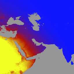
MCD18A1 版本 6.2 是一种中等分辨率成像光谱辐射计 (MODIS) Terra 和 Aqua 组合的向下短波辐射 (DSR) 网格化 3 级产品,每天以 1 公里像素分辨率生成,每 3 小时估计一次 DSR。DSR 是陆地表面的入射太阳辐射… 气候 par 辐射 -
MCD18C2.062 光合有效辐射每日 3 小时
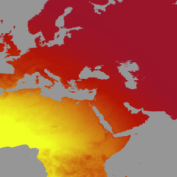
MCD18C2 版本 6.2 是一种中等分辨率成像光谱辐射计 (MODIS) Terra 和 Aqua 组合的光合有效辐射 (PAR) 网格化 3 级产品,每天以 0.05 度(赤道处为 5,600 米)的分辨率生成,并每 3 小时估计一次 PAR。PAR 是入射太阳辐射… 气候 par 辐射 -
MERRA-2 M2T1NXFLX:地表通量诊断 V5.12.4

M2T1NXFLX(或 tavg1_2d_flx_Nx)是 Modern-Era Retrospective analysis for Research and Applications 版本 2 (MERRA-2) 中的每小时时间平均数据集合。此集合包含同化后的地面通量诊断变量,例如总降水量、经过偏差校正的总降水量、地面气温、地面比湿、地面风速等。 气候 merra 降水 海盐 so2 so4 -
MERRA-2 M2T1NXLND:陆地表面诊断 V5.12.4

M2T1NXLND(或 tavg1_2d_lnd_Nx)是现代回顾性分析研究和应用第 2 版 (MERRA-2) 中的每小时时间平均数据集合。此集合包含陆地表面诊断数据,例如基流通量、径流、地表土壤湿度、根区土壤湿度、地表层的水、… 气候 冰冻圈 蒸发 冰 merra 降水 -
MERRA-2 M2T1NXRAD:辐射诊断 V5.12.4

M2T1NXRAD(或 tavg1_2d_rad_Nx)是现代研究与应用回顾性分析版本 2 (MERRA-2) 中的每小时时间平均数据集合。此集合包含辐射诊断数据,例如地表反照率、云面积分数、云内光学厚度、地表入射短波通量(即太阳辐射)、地表… 反照率 大气 气候 发射率 merra 短波 -
MERRA-2 M2T1NXSLV:单层诊断 V5.12.4

M2T1NXSLV(或 tavg1_2d_slv_Nx)是 Modern-Era Retrospective analysis for Research and Applications 版本 2 (MERRA-2) 中的每小时时间平均二维数据集合。此集合包含常用垂直高度的气象诊断数据,例如 2 米(或 10 米、850hPa、500 hPa、250hPa)处的空气温度,… 大气 气候 湿度 merra nasa 压力 -
MOD08_M3.061 Terra 大气月度全球产品

MOD08_M3 V6.1 是一种大气全球产品,包含大气形参的月度 1x1 度网格平均值。这些参数与大气气溶胶粒子属性、臭氧总量、大气水汽、云光学和物理属性以及大气稳定性指数有关。… 大气 气候 地球物理 全球 modis 月度 -
MOD11A1.061 Terra 地表温度和发射率每日全球 1 公里

MOD11A1 V6.1 产品以 1200 x 1200 公里网格提供每日地表温度 (LST) 和发射率值。温度值源自 MOD11_L2 扫描带产品。在 30 度纬度以上,部分像素可能有多项观测结果,其中晴空条件… 气候 每日 发射率 全球 lst modis -
MOD11A2.061 Terra 地表温度和发射率 8 天全球 1 公里

MOD11A2 V6.1 产品以 1200 x 1200 公里的网格提供平均 8 天的地表温度 (LST)。MOD11A2 中的每个像素值都是相应 8 天时间段内收集的所有相应 MOD11A1 LST 像素的简单平均值。MOD11A2 会执行… 8 天 气候 发射率 全球 lst mod11a2 -
MOD21A1D.061 Terra 地表温度和 3 波段发射率每日全球 1km
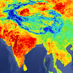
MOD21A1D 数据集每天根据白天 2 级网格化 (L2G) 中间 LST 产品生成,空间分辨率为 1,000 米。L2G 流程将每日 MOD21 观测带状粒度数据映射到正弦 MODIS 网格,并存储落在网格单元格上的所有观测结果… 气候 每日 发射率 全球 lst nasa -
MOD21A1N.061 Terra 地表温度和 3 波段发射率每日全球 1 公里

MOD21A1N 数据集每天根据夜间 2 级网格化 (L2G) 中间 LST 产品生成,空间分辨率为 1,000 米。L2G 流程将每日 MOD21 观测带状粒度数据映射到正弦 MODIS 网格,并存储落在网格单元格上的所有观测结果… 气候 每日 发射率 全球 lst nasa -
MOD21C1.061 Terra 地表温度和 3 波段发射率每日 L3 全球 0.05 度 CMG

MOD21C1 数据集每天生成一次,采用 0.05 度(赤道处为 5,600 米)的气候模型网格 (CMG),数据源为白天 2 级网格化 (L2G) 中间 LST 产品。L2G 流程将每日 MOD21 刈幅颗粒映射到正弦 MODIS 网格,并存储所有 … 气候 每日 发射率 全球 lst nasa -
MOD21C2.061 Terra 地表温度和 3 波段发射率 8 天 L3 全球 0.05 度 CMG
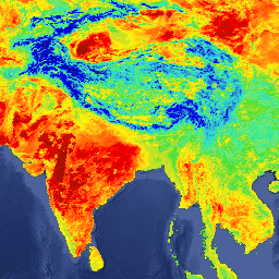
MOD21C2 数据集是一种 8 天合成 LST 产品,它使用基于简单平均方法的算法。该算法会计算 8 天内所有无云 MOD21A1D 和 MOD21A1N 每日采集数据的平均值。与 MOD21A1 数据集不同的是,… 气候 发射率 全球 lst nasa 地表温度 -
MOD21C3.061 Terra 地表温度和 3 波段发射率月度 L3 全球 0.05 度 CMG
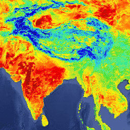
MOD21C3 数据集是一种月度合成 LST 产品,它使用基于简单平均方法的算法。该算法会计算 8 天内所有无云 MOD21A1D 和 MOD21A1N 每日采集数据的平均值。与 MOD21A1 数据集不同的是,… 气候 发射率 全球 lst 月度 nasa -
MYD08_M3.061 Aqua 大气月度全球产品

MYD08_M3 V6.1 是一种大气全球产品,包含大气形参的月度 1x1 度网格平均值。这些参数与大气气溶胶粒子属性、臭氧总量、大气水汽、云光学和物理属性以及大气稳定性指数有关。… aqua 大气 气候 地球物理 全球 modis -
MYD11A1.061 Aqua 地表温度和发射率每日全球 1 公里

MYD11A1 V6.1 产品以 1200 x 1200 公里网格提供每日地表温度 (LST) 和发射率值。温度值源自 MYD11_L2 幅宽产品。在 30 度纬度以上,部分像素可能有多项观测结果,其中晴空条件… aqua 气候 每日 发射率 全球 lst -
MYD11A2.061 Aqua 地表温度和发射率 8 天全球 1 公里
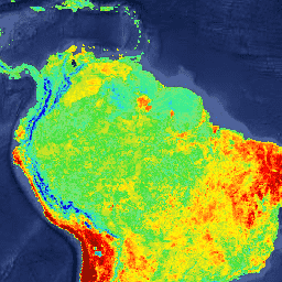
MYD11A2 V6.1 产品以 1200 x 1200 公里的网格提供平均 8 天的地表温度 (LST)。MYD11A2 中的每个像素值都是在相应 8 天内收集的所有相应 MYD11A1 LST 像素的简单平均值。MYD11A2 会执行… 8 天 aqua climate emissivity global lst -
MYD21A1D.061 Aqua 地表温度和 3 波段发射率每日全球 1 公里
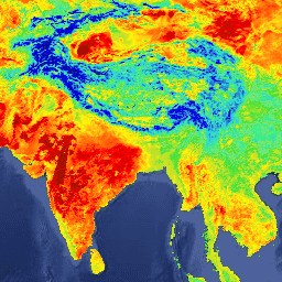
MYD21A1D 数据集每天根据白天 2 级网格化 (L2G) 中间 LST 产品生成,空间分辨率为 1,000 米。L2G 流程将每日 MOD21 观测带状粒度数据映射到正弦 MODIS 网格,并存储落在网格单元格上的所有观测结果… aqua 气候 每日 发射率 全球 lst -
MYD21A1N.061 Aqua 地表温度和 3 波段发射率每日全球 1 公里
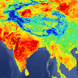
MYD21A1N 数据集每天根据夜间 2 级网格化 (L2G) 中间 LST 产品生成,空间分辨率为 1,000 米。L2G 流程将每日 MOD21 观测带状粒度数据映射到正弦 MODIS 网格,并存储落在网格单元格上的所有观测结果… aqua 气候 每日 发射率 全球 lst -
MYD21C1.061 Aqua 地表温度和 3 波段发射率每日 L3 全球 0.05 度 CMG

MYD21C1 数据集每天生成一次,采用 0.05 度(赤道处为 5,600 米)气候模型网格 (CMG),数据源为白天 2 级格网 (L2G) 中间 LST 产品。L2G 流程将每日 MYD21 扫描带颗粒映射到正弦 MODIS 网格,并存储所有… aqua 气候 每日 发射率 全球 lst -
MYD21C2.061 Aqua 地表温度和 3 波段发射率 8 天 L3 全球 0.05 度 CMG

MYD21C2 数据集是一种 8 天合成 LST 产品,它使用基于简单平均方法的算法。该算法会计算 8 天内所有无云 MYD21A1D 和 MYD21A1N 每日采集的平均值。与 MYD21A1 数据集不同,… aqua 气候 发射率 全球 lst nasa -
MYD21C3.061 Aqua 地表温度和 3 波段发射率月度 L3 全球 0.05 度 CMG

MYD21C3 数据集是一种月度合成 LST 产品,它使用基于简单平均方法的算法。该算法会计算 8 天内所有无云 MYD21A1D 和 MYD21A1N 每日采集的平均值。与 MYD21A1 数据集不同,… aqua 气候 发射率 全球 lst 每月 -
MethaneAIR L3 浓度 v1

此数据集提供甲烷空气成像光谱仪观测到的甲烷大气柱干空气摩尔分数总量的地理空间数据,即“XCH4”。XCH4 定义为甲烷(“CH4”)的总柱含量(分子数)除以总含量… 大气 气候 edf 排放 ghg 甲烷 -
MethaneAIR L4 面积源 v1

区域排放模型仍在开发中,不代表最终产品。此数据集使用 MethaneAIR 飞行测量数据(专注于美国各地产油气地区)提供空间上分解的甲烷排放通量 (kg/hr)。调查的总排放量… 大气 气候 edf 排放 ghg 甲烷 -
MethaneAIR L4 点源 v1

此数据集提供了 13 个石油和天然气或煤炭开采区域(从西部的科罗拉多州、新墨西哥州和得克萨斯州到东部的宾夕法尼亚州、俄亥俄州和西弗吉尼亚州)以及 3 个城市区域(纽约市、…)的高排放甲烷点源检测数据(千克/小时)。 大气 气候 edf 排放 ghg 甲烷 -
MethaneSAT L3 浓度公开预览版 V1.0.0
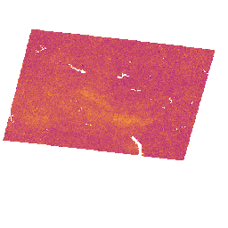
此早期“公开预览版”数据集提供地理空间数据,用于表示从 MethaneSAT 成像光谱仪的测量结果中检索到的甲烷在大气中的柱平均干空气摩尔分数“XCH4”。XCH4 定义为…的总柱含量(单位表面积上方的分子数量) 大气 气候 edf edf-methanesat-ee 排放 ghg -
MethaneSAT L4 区域源公开预览版 V1.0.0
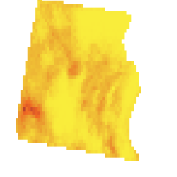
分散区域排放模型仍在开发中,不代表最终产品。此早期“公开预览版”数据集可提供分散区域源的甲烷排放高精度数据。这些排放数据来自美国… 大气 气候 edf edf-methanesat-ee 排放 ghg -
MethaneSAT L4 区域源公开预览版 V2.0.0

分散区域排放模型仍在开发中,不代表最终产品。此早期“公开预览版”数据集可提供分散区域源的甲烷排放高精度数据。这些新颖的测量结果表明,高精度量化甲烷总排放量对于…至关重要 大气 气候 edf edf-methanesat-ee 排放 ghg -
MethaneSAT L4 点源公开预览版 V1.0.0

此早期“公开预览版”数据集可提供来自离散点源的甲烷排放高精度数据。这些甲烷排放通量是使用专门用于利用… 大气 气候 edf edf-methanesat-ee 排放 ghg -
NCEP-DOE 再分析 2(高斯网格),总云量

NCEP-DOE Reanalysis 2 项目使用最先进的分析/预测系统,利用 1979 年到前一年的历史数据执行数据同化。 大气 气候 云 地球物理 ncep noaa -
NCEP/NCAR 再分析数据,海平面气压

NCEP/NCAR 再分析项目是美国国家环境预报中心(NCEP,前身为“NMC”)与美国国家大气研究中心(NCAR)之间的联合项目。这项联合工作的目标是使用历史数据生成新的大气分析,并… 大气 气候 地球物理 ncep noaa 压力 -
NCEP/NCAR 再分析数据,地表温度

NCEP/NCAR 再分析项目是美国国家环境预报中心(NCEP,前身为“NMC”)与美国国家大气研究中心(NCAR)之间的联合项目。这项联合工作的目标是使用历史数据生成新的大气分析,并… 大气 气候 地球物理 ncep noaa 重新分析 -
NCEP/NCAR 再分析数据,水蒸气

NCEP/NCAR 再分析项目是美国国家环境预报中心(NCEP,前身为“NMC”)与美国国家大气研究中心(NCAR)之间的联合项目。这项联合工作的目标是使用历史数据生成新的大气分析,并… 大气 气候 地球物理 ncep noaa 重新分析 -
NEX-DCP30:NASA 地球交换降尺度气候预测的集成统计数据

NASA NEX-DCP30 数据集包含美国本土的降尺度气候情景,这些情景源自在耦合模式比较项目第 5 阶段(CMIP5,参见 Taylor 等人,2012 年)下进行的一般环流模型 (GCM) 运行,并涵盖四种温室… cag climate cmip5 geophysical ipcc nasa -
NEX-DCP30:NASA Earth Exchange 降尺度气候预测

NASA NEX-DCP30 数据集包含美国本土的降尺度气候情景,这些情景源自在耦合模式比较项目第 5 阶段(CMIP5,参见 Taylor 等人,2012 年)下进行的一般环流模型 (GCM) 运行,并涵盖四种温室… cag climate cmip5 geophysical ipcc nasa -
NEX-GDDP-CMIP6:NASA 地球交换全球每日降尺度气候预测

NEX-GDDP-CMIP6 数据集包含根据在耦合模式比较项目第 6 阶段 (CMIP6,参见 Thrasher 等人,2022 年) 下进行的一般环流模型 (GCM) 运行以及在四种“第 1 级”温室气体排放情景中的两种情景下得出的全球降尺度气候情景… cag 气候 gddp 地球物理 ipcc nasa -
NEX-GDDP:NASA Earth Exchange 全球每日降尺度气候预测

NASA NEX-GDDP 数据集包含全球降尺度气候情景,这些情景源自在耦合模式比较项目第 5 阶段 (CMIP5,参见 Taylor 等人,2012 年) 下进行的通用环流模型 (GCM) 运行,并涵盖四种温室气体排放情景中的两种… cag climate cmip5 gddp geophysical ipcc -
NLDAS-2:北美陆地数据同化系统强迫场

陆地数据同化系统 (LDAS) 会结合多种观测源(例如降水计数据、卫星数据和雷达降水测量数据),以生成地球表面或近地表的气候学属性估计值。此数据集是阶段 … 的主要(默认)强迫文件(文件 A) 气候 蒸发 强迫 地球物理 每小时 湿度 -
NOAA CDR GRIDSAT-B1:静止红外通道亮度温度

注意:由于基础设施正在更新,自 2024-03-31 以来,提供方一直未更新此数据集。目前尚无数据集更新恢复的具体时间表。此数据集提供来自地球静止卫星的全球红外测量数据,这些数据构成了高质量的气候数据记录 (CDR)。… 亮度 cdr 气候 红外 noaa 反射率 -
NOAA CDR PATMOSX:云属性、反射率和亮度温度,版本 5.3

此数据集提供多种云属性的高质量气候数据记录 (CDR),以及高级甚高分辨率辐射计 (AVHRR) Pathfinder Atmospheres Extended (PATMOS-x) 亮度温度和反射率。这些数据已拟合到 0.1 x 0.1 的等角度网格,其中包含升序和… 大气 avhrr 亮度 cdr 气候 云 -
NOAA NHC HURDAT2 大西洋飓风目录

飓风最佳轨迹数据库 (HURDAT2)。大西洋盆地,1851-2018 年。 气候 飓风 nhc noaa 表格 天气 -
NOAA NHC HURDAT2 太平洋飓风目录

飓风最佳轨迹数据库 (HURDAT2)。太平洋盆地,1949 年至 2018 年。 气候 飓风 nhc noaa 表格 天气 -
2020 年世界天然森林

《Natural Forests of the World 2020》提供了一张 2020 年的全球天然森林概率地图,分辨率为 10 米。该 API 的开发旨在支持欧盟的《森林砍伐法规》(EUDR) 等举措,以及其他森林保护和监测工作。地图… 生物多样性 气候 保护 森林砍伐 EUDR 森林 -
OpenLandMap 长期地表温度日间月度中位数

2000 年至 2017 年地表温度昼间月平均值。使用 R 中的 data.table 软件包和分位数函数得出。如需详细了解 MODIS LST 产品,请参阅此页面。不包括南极洲。如需在 Earth Engine 之外访问和直观呈现地图,请使用此页面。… 气候 envirometrix lst mod11a2 modis monthly -
OpenLandMap 长期地表温度(白天)月度标准差

基于 2000-2017 年时间序列的 1 公里长期 MODIS LST 白天和夜间温度标准差。使用 R 中的 data.table 软件包和分位数函数得出。如需详细了解 MODIS LST 产品,请参阅此页面。不包括南极洲。如需访问… 气候 envirometrix lst mod11a2 modis monthly -
OpenLandMap 长期地表温度月度昼夜差

基于 2000-2017 年时间序列的 1 公里分辨率 MODIS 地表温度长期昼夜差。基于 R 语言的 data.table 包和分位函数推导。如需详细了解 MODIS LST 产品,请参阅此页面。不包括南极洲。如需访问和直观呈现… climate day envirometrix lst mod11a2 modis -
Oya:5 公里准全球降水估计

降水估计,尚未经过正式的同类评审。很快就会在 arXiv 上发布。** Oya 是一个准全球高分辨率降水估计数据集,源自静止轨道 (GEO) 卫星观测数据。Oya 模型利用了来自 … 的可见光和红外 (VIS-IR) 全光谱通道 气候 地球物理 gpm 预审核 降水 发布者-数据集 -
PERSIANN-CDR:使用人工神经网络的遥感信息降水估计 - 气候数据记录

PERSIANN-CDR 是一种每日准全球降水产品,涵盖的时间范围为 1983 年 1 月 1 日至今。数据按季度生成,通常会有三个月的延迟。该产品由加州大学欧文分校水文气象与遥感中心开发… cdr climate geophysical noaa precipitation weather -
PRISM 每日空间气候数据集

PRISM 每日和每月数据集是由俄勒冈州立大学 PRISM 气候小组制作的美国本土网格化气候数据集。此集合包含 AN81 和 AN91 数据,由“dataset_type”属性指示。网格是使用 PRISM(Parameter-elevation Regressions … 气候 每日 地球物理 俄勒冈州立大学 降水 压力 -
PRISM 长期平均气候数据集 Norm91m

PRISM 每日和每月数据集是由俄勒冈州立大学 PRISM 气候小组制作的美国本土网格化气候数据集。网格是使用 PRISM(独立斜率模型上的形参-海拔回归)开发的。PRISM 插值例程可模拟天气和气候的变化方式… 气候 地球物理 俄勒冈州立大学 降水 压力 prism -
PRISM 月度空间气候数据集 ANm

PRISM 每日和每月数据集是由俄勒冈州立大学 PRISM 气候小组制作的美国本土网格化气候数据集。此集合包含 AN81 和 AN91 数据,如“dataset_type”属性所示。网格是使用 PRISM(Parameter-elevation … 气候 地球物理 月度 俄勒冈州立大学 降水 压力 -
RTMA:实时中尺度分析

实时中尺度分析 (RTMA) 是一种针对近地表天气条件的高空间和时间分辨率分析。此数据集包含美国本土 2.5 公里网格的每小时分析数据。 大气 气候 云 地球物理 湿度 noaa -
重新处理的 GLDAS-2.0:全球陆地数据同化系统

NASA 全球陆地数据同化系统第 2 版 (GLDAS-2) 包含三个组成部分:GLDAS-2.0、GLDAS-2.1 和 GLDAS-2.2。GLDAS-2.0 完全由普林斯顿气象强迫输入数据强迫,并提供 1948 年至 2014 年的时间上一致的序列。GLDAS-2.1 采用模型… 3 小时 气候 冰冻圈 蒸发 强迫 地球物理 -
SPEIbase:标准化降水蒸散指数数据库,版本 2.10

全球 SPEI 数据库 (SPEIbase) 提供了全球范围内干旱情况的长期可靠信息,像素大小为 0.5 度,每月更新一次。它提供 1 到 48 个月的 SPEI 时间尺度。标准化降水蒸散指数 (SPEI) 以标准化变量的形式表示… 气候 气候变化 干旱 蒸发蒸腾 全球 每月 -
Sentinel-5P OFFL CH4:离线甲烷

OFFL/L3_CH4 此数据集提供甲烷浓度的离线高分辨率图像。甲烷 (CH4) 是继二氧化碳 (CO2) 之后,对人为增强的温室效应贡献最大的气体。大约四分之三的甲烷排放是人为造成的,因此,继续记录…非常重要 大气 气候 哥白尼计划 欧洲航天局 欧盟 荷兰皇家气象研究所 -
TOMS 和 OMI 合并的臭氧数据
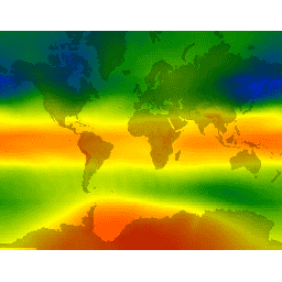
全臭氧测绘光谱仪 (TOMS) 数据是主要的长期连续记录,其中包含基于卫星的观测结果,可用于监测过去 25 年全球和区域总臭氧的变化趋势。这些数据由 NASA 戈达德太空飞行中心的大气实验室生成… 大气 气候 地球物理 nasa 臭氧 -
TRMM 3B42:3 小时降水估计值

热带降雨测量任务 (TRMM) 是 NASA 与日本宇宙航空研究开发机构 (JAXA) 之间的联合任务,旨在监测和研究热带降雨。34B2 产品包含网格化、经过 TRMM 调整的合并红外降水(毫米/小时)和 RMS 降水误差估计值,时间分辨率为 3 小时… 3 小时 气候 地球物理 jaxa nasa 降水 -
TRMM 3B43:月度降水估计值

此合集已不再更新。请参阅 IMERG 月度数据集,该数据集通过算法合并了来自多颗卫星(包括 SSMI、SSMIS、MHS、AMSU-B 和 AMSR-E)的微波数据,每颗卫星都经过了与 TRMM 组合仪器的相互校准。算法 3B43 每月执行一次,以生成单个… 气候 地球物理 jaxa nasa 降水 降雨 -
TerraClimate:全球陆地表面的月度气候和气候水平衡,爱达荷大学

TerraClimate 是一个数据集,其中包含全球陆地表面的月度气候和气候水文平衡数据。该模型使用气候辅助插值,将 WorldClim 数据集中的高空间分辨率气候平均值与 CRU Ts4.0 和日本 55 年再分析 (JRA55) 中的较低空间分辨率但随时间变化的数据相结合。… 气候 干旱 蒸发蒸腾 地球物理 全球 梅赛德 -
气候危害中心 (CHC) 耦合模型比较项目第 6 阶段 (CHC-CMIP6)
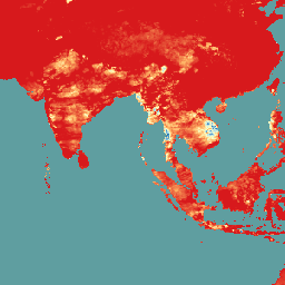
CHC-CMIP6 专门用于支持分析近期的气候相关灾害和近期的气候相关灾害。此气候预测数据集包含观测期(1983 年至 2016 年)和预测期(2030 年和 2050 年)的全球每日网格化数据,可用于识别和… 气候 地球物理 降水 ucsb 天气 -
联合国粮农组织排水有机土壤面积(年度)1.0

关于排水有机土壤的两个相关粮农组织数据集提供了以下估计值:DROSA-A:为农业活动(耕地和放牧草地)而排水的有机土壤面积(以公顷为单位);DROSE-A:有机土壤在…条件下的农业排水产生的碳 (C) 和一氧化二氮 (N2O) 估计值(以千兆克为单位) 农业 气候 气候变化 排放 fao ghg -
VNP21A1D.002:每日 1 公里白天陆地表面温度和发射率
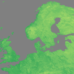
NASA Suomi 国家极地轨道合作伙伴卫星计划 (Suomi NPP) 可见光红外成像辐射计套件 (VIIRS) 地表温度与发射率 (LST&E) 昼间第 1 版产品 (VNP21A1D),系由昼间 2 级格网 (L2G) 中间产品每日汇编而成。L2G 流程可将每日 VNP21 轨道分片数据映射到… 气候 每日 天 陆地 nasa noaa -
VNP21A1N.002:1 公里逐日夜间地表温度与发射率

NASA Suomi 国家极地轨道合作伙伴卫星计划 (Suomi NPP) 可见光红外成像辐射计套件 (VIIRS) 地表温度与发射率 (LST&E) 夜间第 1 版产品 (VNP21A1N),系由夜间 2 级格网 (L2G) 中间产品每日汇编而成。L2G 流程可将每日 VNP21 轨道分片数据映射到… climate daily land nasa night noaa -
WeatherNext 2

WeatherNext 2 是一个实验性数据集,包含由 Google DeepMind 的功能网络生成式天气模型的业务版本生成的全球中期集合天气预报。此实验性数据集包含实时数据和历史数据。实时数据是指与… 气候 预报 gcp-public-data-weathernext 降水 发布者-数据集 温度 -
WeatherNext Gen 预报

WeatherNext Gen 是一个实验性数据集,包含由 Google DeepMind 的基于扩散的集合天气模型的业务版本生成的全球中期集合天气预报。此实验性数据集包含实时数据和历史数据。实时数据是指与不超过… 气候 预报 gcp-public-data-weathernext 降水 发布者-数据集 温度 -
WeatherNext 图表预报

WeatherNext Graph 是一个实验性数据集,包含由 Google DeepMind 的图形神经网络天气模型的业务版本生成的全球中期天气预报。此实验性数据集包含实时数据和历史数据。实时数据是指与不超过… 气候 预报 gcp-public-data-weathernext 降水 发布者-数据集 温度 -
WorldClim BIO 变量 V1

WorldClim V1 Bioclim 提供从月度温度和降雨量中得出的生物气候变量,以生成更具生物学意义的值。生物气候变量表示年度趋势(例如,年平均气温、年降水量)、季节性(例如,气温和降水量的年变化范围)和极端… 伯克利 气候 月度 降水量 温度 天气 -
WorldClim 气候学 V1

WorldClim 版本 1 包含最低温度、平均温度、最高温度和降水量的月度全球平均气候数据。WorldClim 版本 1 由 Robert J. Hijmans、Susan Cameron 和 Juan Parra(加州大学伯克利分校脊椎动物学博物馆),与…合作 伯克利 气候 月度 降水量 温度 天气 -
YCEO 地表城市热岛:像素级年度白天和夜间强度

此数据集包含全球 1 万多个城市群的白天和夜晚的年度、夏季和冬季地表城市热岛 (SUHI) 强度。该数据集是使用 MODIS 8 天 TERRA 和 AQUA 地表温度 (LST) 产品、Landscan 城市范围… 气候 uhi 城市 耶鲁 -
YCEO 地表城市热岛:夏季白天和夜间强度的像素级合成图

此数据集包含全球 1 万多个城市群的白天和夜晚的年度、夏季和冬季地表城市热岛 (SUHI) 强度。该数据集是使用 MODIS 8 天 TERRA 和 AQUA 地表温度 (LST) 产品、Landscan 城市范围… 气候 uhi 城市 耶鲁 -
YCEO 地表城市热岛:冬季白天和夜间强度的像素级年度合成

此数据集包含全球 1 万多个城市群的白天和夜晚的年度、夏季和冬季地表城市热岛 (SUHI) 强度。该数据集是使用 MODIS 8 天 TERRA 和 AQUA 地表温度 (LST) 产品、Landscan 城市范围… 气候 uhi 城市 耶鲁 -
YCEO Surface Urban Heat Islands: Spatially-Averaged Daytime and Nighttime Intensity for Annual, Summer, and Winter

此数据集包含全球 1 万多个城市群的白天和夜晚的年度、夏季和冬季地表城市热岛 (SUHI) 强度。该数据集是使用 MODIS 8 天 TERRA 和 AQUA 地表温度 (LST) 产品、Landscan 城市范围… 气候 uhi 城市 耶鲁 -
YCEO 地表城市热岛:白天和夜间强度的空间平均月度合成图

此数据集包含全球 1 万多个城市群的白天和夜晚的年度、夏季和冬季地表城市热岛 (SUHI) 强度。该数据集是使用 MODIS 8 天 TERRA 和 AQUA 地表温度 (LST) 产品、Landscan 城市范围… 气候 uhi 城市 耶鲁 -
YCEO 地表城市热岛:年度白天和夜间强度的空间平均年度合成

此数据集包含全球 1 万多个城市群的白天和夜晚的年度、夏季和冬季地表城市热岛 (SUHI) 强度。该数据集是使用 MODIS 8 天 TERRA 和 AQUA 地表温度 (LST) 产品、Landscan 城市范围… 气候 uhi 城市 耶鲁
Datasets tagged climate in Earth Engine
[null,null,[],[],["The datasets encompass climate, atmospheric, and environmental monitoring, sourced from institutions like Copernicus, ECMWF, JAXA, and the University of Idaho. Key categories include methane monitoring, featuring high-resolution concentration and emission data from MethaneAIR and Sentinel-5P. Climate reanalysis is provided through ERA5 aggregates. Drought and precipitation are covered by datasets like SPEIbase, GRIDMET, and GSMaP. Atmospheric composition is monitored by CAMS, and climate modeling includes MACAv2-METDATA and TerraClimate. GCOM-C/SGLI measures land and sea surface temperatures. Moreover, there are others datasets, like CHIRPS and WorldClim, that focus on rainfall, temperature, and urban heat island, and datasets provided by NCEP and NASA related to land and atmosphere.\n"]]
