- データセットの可用性
- 2001-01-01T00:00:00Z–2021-01-01T00:00:00Z
- データセット プロバイダ
- 欧州委員会、共同研究センター、Global Wildfire Information System
- タグ
説明
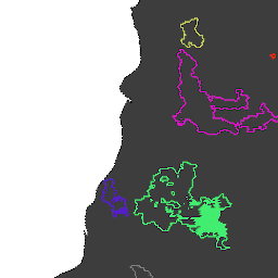
MODIS データセット MCD64A1 に基づく火災境界。このデータは、焼失地域のパッチ間の時空間関係をグラフ構造でエンコードするアルゴリズムに基づいて計算されました。
火災にはそれぞれ、イベントを識別する一意の番号が割り当てられています。
テーブル スキーマ
テーブル スキーマ
| 名前 | 型 | 説明 |
|---|---|---|
| ID | INT | 火災の数値 ID |
| InitialDate | INT | 1970 年 1 月 1 日からのミリ秒単位の初回起動日 |
利用規約
利用規約
引用
引用:
Artés, T.、Oom, D.、De Rigo, D.、Durrant, T. H., Maianti, P.、Libertà, G.、& San-Miguel-Ayanz, J. (2019 年)。火災発生パターンと火災の挙動の分析に使用する、世界規模の山火事データセット。Scientific data、6(1)、1 ~ 11。 doi:10.1038/s41597-019-0312-2
DOI
Earth Engine で探索する
コードエディタ(JavaScript)
// Folder name for a series of tables.
var folder = 'JRC/GWIS/GlobFire/v2/DailyPerimeters';

// List available tables using ee.data.listAssets with asynchronous callback.
function printAssetList(listAssetsOutput) {
  print('Asset list:', listAssetsOutput['assets']);
}
ee.data.listAssets(folder, {}, printAssetList);

// Define a table name (table id) identified from the list of available tables.
var tableName = 'JRC/GWIS/GlobFire/v2/DailyPerimeters/2020';

var computeArea = function(f) {
  return f.set({'area': f.area()});
};

// Import a selected table as a FeatureCollection.
var features = ee.FeatureCollection(tableName).map(computeArea);

// Visualization parameters for linear fire area gradient.
var visParams = {
  palette: ['f5ff64', 'b5ffb4', 'beeaff', 'ffc0e8', '8e8dff', 'adadad'],
  min: 0,
  max: 600000000,
  opacity: 0.8,
};

// Paint fire perimeters to an image using computed fire area as the value property.
var image = ee.Image().float().paint(features, 'area');

// Display the image to the map (include features for exploring with Inspector).
Map.addLayer(image, visParams, 'GlobFire 2020');
Map.addLayer(features, null, 'For Inspector', false);
Map.setCenter(-121.23, 39.7, 12);