Page Summary
-
The dataset provides monthly global vegetation indices at 1km spatial resolution from 2002 to 2025.
-
Key bands include NDVI and EVI, along with detailed quality assurance information and surface reflectance bands.
-
Data has no restrictions on use, sale, or redistribution.
- Dataset Availability
- 2002-07-01T00:00:00Z–2026-06-01T00:00:00Z
- Dataset Producer
- NASA LP DAAC at the USGS EROS Center
- Cadence
- 1 Month
- Tags
Description
The Aqua Moderate Resolution Imaging Spectroradiometer (MODIS) Vegetation Indices (MYD13A3) Version 6.1 data are provided monthly at 1 kilometer (km) spatial resolution as a gridded Level 3 product in the sinusoidal projection. In generating this monthly product, the algorithm ingests all the MYD13A2 products that overlap the month and employs a weighted temporal average.
Documentation:
Bands
Bands
Pixel size: 1000 meters (all bands)
| Name | Units | Min | Max | Scale | Pixel Size | Wavelength | Description | ||||||||||||||||||||||||||||||||||||||||||||||||||||||||||||||||||||||||||||||||||||||||||||
|---|---|---|---|---|---|---|---|---|---|---|---|---|---|---|---|---|---|---|---|---|---|---|---|---|---|---|---|---|---|---|---|---|---|---|---|---|---|---|---|---|---|---|---|---|---|---|---|---|---|---|---|---|---|---|---|---|---|---|---|---|---|---|---|---|---|---|---|---|---|---|---|---|---|---|---|---|---|---|---|---|---|---|---|---|---|---|---|---|---|---|---|---|---|---|---|---|---|---|---|
NDVI |
-2000 | 10000 | 0.0001 | 1000 meters | None | Monthly NDVI average |
|||||||||||||||||||||||||||||||||||||||||||||||||||||||||||||||||||||||||||||||||||||||||||||
EVI |
-2000 | 10000 | 0.0001 | 1000 meters | None | Monthly EVI average |
|||||||||||||||||||||||||||||||||||||||||||||||||||||||||||||||||||||||||||||||||||||||||||||
DetailedQA |
1000 meters | None | VI Quality indicators |
||||||||||||||||||||||||||||||||||||||||||||||||||||||||||||||||||||||||||||||||||||||||||||||||
sur_refl_b01 |
0 | 10000 | 0.0001 | 1000 meters | 620-670nm | Surface reflectance band 1 (red) |
|||||||||||||||||||||||||||||||||||||||||||||||||||||||||||||||||||||||||||||||||||||||||||||
sur_refl_b02 |
0 | 10000 | 0.0001 | 1000 meters | 841-876nm | Surface reflectance band 2 (near-infrared) |
|||||||||||||||||||||||||||||||||||||||||||||||||||||||||||||||||||||||||||||||||||||||||||||
sur_refl_b03 |
0 | 10000 | 0.0001 | 1000 meters | 459-479nm | Surface reflectance band 3 (blue) |
|||||||||||||||||||||||||||||||||||||||||||||||||||||||||||||||||||||||||||||||||||||||||||||
sur_refl_b07 |
0 | 10000 | 0.0001 | 1000 meters | 2105-2155nm | Surface reflectance band 7 (mid-infrared) |
|||||||||||||||||||||||||||||||||||||||||||||||||||||||||||||||||||||||||||||||||||||||||||||
ViewZenith |
deg | 0 | 18000 | 0.01 | 1000 meters | None | View zenith angle of VI Pixel |
||||||||||||||||||||||||||||||||||||||||||||||||||||||||||||||||||||||||||||||||||||||||||||
SolarZenith |
deg | 0 | 18000 | 0.01 | 1000 meters | None | Sun zenith angle of VI pixel |
||||||||||||||||||||||||||||||||||||||||||||||||||||||||||||||||||||||||||||||||||||||||||||
RelativeAzimuth |
deg | -18000 | 18000 | 0.01 | 1000 meters | None | Relative azimuth angle of VI pixel |
||||||||||||||||||||||||||||||||||||||||||||||||||||||||||||||||||||||||||||||||||||||||||||
SummaryQA |
1000 meters | None | Quality reliability of VI pixel |
||||||||||||||||||||||||||||||||||||||||||||||||||||||||||||||||||||||||||||||||||||||||||||||||
SummaryQA Class Table
| Value | Color | Description |
|---|---|---|
| 0 | None | Good Data: use with confidence |
| 1 | None | Marginal Data: useful, but look at other QA information |
| 2 | None | Snow/Ice: target covered with snow/ice |
| 3 | None | Cloudy: target not visible, covered with cloud |
Terms of Use
Terms of Use
MODIS data and products acquired through the LP DAAC have no restrictions on subsequent use, sale, or redistribution.
Citations
Please visit LP DAAC 'Citing Our Data' page for information on citing LP DAAC datasets.
DOIs
Explore with Earth Engine
Code Editor (JavaScript)
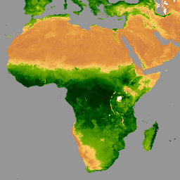
var dataset = ee.ImageCollection('MODIS/061/MYD13A3')
                  .filter(ee.Filter.date('2020-01-01', '2023-05-01'));
var ndvi = dataset.select('NDVI');
var ndviVis = {
  min: 0,
  max: 9000,
  palette: [
    'ffffff', 'ce7e45', 'df923d', 'f1b555', 'fcd163', '99b718', '74a901',
    '66a000', '529400', '3e8601', '207401', '056201', '004c00', '023b01',
    '012e01', '011d01', '011301'
  ],
};
Map.setCenter(6.746, 46.529, 2);
Map.addLayer(ndvi, ndviVis, 'NDVI');