- 데이터 세트 제공
- 1979-01-01T13:00:00Z–2025-12-13T12:00:00Z
- 데이터 세트 제공업체
- NASA Goddard Space Flight Center의 NASA GES DISC
- 케이던스
- 1시간
- 태그
설명
토지 데이터 동화 시스템 (LDAS)은 여러 관측 소스 (예: 강수량 측정기 데이터, 위성 데이터, 레이더 강수량 측정)를 결합하여 지구 표면 또는 그 근처의 기후학적 속성을 추정합니다.
이 데이터 세트는 북미 육지 데이터 동화 시스템(NLDAS-2) 2단계의 기본 강제 파일(파일 A)입니다. 데이터는 1/8도 그리드 간격으로 제공되며 시간 해상도는 시간별입니다.
NLDAS는 NOAA/NCEP의 환경 모델링 센터 (EMC), NASA의 고다드 우주 비행 센터 (GSFC), 프린스턴 대학교, 워싱턴 대학교, NOAA/NWS 수문 개발 사무소 (OHD), NOAA/NCEP 기후 예측 센터 (CPC) 등 여러 그룹 간의 공동 프로젝트입니다. NLDAS는 NOAA의 미주 기후 예측 프로그램(CPPA)의 지원을 받는 핵심 프로젝트입니다.
문서:
대역
픽셀 크기
13915미터
대역
| 이름 | 단위 | 최소 | 최대 | 픽셀 크기 | 설명 |
|---|---|---|---|---|---|
temperature |
°C | -49.79* | 51.2* | 미터 | 지표면 위 2m의 기온 |
specific_humidity |
질량 분율 | 0* | 0.02* | 미터 | 지표면 위 2m에서의 비습 |
pressure |
Pa | 61847.6* | 105338* | 미터 | 표면 기압 |
wind_u |
m/s | -27.93* | 27.54* | 미터 | 지표면 위 10m에서의 U 풍속 구성요소 |
wind_v |
m/s | -27.45* | 35.13* | 미터 | 지표면 위 10m에서의 V 바람 구성요소 |
longwave_radiation |
W/m^2 | 72.18* | 545.11* | 미터 | 표면 하향 장파 복사 |
convective_fraction |
0* | 1* | 미터 | 대류성 총 강수량의 비율: NARR에서 가져옴 |
|
potential_energy |
J/kg | 0* | 76666.2* | 미터 | 대류 가용 위치 에너지 (J/kg): NARR에서 가져옴 |
potential_evaporation |
kg/m^2 | 0* | 2.76* | 미터 | 잠재적 증발: NARR에서 |
total_precipitation |
kg/m^2 | 0* | 124.19* | 미터 | 시간별 총 강수량 |
shortwave_radiation |
W/m^2 | 0* | 1368.54* | 미터 | 표면 하향 단파 복사 - 편향 수정 |
이미지 속성
이미지 속성
| 이름 | 유형 | 설명 |
|---|---|---|
| end_hour | DOUBLE | 종료 시간 |
| start_hour | DOUBLE | 시작 시간 |
이용약관
이용약관
GES DISC (Goddard Earth Sciences Data and Information Services Center)의 데이터 배포는 NASA의 SMD (Science Mission Directorate)의 지원을 받습니다. NASA 지구과학 데이터 및 정보 정책에 따라 GES DISC 보관 파일의 데이터는 사용자 커뮤니티에 무료로 제공됩니다. 자세한 내용은 GES DISC 데이터 정책 페이지를 참고하세요.
인용
데이터를 사용할 때는 데이터 세트 소스를 적절하게 인용해야 합니다. 공식 참조는 다음과 같은 형식으로 표시합니다. \<저자\\>, 2012년, 2013년 최종 업데이트: \
. NASA/GSFC, Greenbelt, MD, USA, NASA GES DISC (Goddard Earth Sciences Data and Information Services Center). 액세스 데이터 \ </저자\\>\<doi\\> 출처, Parsons 외., 2010년, doi:10.1029/2010EO340001.</doi\\>
Earth Engine으로 탐색
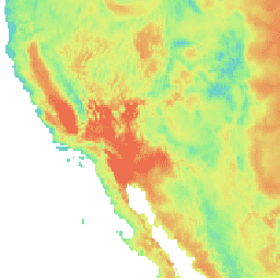
코드 편집기(JavaScript)
var dataset = ee.ImageCollection('NASA/NLDAS/FORA0125_H002')
                  .filter(ee.Filter.date('2018-07-01', '2018-07-30'));
var temperature = dataset.select('temperature');
var temperatureVis = {
  min: -5.0,
  max: 40.0,
  palette: ['3d2bd8', '4e86da', '62c7d8', '91ed90', 'e4f178', 'ed6a4c'],
};
Map.setCenter(-110.21, 35.1, 4);
Map.addLayer(temperature, temperatureVis, 'Temperature');