캐나다 디지털 고도 모델 (CDEM)은 캐나다 천연자원부 (NRCan)의 고도계 시스템의 일부이며 기존 캐나다 디지털 고도 데이터 (CDED)에서 파생되었습니다. 이러한 데이터에서 고도는 지면 또는 반사 표면 고도일 수 있습니다. CDEM은 해상도가 다양한 여러 DEM으로 구성됩니다. 이러한 값은 …에 따라 다릅니다.
[null,null,[],[[["\u003cp\u003eThe Canadian Digital Elevation Model (CDEM) provides elevation data for Canada, stemming from the Canadian Digital Elevation Data (CDED).\u003c/p\u003e\n"],["\u003cp\u003eCDEM is comprised of multiple DEMs with varying resolutions, based on latitude, with a base resolution of 0.75 arc-seconds.\u003c/p\u003e\n"],["\u003cp\u003eElevations in the CDEM represent either ground or reflective surface elevations and range from approximately -226 meters to 5944 meters.\u003c/p\u003e\n"],["\u003cp\u003eThe dataset is available from 1945 to 2011 and is licensed under the Open Government Licence - Canada.\u003c/p\u003e\n"],["\u003cp\u003eCDEM can be accessed and analyzed using Google Earth Engine.\u003c/p\u003e\n"]]],["The Canadian Digital Elevation Model (CDEM), provided by NRCan, offers elevation data from 1945-01-01T00:00:00Z to 2011-01-01T00:00:00Z. It contains ground or reflective surface elevations, comprised of multiple DEMs with varying resolutions based on latitude. Data, accessible via Earth Engine, is licensed under the Open Government Licence - Canada, with a pixel size of 23.19 meters. The dataset includes an \"elevation\" band with values ranging from -226 to 5944 meters.\n"],null,["# Canadian Digital Elevation Model\n\nDataset Availability\n: 1945-01-01T00:00:00Z--2011-01-01T00:00:00Z\n\nDataset Provider\n:\n\n\n [NRCan](https://open.canada.ca/data/en/dataset/7f245e4d-76c2-4caa-951a-45d1d2051333)\n\nTags\n:\n [canada](/earth-engine/datasets/tags/canada) [dem](/earth-engine/datasets/tags/dem) [elevation](/earth-engine/datasets/tags/elevation) [elevation-topography](/earth-engine/datasets/tags/elevation-topography) [geophysical](/earth-engine/datasets/tags/geophysical) [topography](/earth-engine/datasets/tags/topography) \n cdem \nnrcan \n\n#### Description\n\nThe Canadian Digital Elevation Model (CDEM) is part of Natural Resources\nCanada's (NRCan) altimetry system and stems from the existing Canadian\nDigital Elevation Data (CDED). In these data, elevations can be either\nground or reflective surface elevations.\n\nThe CDEM is comprised of multiple DEMs with varying resolutions. These\nvary according to latitude and have a base resolution of 0.75 arc-seconds.\nFor more information see the [Product Specifications](https://ftp.geogratis.gc.ca/pub/nrcan_rncan/elevation/cdem_mnec/doc/CDEM_product_specs.pdf)\n\nContains information licensed under the\n[Open Government Licence - Canada](https://open.canada.ca/en/open-government-licence-canada).\n\n### Bands\n\n\n**Pixel Size**\n\n23.19 meters\n\n**Bands**\n\n| Name | Units | Min | Max | Pixel Size | Description |\n|-------------|-------|--------|--------|------------|-------------|\n| `elevation` | m | -226\\* | 5944\\* | meters | Elevation |\n\n\\* estimated min or max value\n\n### Terms of Use\n\n**Terms of Use**\n\nLicensed under the\n[Open Government Licence - Canada](https://open.canada.ca/en/open-government-licence-canada).\n\n### Explore with Earth Engine\n\n| **Important:** Earth Engine is a platform for petabyte-scale scientific analysis and visualization of geospatial datasets, both for public benefit and for business and government users. Earth Engine is free to use for research, education, and nonprofit use. To get started, please [register for Earth Engine access.](https://console.cloud.google.com/earth-engine)\n\n### Code Editor (JavaScript)\n\n```javascript\n
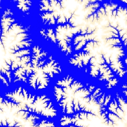
var dataset = ee.ImageCollection('NRCan/CDEM');\nvar elevation = dataset.select('elevation');\nvar elevationVis = {\n min: -50.0,\n max: 1500.0,\n palette: ['0905ff', 'ffefc4', 'ffffff'],\n};\nMap.setCenter(-139.3643, 63.3213, 9);\nMap.addLayer(elevation, elevationVis, 'Elevation');\n```\n[Open in Code Editor](https://code.earthengine.google.com/?scriptPath=Examples:Datasets/NRCan/NRCan_CDEM) \n[Canadian Digital Elevation Model](/earth-engine/datasets/catalog/NRCan_CDEM) \nThe Canadian Digital Elevation Model (CDEM) is part of Natural Resources Canada's (NRCan) altimetry system and stems from the existing Canadian Digital Elevation Data (CDED). In these data, elevations can be either ground or reflective surface elevations. The CDEM is comprised of multiple DEMs with varying resolutions. These vary according ... \nNRCan/CDEM, canada,dem,elevation,elevation-topography,geophysical,topography \n1945-01-01T00:00:00Z/2011-01-01T00:00:00Z \n41 -142 84 -52 \nGoogle Earth Engine \nhttps://developers.google.com/earth-engine/datasets\n\n- [](https://doi.org/https://open.canada.ca/data/en/dataset/7f245e4d-76c2-4caa-951a-45d1d2051333)\n- [](https://doi.org/https://developers.google.com/earth-engine/datasets/catalog/NRCan_CDEM)"]]