The United States Census Bureau TIGER dataset contains the 2018 boundaries
for primary legal divisions of US states. In most states, these entities
are termed "counties". In Louisiana, these divisions are known as
"parishes".
Alaska has governmental entities called "boroughs" which fill a similar
governmental role to counties, but in some areas those governmental
responsibilities are handled directly by the state and sometimes by a city.
For Alaska, county equivalent entities thus include
organized boroughs,
combined city and borough entities (e.g. Juneau),
municipalities, and
census areas.
The census areas are delineated cooperatively for statistical purposes by
the State of Alaska and the Census Bureau.
In four states (Maryland, Missouri, Nevada, and Virginia), there are one
or more incorporated places that are independent of any county
organization and thus constitute primary divisions of their states. These
incorporated places are known as independent cities and are treated as
county-equivalent entities for purposes of data presentation.
The District of Columbia and Guam have no primary divisions and each area is
considered a county-equivalent entity for purposes of data presentation.
The Census Bureau treats the following entities as equivalents of counties
for purposes of data presentation: municipios in Puerto Rico, districts
and islands in America Samoa, municipalities in the Commonwealth of the
Northern Mariana Islands, and islands in the U.S. Virgin Islands.
Metropolitan statistical area/micropolitan statistical area code
CLASSFP
STRING
FIPS class code
COUNTYFP
STRING
County FIPS code
COUNTYNS
STRING
County GNIS code
CSAFP
STRING
Combined statistical area code
FUNCSTAT
STRING
Functional Status
GEOID
STRING
County identifier; a concatenation of state FIPS code and county FIPS code
INTPTLAT
STRING
Internal point latitude
INTPTLON
STRING
Internal point longitude
LSAD
STRING
Legal/statistical area description for the county
METDIVFP
STRING
Metropolitan division code
MTFCC
STRING
MAF/TIGER feature class code (=G4020)
NAME
STRING
County name
NAMELSAD
STRING
Name and the translated legal/statistical area description for the county
STATEFP
STRING
State FIPS code
Terms of Use
Terms of Use
The U.S. Census Bureau offers some of its public data
in machine-readable format via an Application Programming Interface
(API). All of the content, documentation, code and related materials
made available through the API are subject to these terms and
conditions.
Citations
Citations:
For the creation of any reports, publications, new data sets, derived
products, or services resulting from the data set, users should
cite the US Census Bureau.
The United States Census Bureau TIGER dataset contains the 2018 boundaries for primary legal divisions of US states. In most states, these entities are termed "counties". In Louisiana, these divisions are known as "parishes". Alaska has governmental entities called "boroughs" which fill a similar governmental role to counties, but in …
[null,null,[],[[["\u003cp\u003eThe TIGER/2018/Counties dataset provides 2018 boundaries for US counties and county equivalents (parishes, boroughs, etc.) from the US Census Bureau.\u003c/p\u003e\n"],["\u003cp\u003eThe dataset includes attributes like land and water area, FIPS codes, geographic identifiers, and names.\u003c/p\u003e\n"],["\u003cp\u003eUsers can access the dataset as a FeatureCollection or a FeatureView for efficient visualization and analysis in Earth Engine.\u003c/p\u003e\n"],["\u003cp\u003eThe dataset is available for the period of 2018-01-01 to 2019-01-01 and is subject to US Census Bureau terms of use.\u003c/p\u003e\n"],["\u003cp\u003eProper citation to the US Census Bureau is required when using this data in publications or derived products.\u003c/p\u003e\n"]]],["The TIGER dataset from the US Census Bureau provides 2018 boundaries for primary legal divisions within US states, typically called \"counties\" but also including parishes, boroughs, and other equivalent entities. The data, accessible via Earth Engine, is available from 2018-01-01T00:00:00Z to 2019-01-01T00:00:00Z. It can be visualized as a `FeatureCollection` or a `FeatureView` layer. Code examples demonstrate how to display the data and use specific visualization parameters. The data includes various attributes like land area, water area, FIPS codes, and county names.\n"],null,["# TIGER: US Census Counties 2018\n\nDataset Availability\n: 2018-01-01T00:00:00Z--2019-01-01T00:00:00Z\n\nDataset Provider\n:\n\n\n [United States Census Bureau](https://www.census.gov/programs-surveys/geography/guidance/tiger-data-products-guide.html)\n\nTags\n:\n[census](/earth-engine/datasets/tags/census) [county](/earth-engine/datasets/tags/county) [infrastructure-boundaries](/earth-engine/datasets/tags/infrastructure-boundaries) [table](/earth-engine/datasets/tags/table) [tiger](/earth-engine/datasets/tags/tiger) [us](/earth-engine/datasets/tags/us) \n\n#### Description\n\nThe United States Census Bureau TIGER dataset contains the 2018 boundaries\nfor primary legal divisions of US states. In most states, these entities\nare termed \"counties\". In Louisiana, these divisions are known as\n\"parishes\".\n\nAlaska has governmental entities called \"boroughs\" which fill a similar\ngovernmental role to counties, but in some areas those governmental\nresponsibilities are handled directly by the state and sometimes by a city.\nFor Alaska, county equivalent entities thus include\n\n1. organized boroughs,\n2. combined city and borough entities (e.g. Juneau),\n3. municipalities, and\n4. census areas.\n\nThe census areas are delineated cooperatively for statistical purposes by\nthe State of Alaska and the Census Bureau.\n\nIn four states (Maryland, Missouri, Nevada, and Virginia), there are one\nor more incorporated places that are independent of any county\norganization and thus constitute primary divisions of their states. These\nincorporated places are known as independent cities and are treated as\ncounty-equivalent entities for purposes of data presentation.\n\nThe District of Columbia and Guam have no primary divisions and each area is\nconsidered a county-equivalent entity for purposes of data presentation.\nThe Census Bureau treats the following entities as equivalents of counties\nfor purposes of data presentation: municipios in Puerto Rico, districts\nand islands in America Samoa, municipalities in the Commonwealth of the\nNorthern Mariana Islands, and islands in the U.S. Virgin Islands.\n\nFor full technical details on all TIGER 2018 products, see the [TIGER\ntechnical documentation](https://www2.census.gov/geo/pdfs/maps-data/data/tiger/tgrshp2018/TGRSHP2018_TechDoc.pdf).\n\n### Table Schema\n\n**Table Schema**\n\n| Name | Type | Description |\n|----------|--------|----------------------------------------------------------------------------|\n| ALAND | DOUBLE | Land area |\n| AWATER | DOUBLE | Water area |\n| CBSAFP | STRING | Metropolitan statistical area/micropolitan statistical area code |\n| CLASSFP | STRING | FIPS class code |\n| COUNTYFP | STRING | County FIPS code |\n| COUNTYNS | STRING | County GNIS code |\n| CSAFP | STRING | Combined statistical area code |\n| FUNCSTAT | STRING | Functional Status |\n| GEOID | STRING | County identifier; a concatenation of state FIPS code and county FIPS code |\n| INTPTLAT | STRING | Internal point latitude |\n| INTPTLON | STRING | Internal point longitude |\n| LSAD | STRING | Legal/statistical area description for the county |\n| METDIVFP | STRING | Metropolitan division code |\n| MTFCC | STRING | MAF/TIGER feature class code (=G4020) |\n| NAME | STRING | County name |\n| NAMELSAD | STRING | Name and the translated legal/statistical area description for the county |\n| STATEFP | STRING | State FIPS code |\n\n### Terms of Use\n\n**Terms of Use**\n\nThe U.S. Census Bureau offers some of its public data\nin machine-readable format via an Application Programming Interface\n(API). All of the content, documentation, code and related materials\nmade available through the API are subject to [these terms and\nconditions](https://www.census.gov/data/developers/about/terms-of-service.html).\n\n### Citations\n\nCitations:\n\n- For the creation of any reports, publications, new data sets, derived\n products, or services resulting from the data set, users should\n [cite the US Census Bureau](https://www.census.gov/about/policies/citation.html).\n\n### Explore with Earth Engine\n\n| **Important:** Earth Engine is a platform for petabyte-scale scientific analysis and visualization of geospatial datasets, both for public benefit and for business and government users. Earth Engine is free to use for research, education, and nonprofit use. To get started, please [register for Earth Engine access.](https://console.cloud.google.com/earth-engine)\n\n### Code Editor (JavaScript)\n\n```javascript\n
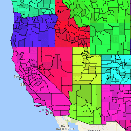
var dataset = ee.FeatureCollection('TIGER/2018/Counties');\nvar visParams = {\n palette: ['purple', 'blue', 'green', 'yellow', 'orange', 'red'],\n min: 0,\n max: 50,\n opacity: 0.8,\n};\n\n// Turn the strings into numbers\ndataset = dataset.map(function (f) {\n return f.set('STATEFP', ee.Number.parse(f.get('STATEFP')));\n});\n\nvar image = ee.Image().float().paint(dataset, 'STATEFP');\nvar countyOutlines = ee.Image().float().paint({\n featureCollection: dataset,\n color: 'black',\n width: 1\n});\n\nMap.setCenter(-99.844, 37.649, 5);\nMap.addLayer(image, visParams, 'TIGER/2018/Counties');\nMap.addLayer(countyOutlines, {}, 'county outlines');\nMap.addLayer(dataset, null, 'for Inspector', false);\n```\n[Open in Code Editor](https://code.earthengine.google.com/?scriptPath=Examples:Datasets/TIGER/TIGER_2018_Counties)\n\n### Visualize as a FeatureView\n\n\nA `FeatureView` is a view-only, accelerated representation of a\n`FeatureCollection`. For more details, visit the\n[`FeatureView` documentation.](/earth-engine/guides/featureview_overview)\n| **Important:** Earth Engine is a platform for petabyte-scale scientific analysis and visualization of geospatial datasets, both for public benefit and for business and government users. Earth Engine is free to use for research, education, and nonprofit use. To get started, please [register for Earth Engine access.](https://console.cloud.google.com/earth-engine)\n\n### Code Editor (JavaScript)\n\n```javascript\nvar fvLayer = ui.Map.FeatureViewLayer('TIGER/2018/Counties_FeatureView');\n\nvar visParams = {\n opacity: 1,\n polygonStrokeColor: 'black',\n polygonFillColor: {\n property: 'STATEFP',\n categories: [\n ['08', 'purple'], // Colorado counties\n ['32', 'blue'] // Nevada counties\n ],\n defaultValue: 'white'\n }\n};\n\nfvLayer.setVisParams(visParams);\nfvLayer.setName('US census counties (FV)');\n\nMap.setCenter(-99.844, 37.649, 5);\nMap.add(fvLayer);\n```\n[Open in Code Editor](https://code.earthengine.google.com/?scriptPath=Examples:Datasets/TIGER/TIGER_2018_Counties_FeatureView) \n[TIGER: US Census Counties 2018](/earth-engine/datasets/catalog/TIGER_2018_Counties) \nThe United States Census Bureau TIGER dataset contains the 2018 boundaries for primary legal divisions of US states. In most states, these entities are termed \"counties\". In Louisiana, these divisions are known as \"parishes\". Alaska has governmental entities called \"boroughs\" which fill a similar governmental role to counties, but in ... \nTIGER/2018/Counties, census,county,infrastructure-boundaries,table,tiger,us \n2018-01-01T00:00:00Z/2019-01-01T00:00:00Z \n-14.69 -180 71.567 -64.435 \nGoogle Earth Engine \nhttps://developers.google.com/earth-engine/datasets\n\n- [](https://doi.org/https://www.census.gov/programs-surveys/geography/guidance/tiger-data-products-guide.html)\n- [](https://doi.org/https://developers.google.com/earth-engine/datasets/catalog/TIGER_2018_Counties)"]]