Aqueduct Floods 데이터는 현재 기준 조건과 2030년, 2050년, 2080년의 미래 예측에 따라 하천 및 해안 지역의 홍수 위험을 측정합니다.
Aqueduct Floods는 위험 지도를 제공하고 위험을 평가하는 것 외에도 제방 홍수 방지 전략의 가치를 평가하기 위해 포괄적인 비용 편익 분석을 수행하는 데 도움이 됩니다.
Aqueduct Floods는 재해 위험 분석가와 관리자에게 식량 위험 및 적응 전략 비용에 관한 정량적 정보를 제공하고 정책 및 투자 의사 결정을 지원하는 것을 목표로 합니다.
Google Earth Engine팀 권장사항:
이 데이터 세트는 다음 용도로 사용할 수 있습니다.
대규모 지역 분석: 미국 카운티 수준 / 대도시 크기의 넓은 지역에 대한 광범위한 위험은 무엇인가요?
예비 평가: 정확한 범람원 침수 지도가 필요하지 않고 하천 방류량의 잠재적 변화를 지역 규모로 신속하게 '첫눈'에 파악해야 하는 경우
상대적 변화: 다양한 기후 시나리오를 살펴보므로 영향의 크기 변화를 일반화하는 데 사용할 수 있습니다.
이 데이터 세트는 다음 용도로 사용하면 안 됩니다.
자세한 홍수 침수 매핑: 특정 속성 위험을 확인하는 등
평평한 저지대 강: 방정식의 단순화는 범람원에서 많이 발생하는 역류 효과 (물이 뒤로 흐르는 현상)를 고려하지 않습니다.
수력 구조 분석: 상당한 배수 효과를 유발하는 교량, 제방, 보와 같은 구조의 구체적인 영향을 평가하는 데는 적합하지 않습니다.
사용된 방법에 관한 자세한 내용은 데이터 제공업체의 기술 참고사항을 참고하고 이 데이터가 애플리케이션에 적합한지 확인하세요.
Aqueduct Floods 데이터는 현재 기준 조건과 2030년, 2050년, 2080년의 미래 예측에 따라 하천 및 해안 지역의 홍수 위험을 측정합니다. Aqueduct Floods는 위험 지도를 제공하고 위험을 평가하는 것 외에도 제방 홍수 방지 전략의 가치를 평가하기 위한 포괄적인 비용 편익 분석을 수행하는 데 도움이 됩니다. 수도교 홍수 …
[null,null,[],[[["\u003cp\u003eThe Aqueduct Floods dataset provides riverine and coastal flood risk data under current and future scenarios (2030, 2050, 2080).\u003c/p\u003e\n"],["\u003cp\u003eIt includes hazard maps, risk assessments, and supports cost-benefit analysis for flood protection strategies.\u003c/p\u003e\n"],["\u003cp\u003eThe dataset covers a period from 2010 to 2080, with global coverage at a 1000-meter resolution.\u003c/p\u003e\n"],["\u003cp\u003eData is freely available for use with attribution to the World Resources Institute (WRI).\u003c/p\u003e\n"],["\u003cp\u003eThe dataset can be accessed and analyzed using Google Earth Engine.\u003c/p\u003e\n"]]],["The Aqueduct Floods dataset, provided by the World Resources Institute, measures riverine and coastal flood risks from 2010 to 2080, including future projections for 2030, 2050, and 2080. It offers flood hazard maps, risk assessments, and cost-benefit analyses for dike protection. Data includes inundation depth and is available in a Google Earth Engine ImageCollection. Users can conduct comprehensive analyses using various flood types, climate scenarios, and sea-level rise projections. The dataset is free to use, with proper attribution to WRI.\n"],null,["# WRI Aqueduct Floods Hazard Maps Version 2\n\nDataset Availability\n: 2010-01-01T00:00:00Z--2080-12-31T23:59:59Z\n\nDataset Provider\n:\n\n\n [World Resources Institute](https://www.wri.org/research/aqueduct-floods-methodology)\n\nTags\n:\n[flood](/earth-engine/datasets/tags/flood) [monitoring](/earth-engine/datasets/tags/monitoring) [surface-ground-water](/earth-engine/datasets/tags/surface-ground-water) [wri](/earth-engine/datasets/tags/wri) \n\n#### Description\n\nAqueduct Floods data measures riverine and coastal food risks under both\ncurrent baseline conditions and future projections in 2030, 2050, and 2080.\nIn addition to providing hazard maps and assessing risks, Aqueduct Floods\nhelps to conduct comprehensive cost-benefit analysis to evaluate the value\nof dike flood protection strategies.\n\nAqueduct Floods aims to empower disaster risk analysts and managers with\nquantitative information on food risks and adaptation strategy costs, and to\nhelp inform policy and investment decision-making.\n\nGoogle Earth Engine team recommendation:\n\nThis dataset can be used for:\n\n- Larger scale regional analysis: what is the broad risk to the big area of the size of a US county level / large city?\n- Preliminary assessments: when you need a quick, regional-scale \"first look\" at potential changes in river discharge without needing precise floodplain inundation maps.\n- Relative changes: This looks at different climate scenarios so can be used for generalized changes in magnitude of impacts\n\nThis dataset should not be used for:\n\n- Detailed flood inundation mapping: such as looking at properties specific risk\n- Flat, lowland rivers: the simplification of the equations do not take into account backwater effects (water flowing backwards) which happens a lot in flood plains\n- Analyzing hydraulic structures: it is not suitable for assessing the specific impact of structures like bridges, levees, or weirs that cause significant backwater effects\n\nPlease see\n[the technical note](https://files.wri.org/d8/s3fs-public/aqueduct-floods-methodology.pdf)\nfrom data provider for full details on the methods used and to\nunderstand if this data is right for your application.\n\n### Bands\n\n\n**Pixel Size**\n\n1000 meters\n\n**Bands**\n\n| Name | Units | Min | Max | Pixel Size | Description |\n|--------------------|-------|-----|---------|------------|------------------------|\n| `inundation_depth` | m | 0\\* | 32.05\\* | meters | Flood inundation depth |\n\n\\* estimated min or max value\n\n### Image Properties\n\n**Image Properties**\n\n| Name | Type | Description |\n|-----------------|--------|-----------------------------------------------------------------------------------------------------------------------------------------------------------------------------------------------------------------------------------------------------------------------------------------------------------------------------------------------------------------------------------------------------------------|\n| climatescenario | STRING | Climate Scenario types: - historical: Baseline condition/ no climate scenario needed - rcp4p5: Representative Concentration Pathway 4.5 (steady carbon emissions) - rcp8p5: Representative Concentration Pathway 8.5 (rising carbon emissions) |\n| floodtype | STRING | Type of Flood: - inuncoast: Coastal flood hazard - inunriver: Riverine flood hazard |\n| projection | INT | Sea level rise scenario (in percentile) - 5: A low sea level rise scenario - 50: The median sea level rise projection - 95: A high sea level rise scenario |\n| returnperiod | INT | Return period is the average time interval expected between hazard events of a given magnitude or greater (in years). The flood hazard maps are generated for return periods of 1, 2, 5, 10, 25, 50, 100, 250, 500, and 1000 years. |\n| subsidence | STRING | Applies only for inuncoast flood type - nosub: Subsidence not included in projection - wtsub: Subsidence included in projection |\n| model | STRING | Applies only for inunriver flood type, represents type of model used. - 000000000WATCH: Baseline condition - 00000NorESM1-M: (GCM model) Bjerknes Centre for Climate Research, Norwegian Meteorological Institute - 0000GFDL_ESM2M: (GCM model) Geophysical Fluid Dynamics Laboratory (NOAA) - 0000HadGEM2-ES: (GCM model) Met Office Hadley Centre - 00IPSL-CM5A-LR: (GCM model) Institut Pierre Simon Laplace |\n| year | INT | Flood occurence year |\n\n### Terms of Use\n\n**Terms of Use**\n\nThe WRI datasets are available without restriction\non use or distribution. WRI does request that the\nuser give proper attribution and identify WRI, where applicable,\nas the source of the data. For more information check\n[WRI's open data commitment](https://www.wri.org/data/open-data-commitment),\n\n### Explore with Earth Engine\n\n| **Important:** Earth Engine is a platform for petabyte-scale scientific analysis and visualization of geospatial datasets, both for public benefit and for business and government users. Earth Engine is free to use for research, education, and nonprofit use. To get started, please [register for Earth Engine access.](https://console.cloud.google.com/earth-engine)\n\n### Code Editor (JavaScript)\n\n```javascript\n
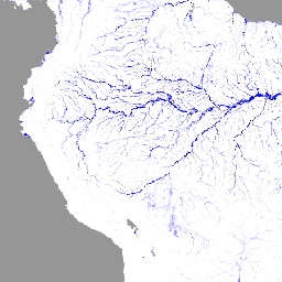
var dataset = ee.ImageCollection('WRI/Aqueduct_Flood_Hazard_Maps/V2');\nvar inundationDepth = dataset.select('inundation_depth');\nvar inundationDepthVis = {\n min: 0,\n max: 1,\n palette: ['ffffff','0000ff'],\n};\nMap.setCenter(-68.36, -6.73, 4);\nMap.addLayer(inundationDepth, inundationDepthVis, 'Aqueduct Flood Hazard Maps');\n```\n[Open in Code Editor](https://code.earthengine.google.com/?scriptPath=Examples:Datasets/WRI/WRI_Aqueduct_Flood_Hazard_Maps_V2) \n[WRI Aqueduct Floods Hazard Maps Version 2](/earth-engine/datasets/catalog/WRI_Aqueduct_Flood_Hazard_Maps_V2) \nAqueduct Floods data measures riverine and coastal food risks under both current baseline conditions and future projections in 2030, 2050, and 2080. In addition to providing hazard maps and assessing risks, Aqueduct Floods helps to conduct comprehensive cost-benefit analysis to evaluate the value of dike flood protection strategies. Aqueduct Floods ... \nWRI/Aqueduct_Flood_Hazard_Maps/V2, flood,monitoring,surface-ground-water,wri \n2010-01-01T00:00:00Z/2080-12-31T23:59:59Z \n-90 -180 90 180 \nGoogle Earth Engine \nhttps://developers.google.com/earth-engine/datasets\n\n- [](https://doi.org/https://www.wri.org/research/aqueduct-floods-methodology)\n- [](https://doi.org/https://developers.google.com/earth-engine/datasets/catalog/WRI_Aqueduct_Flood_Hazard_Maps_V2)"]]