-
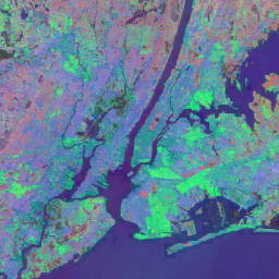
Répartition mondiale des forêts de mangroves, version 1 (2000)
La base de données a été préparée à l'aide de données satellitaires Landsat data de l'année 2000. Plus de 1 000 scènes Landsat obtenues auprès du Centre d'observation et de recherche sur les ressources terrestres (EROS) de l'USGS ont été classées à l'aide de techniques de classification d'images numériques supervisées et non supervisées hybrides. Cette base de données est la première, la plus complète et la plus … annuel ciesin biomasse forestière mondial dérivé de Landsat mangrove -
Historique annuel de la classification de l'eau du JRC, version 1.4
Cet ensemble de données contient des cartes de l'emplacement et de la distribution temporelle des eaux de surface de 1984 à 2021, et fournit des statistiques sur l'étendue et l'évolution de ces surfaces d'eau. Pour en savoir plus, consultez l'article de revue associé: High-resolution mapping of global surface water and its … annuel géophysique Google historique JRC dérivé de Landsat -
MOD44B.061 Terra Vegetation Continuous Fields Yearly Global 250m
Le produit Terra MODIS Vegetation Continuous Fields (VCF) est une représentation au niveau des sous-pixels des estimations de la couverture végétale de surface à l'échelle mondiale. Conçu pour représenter en continu la surface terrestre de la Terre en tant que proportion de caractéristiques de végétation de base, il fournit une gradation de trois composants de couverture de surface: pourcentage de couverture arboricole, pourcentage de … annuel géophysique mondial occupation des sols modis nasa -
Open Buildings Temporal V1
L'ensemble de données temporels Open Buildings 2,5D contient des données sur la présence de bâtiments, le nombre fractionnaire de bâtiments et la hauteur des bâtiments à une résolution spatiale effective1 de 4 m (les rasters sont fournis à une résolution de 0,5 m) à une cadence annuelle de 2016 à 2023. Il est produit à partir d'images basse résolution Open Source de la … afrique annuel asie bâti hauteur bâtiments ouverts -
Intégration par satellite V1
L'ensemble de données Google Satellite Embedding est une collection mondiale d'embeddings géospatiaux appris, prêts à l'analyse. Chaque pixel de 10 mètres de cet ensemble de données est une représentation à 64 dimensions, ou "vecteur d'encapsulation", qui encode les trajectoires temporelles des conditions de surface à ce pixel et autour de celui-ci, telles que mesurées par diverses observations de la Terre. annuelles mondiales Google issues de Landsat images satellites issues de Sentinel-1 -
Composites annuels des bandes jour/nuit de VIIRS (version 2.1)
Le jeu de données annuel mondial sur les lumières nocturnes du VIIRS est une série temporelle produite à partir de grilles mensuelles de radiance moyenne sans nuage couvrant la période 2013-2021. Les données pour 2022 sont disponibles dans l'ensemble de données NOAA/VIIRS/DNB/ANNUAL_V22. Une première étape de filtrage a supprimé les pixels ensoleillés, éclairés par la lune et nuageux, ce qui a donné des composites bruts qui … annuel dnb eog lumières nuit noaa -
Composites annuels des bandes jour/nuit de VIIRS (v2.2)
Le jeu de données annuel mondial sur les lumières nocturnes du VIIRS est une série temporelle produite à partir de grilles mensuelles de radiance moyenne sans nuage pour 2022. Les données des années précédentes sont disponibles dans l'ensemble de données NOAA/VIIRS/DNB/ANNUAL_V21. Une première étape de filtrage a supprimé les pixels ensoleillés, éclairés par la lune et nuageux, ce qui a donné des composites bruts contenant … annuel dnb eog lumières nuit noaa
Datasets tagged annual in Earth Engine
[null,null,[],[[["\u003cp\u003eThe Open Buildings Temporal V1 dataset provides annual data (2016-2023) on building presence, counts, and heights across Africa and Asia.\u003c/p\u003e\n"],["\u003cp\u003eThe JRC Yearly Water Classification History, v1.4 dataset offers annual maps and statistics on global surface water distribution and change from 1984 to 2021.\u003c/p\u003e\n"],["\u003cp\u003eThe Global Mangrove Forests Distribution, v1 (2000) dataset presents a global mangrove forest distribution map derived from Landsat satellite data from the year 2000.\u003c/p\u003e\n"],["\u003cp\u003eThe MOD44B.006 Terra Vegetation Continuous Fields Yearly Global 250m dataset provides yearly global vegetation cover estimates, including tree cover percentages.\u003c/p\u003e\n"],["\u003cp\u003eThe VIIRS Nighttime Day/Night Annual Band Composites V2.1 and V2.2 datasets offer annual global nighttime lights data, with V2.1 spanning 2013 to 2021 and V2.2 covering 2022.\u003c/p\u003e\n"]]],["The datasets provide annual global information on various Earth features. The Open Buildings dataset offers building presence, counts, and heights from 2016-2023. JRC data maps surface water distribution and changes from 1984-2021. Another dataset, based on data from 2000, details mangrove forest distribution. MODIS data provides continuous vegetation cover estimates, including tree cover percentages. Lastly, VIIRS data sets map annual nighttime light composites from 2013-2022, based on cloud-free average radiance grids.\n"],null,["# Datasets tagged annual in Earth Engine\n\n-\n\n |-------------------------------------------------------------------------------------------------------------------------------------------------------------------------------------------------------------------------------------------------------------------------------------------------------------------------------|\n | [### Global Mangrove Forests Distribution, v1 (2000)](/earth-engine/datasets/catalog/LANDSAT_MANGROVE_FORESTS) |\n | The database was prepared using Landsat satellite data from the year 2000. More than 1,000 Landsat scenes obtained from the USGS Earth Resources Observation and Science Center (EROS) were classified using hybrid supervised and unsupervised digital image classification techniques. This database is the first, most ... |\n | [annual](/earth-engine/datasets/tags/annual) [ciesin](/earth-engine/datasets/tags/ciesin) [forest-biomass](/earth-engine/datasets/tags/forest-biomass) [global](/earth-engine/datasets/tags/global) [landsat-derived](/earth-engine/datasets/tags/landsat-derived) [mangrove](/earth-engine/datasets/tags/mangrove) |\n\n-\n\n |--------------------------------------------------------------------------------------------------------------------------------------------------------------------------------------------------------------------------------------------------------------------------------------------------------|\n | [### JRC Yearly Water Classification History, v1.4](/earth-engine/datasets/catalog/JRC_GSW1_4_YearlyHistory) |\n | This dataset contains maps of the location and temporal distribution of surface water from 1984 to 2021 and provides statistics on the extent and change of those water surfaces. For more information see the associated journal article: High-resolution mapping of global surface water and its ... |\n | [annual](/earth-engine/datasets/tags/annual) [geophysical](/earth-engine/datasets/tags/geophysical) [google](/earth-engine/datasets/tags/google) [history](/earth-engine/datasets/tags/history) [jrc](/earth-engine/datasets/tags/jrc) [landsat-derived](/earth-engine/datasets/tags/landsat-derived) |\n\n-\n\n |------------------------------------------------------------------------------------------------------------------------------------------------------------------------------------------------------------------------------------------------------------------------------------------------------------------------------------------------------|\n | [### MOD44B.061 Terra Vegetation Continuous Fields Yearly Global 250m](/earth-engine/datasets/catalog/MODIS_061_MOD44B) |\n | The Terra MODIS Vegetation Continuous Fields (VCF) product is a sub-pixel-level representation of surface vegetation cover estimates globally. Designed to continuously represent Earth's terrestrial surface as a proportion of basic vegetation traits, it provides a gradation of three surface cover components: percent tree cover, percent ... |\n | [annual](/earth-engine/datasets/tags/annual) [geophysical](/earth-engine/datasets/tags/geophysical) [global](/earth-engine/datasets/tags/global) [landuse-landcover](/earth-engine/datasets/tags/landuse-landcover) [modis](/earth-engine/datasets/tags/modis) [nasa](/earth-engine/datasets/tags/nasa) |\n\n-\n\n |--------------------------------------------------------------------------------------------------------------------------------------------------------------------------------------------------------------------------------------------------------------------------------------------------------------------------------|\n | [### Open Buildings Temporal V1](/earth-engine/datasets/catalog/GOOGLE_Research_open-buildings-temporal_v1) |\n | The Open Buildings 2.5D Temporal Dataset contains data about building presence, fractional building counts, and building heights at an effective1 spatial resolution of 4m (rasters are provided at 0.5m resolution) at an annual cadence from 2016-2023. It is produced from open-source, low-resolution imagery from the ... |\n | [africa](/earth-engine/datasets/tags/africa) [annual](/earth-engine/datasets/tags/annual) [asia](/earth-engine/datasets/tags/asia) [built-up](/earth-engine/datasets/tags/built-up) [height](/earth-engine/datasets/tags/height) [open-buildings](/earth-engine/datasets/tags/open-buildings) |\n\n-\n\n |-----------------------------------------------------------------------------------------------------------------------------------------------------------------------------------------------------------------------------------------------------------------------------------------------------------------------------------------------|\n | [### Satellite Embedding V1](/earth-engine/datasets/catalog/GOOGLE_SATELLITE_EMBEDDING_V1_ANNUAL) |\n | The Google Satellite Embedding dataset is a global, analysis-ready collection of learned geospatial embeddings. Each 10-meter pixel in this dataset is a 64-dimensional representation, or \"embedding vector,\" that encodes temporal trajectories of surface conditions at and around that pixel as measured by various Earth observation ... |\n | [annual](/earth-engine/datasets/tags/annual) [global](/earth-engine/datasets/tags/global) [google](/earth-engine/datasets/tags/google) [landsat-derived](/earth-engine/datasets/tags/landsat-derived) [satellite-imagery](/earth-engine/datasets/tags/satellite-imagery) [sentinel1-derived](/earth-engine/datasets/tags/sentinel1-derived) |\n\n-\n\n |------------------------------------------------------------------------------------------------------------------------------------------------------------------------------------------------------------------------------------------------------------------------------------------------------------------------------|\n | [### VIIRS Nighttime Day/Night Annual Band Composites V2.1](/earth-engine/datasets/catalog/NOAA_VIIRS_DNB_ANNUAL_V21) |\n | Annual global VIIRS nighttime lights dataset is a time series produced from monthly cloud-free average radiance grids spanning 2013 to 2021. Data for 2022 are available in the NOAA/VIIRS/DNB/ANNUAL_V22 dataset. An initial filtering step removed sunlit, moonlit and cloudy pixels, leading to rough composites that ... |\n | [annual](/earth-engine/datasets/tags/annual) [dnb](/earth-engine/datasets/tags/dnb) [eog](/earth-engine/datasets/tags/eog) [lights](/earth-engine/datasets/tags/lights) [nighttime](/earth-engine/datasets/tags/nighttime) [noaa](/earth-engine/datasets/tags/noaa) |\n\n-\n\n |-----------------------------------------------------------------------------------------------------------------------------------------------------------------------------------------------------------------------------------------------------------------------------------------------------------------------------------|\n | [### VIIRS Nighttime Day/Night Annual Band Composites V2.2](/earth-engine/datasets/catalog/NOAA_VIIRS_DNB_ANNUAL_V22) |\n | Annual global VIIRS nighttime lights dataset is a time series produced from monthly cloud-free average radiance grids for 2022. Data for earlier years are available in the NOAA/VIIRS/DNB/ANNUAL_V21 dataset. An initial filtering step removed sunlit, moonlit and cloudy pixels, leading to rough composites that contains ... |\n | [annual](/earth-engine/datasets/tags/annual) [dnb](/earth-engine/datasets/tags/dnb) [eog](/earth-engine/datasets/tags/eog) [lights](/earth-engine/datasets/tags/lights) [nighttime](/earth-engine/datasets/tags/nighttime) [noaa](/earth-engine/datasets/tags/noaa) |"]]