-
VIIRS 야간 주간/야간 연간 밴드 컴포지트 V2.1

연간 글로벌 VIIRS 야간 조명 데이터 세트는 2013년부터 2021년까지의 월별 클라우드 없는 평균 복사 휘도 그리드에서 생성된 시계열입니다. 2022년 데이터는 NOAA/VIIRS/DNB/ANNUAL_V22 데이터 세트에서 확인할 수 있습니다. 초기 필터링 단계에서 햇빛, 달빛, 구름이 있는 픽셀을 삭제하여 다음과 같은 대략적인 컴포지트가 생성되었습니다. annual dnb eog lights nighttime noaa -
VIIRS 야간 주간/야간 연간 밴드 컴포지트 V2.2

연간 글로벌 VIIRS 야간 조명 데이터 세트는 2022년의 월별 클라우드 없는 평균 복사 휘도 그리드에서 생성된 시계열입니다. 이전 연도의 데이터는 NOAA/VIIRS/DNB/ANNUAL_V21 데이터 세트에서 확인할 수 있습니다. 초기 필터링 단계에서 햇빛, 달빛, 구름이 있는 픽셀이 삭제되어 … annual dnb eog lights nighttime noaa -
VIIRS 야간 주간/야간 밴드 컴포지트 버전 1
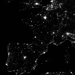
가시광선 적외선 이미징 방사계 스위트 (VIIRS) 주간/야간 대역 (DNB)의 야간 데이터를 사용하는 월별 평균 복사 휘도 합성 이미지입니다. 이러한 데이터는 매월 합성되므로 해당 월에 양질의 데이터 범위를 확보할 수 없는 지역이 전 세계에 많이 있습니다. … dnb eog lights monthly nighttime noaa -
VIIRS Stray Light Corrected Nighttime Day/Night Band Composites Version 1

가시광선 적외선 이미징 방사계 스위트 (VIIRS) 주간/야간 대역 (DNB)의 야간 데이터를 사용하는 월별 평균 복사 휘도 합성 이미지입니다. 이러한 데이터는 매월 합성되므로 해당 월에 양질의 데이터 범위를 확보할 수 없는 지역이 전 세계에 많이 있습니다. … dnb eog lights monthly nighttime noaa -
VNP46A1: VIIRS 일일 그리드 주야간 밴드 500m 선형 위도 경도 그리드 야간

Suomi National Polar-orbiting Partnership (SNPP) Visible Infrared Imaging Radiometer Suite (VIIRS)는 지구 시스템 과학 및 애플리케이션에 적합한 야간 가시광선 및 근적외선 (NIR)의 전 세계 일일 측정을 제공하는 Day-Night Band (DNB) 센서를 지원합니다. 저조도에서 VIIRS DNB의 초감도 … daily dnb nasa noaa population viirs
Datasets tagged dnb in Earth Engine
[null,null,[],[],["The core content details datasets from the VIIRS Day/Night Band (DNB) sensor. It provides daily measurements of nocturnal light. Annual datasets from 2013-2022 are available, composited from monthly cloud-free average radiance grids, with sunlit, moonlit, and cloudy pixels removed. Monthly average radiance composites, both standard and stray light corrected, are also provided, though some areas have limited monthly data coverage.\n"]]