-
MOD09CMG.061 Terra 地表反射率 1 日分 L3 グローバル 0.05 度 CMG
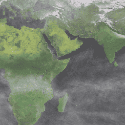
MOD09CMG バージョン 6.1 プロダクトは、Terra 中分解能撮像分光放射計(MODIS)バンド 1 ~ 7 の地表スペクトル反射率の推定値を提供します。このプロダクトは、5,600 メートル ピクセルの解像度に再サンプリングされ、ガス、エアロゾル、レイリー散乱などの大気条件が補正されています。MOD09CMG データは... brightness-temperature ozone satellite-imagery surface-reflectance terra -
MYD09CMG.061 Aqua Surface Reflectance Daily L3 Global 0.05 Deg CMG
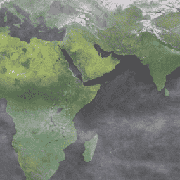
MYD09CMG バージョン 6.1 プロダクトは、Aqua 中分解能撮像分光放射計(MODIS)バンド 1 ~ 7 の表面スペクトル反射率の推定値を提供します。このプロダクトは、5,600 メートル / ピクセルの解像度に再サンプリングされ、ガス、エアロゾル、レイリー散乱などの大気条件が補正されています。MYD09CMG データは... aqua brightness-temperature ozone satellite-imagery surface-reflectance -
Sentinel-5P NRTI O3: 準リアルタイム オゾン
NRTI/L3_O3 このデータセットは、総柱状オゾン濃度の高解像度画像をほぼリアルタイムで提供します。成層圏の列データについては、COPERNICUS/S5P/OFFL/L3_O3_TCL も参照してください。成層圏では、オゾン層が危険な太陽紫外線から生物圏を保護しています。成層圏では、オゾンは効率的な浄化剤として機能しますが、 air-quality atmosphere copernicus esa eu o3 -
Sentinel-5P OFFL O3 TCL: オフラインの成層圏オゾン
OFFL/L3_O3_TCL このデータセットは、北緯 20 度から南緯 20 度までのオゾン濃度を示す、地上 1000 m 以上の高解像度オフライン画像を提供します。合計列のデータについては、COPERNICUS/S5P/OFFL/L3_O3 と COPERNICUS/S5P/NRTI/L3_O3 も参照してください。成層圏では、オゾン層が危険な太陽紫外線から生物圏を保護しています。成層圏では、次のように機能します。 air-quality atmosphere copernicus esa eu o3 -
Sentinel-5P OFFL O3: オフライン オゾン
OFFL/L3_O3 このデータセットは、総柱状オゾン濃度の高解像度オフライン画像を提供します。成層圏の列データについては、COPERNICUS/S5P/OFFL/L3_O3_TCL も参照してください。成層圏では、オゾン層が危険な太陽紫外線から生物圏を保護しています。成層圏では、オゾンは効率的な浄化剤として機能しますが、 air-quality atmosphere copernicus esa eu o3 -
TOMS と OMI の統合オゾンデータ
Total Ozone Mapping Spectrometer(TOMS)データは、過去 25 年間の全球および地域のオゾン総量の傾向のモニタリングに使用できる、衛星ベースの観測の主要な長期連続記録です。データは、NASA ゴダード宇宙飛行センターの大気研究所によって生成されます。 大気 気候 geophysical NASA オゾン
Datasets tagged ozone in Earth Engine
[null,null,[],[[["\u003cp\u003eThis page provides access to various ozone datasets, including near real-time, offline, and tropospheric ozone data from Sentinel-5P.\u003c/p\u003e\n"],["\u003cp\u003eDatasets offer high-resolution imagery of total column and tropospheric ozone concentrations for monitoring and analysis.\u003c/p\u003e\n"],["\u003cp\u003eSurface reflectance data from Terra and Aqua MODIS sensors are also included, corrected for atmospheric conditions like gasses and aerosols.\u003c/p\u003e\n"],["\u003cp\u003eTOMS and OMI merged data provide a long-term record of satellite-based observations for monitoring global and regional ozone trends.\u003c/p\u003e\n"],["\u003cp\u003eThese datasets can be used for studying air quality, climate change, and the impact of ozone on the biosphere.\u003c/p\u003e\n"]]],[],null,["# Datasets tagged ozone in Earth Engine\n\n-\n\n |----------------------------------------------------------------------------------------------------------------------------------------------------------------------------------------------------------------------------------------------------------------------------------------------------------------------------------------|\n | [### MOD09CMG.061 Terra Surface Reflectance Daily L3 Global 0.05 Deg CMG](/earth-engine/datasets/catalog/MODIS_061_MOD09CMG) |\n | The MOD09CMG Version 6.1 product provides an estimate of the surface spectral reflectance of Terra Moderate Resolution Imaging Spectroradiometer (MODIS) Bands 1 through 7, resampled to 5600 meter pixel resolution and corrected for atmospheric conditions such as gasses, aerosols, and Rayleigh scattering. The MOD09CMG data ... |\n | [brightness-temperature](/earth-engine/datasets/tags/brightness-temperature) [ozone](/earth-engine/datasets/tags/ozone) [satellite-imagery](/earth-engine/datasets/tags/satellite-imagery) [surface-reflectance](/earth-engine/datasets/tags/surface-reflectance) [terra](/earth-engine/datasets/tags/terra) |\n\n-\n\n |---------------------------------------------------------------------------------------------------------------------------------------------------------------------------------------------------------------------------------------------------------------------------------------------------------------------------------------|\n | [### MYD09CMG.061 Aqua Surface Reflectance Daily L3 Global 0.05 Deg CMG](/earth-engine/datasets/catalog/MODIS_061_MYD09CMG) |\n | The MYD09CMG Version 6.1 product provides an estimate of the surface spectral reflectance of Aqua Moderate Resolution Imaging Spectroradiometer (MODIS) Bands 1 through 7, resampled to 5600 meter pixel resolution and corrected for atmospheric conditions such as gasses, aerosols, and Rayleigh scattering. The MYD09CMG data ... |\n | [aqua](/earth-engine/datasets/tags/aqua) [brightness-temperature](/earth-engine/datasets/tags/brightness-temperature) [ozone](/earth-engine/datasets/tags/ozone) [satellite-imagery](/earth-engine/datasets/tags/satellite-imagery) [surface-reflectance](/earth-engine/datasets/tags/surface-reflectance) |\n\n-\n\n |--------------------------------------------------------------------------------------------------------------------------------------------------------------------------------------------------------------------------------------------------------------------------------------------------------------------------------------------------------------------|\n | [### Sentinel-5P NRTI O3: Near Real-Time Ozone](/earth-engine/datasets/catalog/COPERNICUS_S5P_NRTI_L3_O3) |\n | NRTI/L3_O3 This dataset provides near-real-time high-resolution imagery of total column ozone concentrations. See also COPERNICUS/S5P/OFFL/L3_O3_TCL for the tropospheric column data. In the stratosphere, the ozone layer shields the biosphere from dangerous solar ultraviolet radiation. In the troposphere, it acts as an efficient cleansing agent, but ... |\n | [air-quality](/earth-engine/datasets/tags/air-quality) [atmosphere](/earth-engine/datasets/tags/atmosphere) [copernicus](/earth-engine/datasets/tags/copernicus) [esa](/earth-engine/datasets/tags/esa) [eu](/earth-engine/datasets/tags/eu) [o3](/earth-engine/datasets/tags/o3) |\n\n-\n\n |----------------------------------------------------------------------------------------------------------------------------------------------------------------------------------------------------------------------------------------------------------------------------------------------------------------------------------------------------------------------|\n | [### Sentinel-5P OFFL O3 TCL: Offline Tropospheric Ozone](/earth-engine/datasets/catalog/COPERNICUS_S5P_OFFL_L3_O3_TCL) |\n | OFFL/L3_O3_TCL This dataset provides offline tropospheric high-resolution imagery of ozone concentrations between 20N and 20S. See also COPERNICUS/S5P/OFFL/L3_O3 and COPERNICUS/S5P/NRTI/L3_O3 for the total column data. In the stratosphere, the ozone layer shields the biosphere from dangerous solar ultraviolet radiation. In the troposphere, it acts as ... |\n | [air-quality](/earth-engine/datasets/tags/air-quality) [atmosphere](/earth-engine/datasets/tags/atmosphere) [copernicus](/earth-engine/datasets/tags/copernicus) [esa](/earth-engine/datasets/tags/esa) [eu](/earth-engine/datasets/tags/eu) [o3](/earth-engine/datasets/tags/o3) |\n\n-\n\n |-------------------------------------------------------------------------------------------------------------------------------------------------------------------------------------------------------------------------------------------------------------------------------------------------------------------------------------------------------------|\n | [### Sentinel-5P OFFL O3: Offline Ozone](/earth-engine/datasets/catalog/COPERNICUS_S5P_OFFL_L3_O3) |\n | OFFL/L3_O3 This dataset provides offline high-resolution imagery of total column ozone concentrations. See also COPERNICUS/S5P/OFFL/L3_O3_TCL for the tropospheric column data. In the stratosphere, the ozone layer shields the biosphere from dangerous solar ultraviolet radiation. In the troposphere, it acts as an efficient cleansing agent, but ... |\n | [air-quality](/earth-engine/datasets/tags/air-quality) [atmosphere](/earth-engine/datasets/tags/atmosphere) [copernicus](/earth-engine/datasets/tags/copernicus) [esa](/earth-engine/datasets/tags/esa) [eu](/earth-engine/datasets/tags/eu) [o3](/earth-engine/datasets/tags/o3) |\n\n-\n\n |---------------------------------------------------------------------------------------------------------------------------------------------------------------------------------------------------------------------------------------------------------------------------------------------------------------------|\n | [### TOMS and OMI Merged Ozone Data](/earth-engine/datasets/catalog/TOMS_MERGED) |\n | The Total Ozone Mapping Spectrometer (TOMS) data represent the primary long-term, continuous record of satellite-based observations available for use in monitoring global and regional trends in total ozone over the past 25 years. The data are produced by the Laboratory for Atmospheres at NASA's Goddard ... |\n | [atmosphere](/earth-engine/datasets/tags/atmosphere) [climate](/earth-engine/datasets/tags/climate) [geophysical](/earth-engine/datasets/tags/geophysical) [nasa](/earth-engine/datasets/tags/nasa) [ozone](/earth-engine/datasets/tags/ozone) |"]]