-
Breathing Earth System Simulator(BESS)放射線 v1
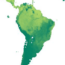
Breathing Earth System Simulator(BESS)は、大気と樹冠の放射伝達、樹冠の光合成、蒸散、エネルギーバランスを結合した、簡素化されたプロセスベースのモデルです。大気放射伝達モデルと人工ニューラル ネットワークを MODIS 大気プロダクトからの強制力と結合して、5 km の 1 日プロダクトを生成します。… 気候 蒸発散 gpp MODIS 由来 PAR 放射量 -
MCD18A1.062 表面放射量(1 日/3 時間)
MCD18A1 バージョン 6.2 は、Moderate Resolution Imaging Spectroradiometer(MODIS)Terra と Aqua の組み合わせによる下向き短波放射(DSR)グリッド化レベル 3 プロダクトです。1 キロメートル ピクセルの解像度で毎日生成され、3 時間ごとに DSR が推定されます。DSR は、陸地表面に降り注ぐ太陽放射量です。 気候 par 放射線 -
MCD18C2.062 光合成有効放射量 1 日 3 時間分
MCD18C2 バージョン 6.2 は、Moderate Resolution Imaging Spectroradiometer(MODIS)Terra と Aqua の組み合わせによる光合成有効放射(PAR)グリッド化レベル 3 プロダクトです。0.05 度(赤道で 5,600 メートル)の解像度で毎日生成され、3 時間ごとに PAR が推定されます。PAR は太陽光の照射量です。 気候 par 放射線
Datasets tagged par in Earth Engine
[null,null,[],[[["\u003cp\u003eMCD18 V6.1 datasets, including MCD18A1 and MCD18C2, are discontinued and being replaced by V6.2.\u003c/p\u003e\n"],["\u003cp\u003eMCD18A1 and MCD18C2 provide Moderate Resolution Imaging Spectroradiometer (MODIS) Terra and Aqua data related to surface radiation and photosynthetically active radiation, respectively.\u003c/p\u003e\n"],["\u003cp\u003eThe Breathing Earth System Simulator (BESS) Radiation dataset offers daily estimates of radiation, GPP, and evapotranspiration at a 5-km resolution using a coupled atmosphere-canopy model driven by MODIS data.\u003c/p\u003e\n"]]],[],null,["# Datasets tagged par in Earth Engine\n\n-\n\n |-------------------------------------------------------------------------------------------------------------------------------------------------------------------------------------------------------------------------------------------------------------------------------------------------------------------------------------------------------------------|\n | [### Breathing Earth System Simulator (BESS) Radiation v1](/earth-engine/datasets/catalog/SNU_ESL_BESS_Rad_v1) |\n | Breathing Earth System Simulator (BESS) is a simplified process-based model that couples atmosphere and canopy radiative transfers, canopy photosynthesis, transpiration, and energy balance. It couples an atmospheric radiative transfer model and artificial neural network with forcings from MODIS atmospheric products to generate 5-km daily products. ... |\n | [climate](/earth-engine/datasets/tags/climate) [evapotranspiration](/earth-engine/datasets/tags/evapotranspiration) [gpp](/earth-engine/datasets/tags/gpp) [modis-derived](/earth-engine/datasets/tags/modis-derived) [par](/earth-engine/datasets/tags/par) [radiation](/earth-engine/datasets/tags/radiation) |\n\n-\n\n |------------------------------------------------------------------------------------------------------------------------------------------------------------------------------------------------------------------------------------------------------------------------------------------------------------------|\n | [### MCD18A1.062 Surface Radiation Daily/3-Hour](/earth-engine/datasets/catalog/MODIS_062_MCD18A1) |\n | The MCD18A1 Version 6.2 is a Moderate Resolution Imaging Spectroradiometer (MODIS) Terra and Aqua combined Downward Shortwave Radiation (DSR) gridded Level 3 product produced daily at 1 kilometer pixel resolution with estimates of DSR every 3 hours. DSR is incident solar radiation over land surfaces ... |\n | [climate](/earth-engine/datasets/tags/climate) [par](/earth-engine/datasets/tags/par) [radiation](/earth-engine/datasets/tags/radiation) |\n\n-\n\n |--------------------------------------------------------------------------------------------------------------------------------------------------------------------------------------------------------------------------------------------------------------------------------------------------------------------|\n | [### MCD18C2.062 Photosynthetically Active Radiation Daily 3-Hour](/earth-engine/datasets/catalog/MODIS_062_MCD18C2) |\n | The MCD18C2 Version 6.2 is a Moderate Resolution Imaging Spectroradiometer (MODIS) Terra and Aqua combined Photosynthetically Active Radiation (PAR) gridded Level 3 product produced daily at 0.05 degree (5,600 meters at the equator) resolution with estimates of PAR every 3 hours. PAR is incident solar ... |\n | [climate](/earth-engine/datasets/tags/climate) [par](/earth-engine/datasets/tags/par) [radiation](/earth-engine/datasets/tags/radiation) |"]]