-
열대 우림 모니터링을 위한 NICFI 위성 데이터 프로그램 기본 지도 - 아프리카
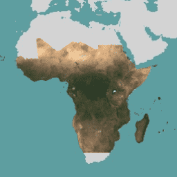
이 이미지 모음은 열대 지역의 고해상도 위성 모니터링에 대한 액세스를 제공하며, 그 주요 목적은 열대림 손실을 줄이고 되돌려 기후 변화에 대처하고, 생물 다양성을 보존하고, 산림 재성장, 복원, 개선에 기여하고, 지속 가능한 개발을 촉진하는 것입니다. basemaps forest nicfi planet planet-nicfi publisher-dataset -
열대림 모니터링을 위한 NICFI 위성 데이터 프로그램 기본 지도 - 아메리카
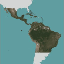
이 이미지 모음은 열대 지역의 고해상도 위성 모니터링에 대한 액세스를 제공하며, 그 주요 목적은 열대림 손실을 줄이고 되돌려 기후 변화에 대처하고, 생물 다양성을 보존하고, 산림 재성장, 복원, 개선에 기여하고, 지속 가능한 개발을 촉진하는 것입니다. basemaps forest nicfi planet planet-nicfi publisher-dataset -
열대림 모니터링을 위한 NICFI 위성 데이터 프로그램 기본 지도 - 아시아

이 이미지 모음은 열대 지역의 고해상도 위성 모니터링에 대한 액세스를 제공하며, 그 주요 목적은 열대림 손실을 줄이고 되돌려 기후 변화에 대처하고, 생물 다양성을 보존하고, 산림 재성장, 복원, 개선에 기여하고, 지속 가능한 개발을 촉진하는 것입니다. basemaps forest nicfi planet planet-nicfi publisher-dataset -
Planet SkySat 공개 정사영상, 멀티스펙트럼

Planet Labs Inc. SkySat 위성에서 수집한 이 데이터는 2015년 실험적인 'Skybox for Good 베타' 프로그램과 다양한 위기 대응 이벤트, 기타 몇 가지 프로젝트를 위해 수집되었습니다. 이 데이터는 5밴드 멀티스펙트럼/팬 컬렉션과 … highres multispectral pansharpened planet satellite-imagery skysat -
Planet SkySat 공개 정사영상, RGB

Planet Labs Inc. SkySat 위성에서 수집한 이 데이터는 2015년 실험적인 'Skybox for Good 베타' 프로그램과 다양한 위기 대응 이벤트, 기타 몇 가지 프로젝트를 위해 수집되었습니다. 이 데이터는 5밴드 멀티스펙트럼/팬 컬렉션과 … highres pansharpened planet rgb satellite-imagery skysat
Datasets tagged planet in Earth Engine
[null,null,[],[],[]]