-
SPL3SMP_E.005 SMAP L3 ラジオメーター 世界の土壌水分(9 km、1 日)
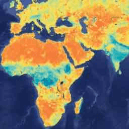
2023 年 12 月 4 日以降のデータは、NASA/SMAP/SPL3SMP_E/006 コレクションで利用できます。このレベル 3(L3)の土壌水分プロダクトは、Soil Moisture Active Passive(SMAP)L バンド放射計によって取得された地球上の地表状態の 1 日の複合データを提供します。ここでの毎日のデータは、降順(ローカル… drought nasa smap soil soil-moisture surface -
SPL3SMP_E.006 SMAP L3 ラジオメーター 世界の土壌水分(9 km、1 日)
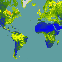
2023 年 12 月 4 日より前のデータは、以前の NASA/SMAP/SPL3SMP_E/005 コレクションで入手できます。最終的には再処理され、このコレクションに追加されます。このレベル 3(L3)の土壌水分プロダクトは、Soil Moisture Active Passive(SMAP)L バンドによって取得された地球上の地表状態の 1 日の複合データを提供します。 drought nasa smap soil soil-moisture surface -
SPL4SMGP.008 SMAP L4 世界の地表および根域の土壌水分(3 時間ごと、9 km)
SMAP レベル 4(L4)土壌水分プロダクトには、表層土壌水分(0 ~ 5 cm の垂直平均)、根圏土壌水分(0 ~ 100 cm の垂直平均)、および表層気象強制変数、土壌温度、蒸発散量、正味放射量などの追加の研究プロダクト(検証済みではない)が含まれます。このデータセットは、正式には … と呼ばれます。 drought nasa smap soil soil-moisture surface
Datasets tagged smap in Earth Engine
[null,null,[],[[["\u003cp\u003eNASA's SMAP mission offers Level-3 (L3) daily composite soil moisture data, with SPL3SMP_E.005 covering data before December 4, 2023, and SPL3SMP_E.006 covering data from December 4, 2023, onwards.\u003c/p\u003e\n"],["\u003cp\u003eSMAP L3 data provides insights into global land surface conditions, specifically soil moisture, retrieved using the L-Band radiometer.\u003c/p\u003e\n"],["\u003cp\u003eThe SMAP Level-4 (L4) product (SPL4SMGP.007) offers 3-hourly, 9-km resolution data for surface and root zone soil moisture, along with supplementary research products like temperature, evapotranspiration, and net radiation.\u003c/p\u003e\n"]]],[],null,["# Datasets tagged smap in Earth Engine\n\n-\n\n |---------------------------------------------------------------------------------------------------------------------------------------------------------------------------------------------------------------------------------------------------------------------------------------------------------------------------------------|\n | [### SPL3SMP_E.005 SMAP L3 Radiometer Global Daily 9 km Soil Moisture](/earth-engine/datasets/catalog/NASA_SMAP_SPL3SMP_E_005) |\n | Data starting from 2023-12-04 are available in the NASA/SMAP/SPL3SMP_E/006 collection. This Level-3 (L3) soil moisture product provides a daily composite of global land surface conditions retrieved by the Soil Moisture Active Passive (SMAP) L-Band radiometer. The daily data here were collected from the descending (local ... |\n | [drought](/earth-engine/datasets/tags/drought) [nasa](/earth-engine/datasets/tags/nasa) [smap](/earth-engine/datasets/tags/smap) [soil](/earth-engine/datasets/tags/soil) [soil-moisture](/earth-engine/datasets/tags/soil-moisture) [surface](/earth-engine/datasets/tags/surface) |\n\n-\n\n |----------------------------------------------------------------------------------------------------------------------------------------------------------------------------------------------------------------------------------------------------------------------------------------------------------------------------------|\n | [### SPL3SMP_E.006 SMAP L3 Radiometer Global Daily 9 km Soil Moisture](/earth-engine/datasets/catalog/NASA_SMAP_SPL3SMP_E_006) |\n | Data prior from 2023-12-04 are available in the older NASA/SMAP/SPL3SMP_E/005 collection. They will eventually be reprocessed and added to this collection. This Level-3 (L3) soil moisture product provides a daily composite of global land surface conditions retrieved by the Soil Moisture Active Passive (SMAP) L-Band ... |\n | [drought](/earth-engine/datasets/tags/drought) [nasa](/earth-engine/datasets/tags/nasa) [smap](/earth-engine/datasets/tags/smap) [soil](/earth-engine/datasets/tags/soil) [soil-moisture](/earth-engine/datasets/tags/soil-moisture) [surface](/earth-engine/datasets/tags/surface) |\n\n-\n\n |-------------------------------------------------------------------------------------------------------------------------------------------------------------------------------------------------------------------------------------------------------------------------------------------------------------------------------------------------------------------|\n | [### SPL4SMGP.008 SMAP L4 Global 3-hourly 9-km Surface and Root Zone Soil Moisture](/earth-engine/datasets/catalog/NASA_SMAP_SPL4SMGP_008) |\n | The SMAP Level-4 (L4) Soil Moisture product includes surface soil moisture (0-5 cm vertical average), root-zone soil moisture (0-100 cm vertical average), and additional research products (not validated), including surface meteorological forcing variables, soil temperature, evapotranspiration, and net radiation. This dataset, formally known as the ... |\n | [drought](/earth-engine/datasets/tags/drought) [nasa](/earth-engine/datasets/tags/nasa) [smap](/earth-engine/datasets/tags/smap) [soil](/earth-engine/datasets/tags/soil) [soil-moisture](/earth-engine/datasets/tags/soil-moisture) [surface](/earth-engine/datasets/tags/surface) |"]]