
Stylizacja granic na podstawie danych umożliwia dostęp do wielokątów Google dla granic administracyjnych, stosowanie stylizacji do wielokątów granicznych i ich wyświetlanie na mapach.
Stylizacja granic oparta na danych umożliwia kierowanie na regiony według identyfikatora miejsca i stosowanie niestandardowej stylizacji do granicy na mapie. Każdy typ funkcji reprezentuje typ regionu. Podczas konfigurowania stylu mapy możesz wybrać, które typy funkcji mają być włączone. Aby sprawdzić zasięg granicy w poszczególnych krajach, zapoznaj się z zasięgiem granicy Google.
Typy funkcji
Stylizacja oparta na danych zapewnia dostęp do granic Google w przypadku typów funkcji, które reprezentują obszary administracyjne. Obszary administracyjne są podzielone na kategorie według funkcji, np. kraj, stan, miejscowość i kod pocztowy. Typy funkcji są uporządkowane według poziomu administracyjnego, którego struktura różni się w zależności od kraju. Są to między innymi:
GMSFeatureTypeCountry– krajowy podmiot polityczny, zwykle typ o najwyższym priorytecie.GMSFeatureTypeAdministrativeAreaLevel1– podmiot prawny pierwszego rzędu poniżej poziomu kraju. W Stanach Zjednoczonych są to stany.GMSFeatureTypeAdministrativeAreaLevel2– jednostka prawna drugiego rzędu na poziomie niższym niż kraj. W Stanach Zjednoczonych są to hrabstwa.GMSFeatureTypeLocality– zarejestrowany podmiot polityczny miasta lub miasteczka.GMSFeatureTypePostalCode– kod pocztowy, który służy do adresowania przesyłek pocztowych na terenie danego kraju.GMSFeatureTypeSchoolDistrict– okręg szkolny; obejmuje szkoły podstawowe, średnie i jednolite.
Obszary administracyjne są na mapie reprezentowane jako warstwy cech. Każdy typ ma swoją własną warstwę. Warstwy cech są włączone w poszczególnych stylach mapy. Podczas konfigurowania stylu mapy w konsoli Google Cloud możesz wybrać, które warstwy funkcji mają być włączone.
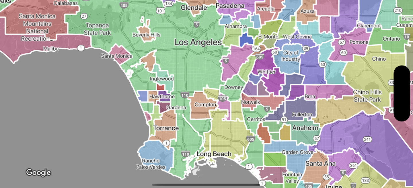
Wielokąty granic stylów
Do wielokątów granicznych możesz stosować style wypełnienia (kolor, krycie) i kreski (kolor, krycie, grubość). Stylowanie umożliwia:
- nadać styl wielokątowi granicy lub wyświetlić wszystkie granice danego typu obiektu;
- Utwórz mapę kartogramu.
Zasięg granic Google pokazuje dostępność poszczególnych typów funkcji w poszczególnych krajach.